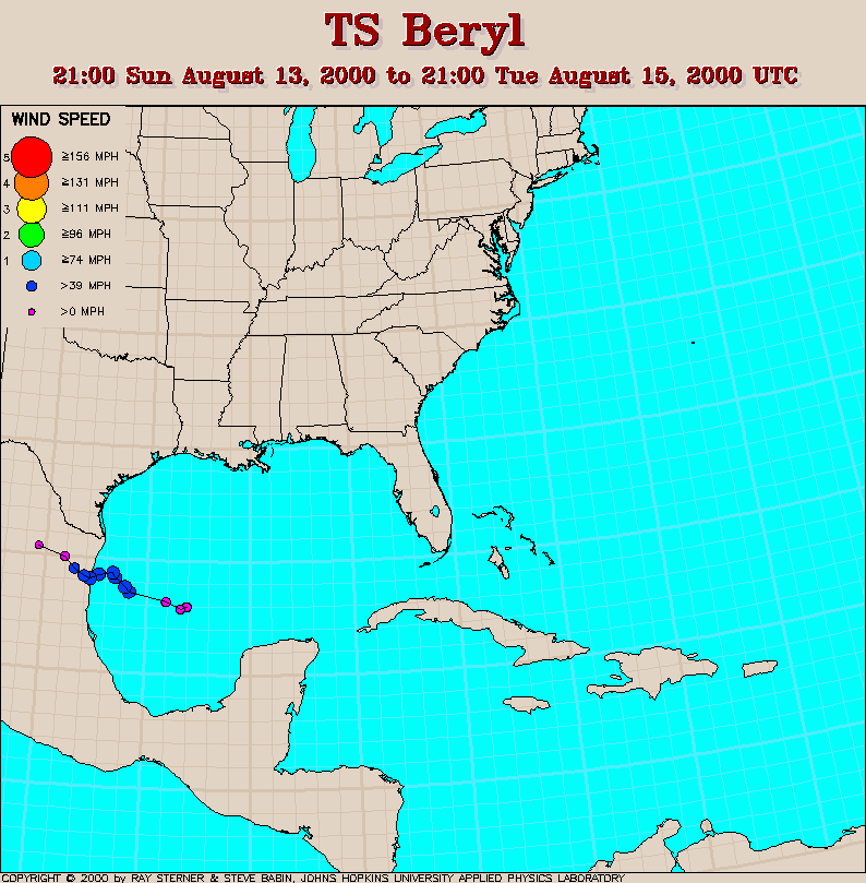
Track maps
Beryl developed from Tropical Depression Five in the Gulf of Mexico.
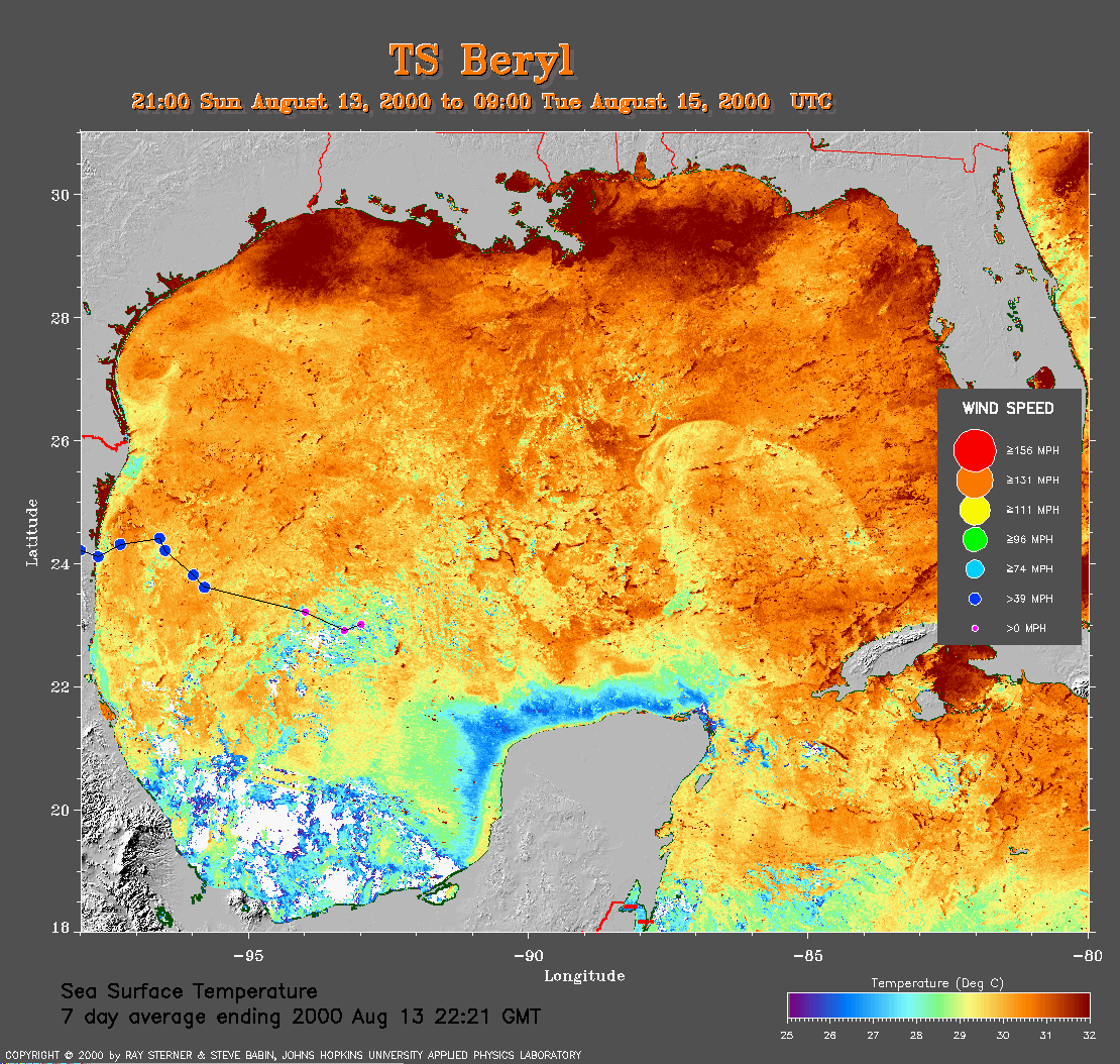 7 day average SST image from 13 August
(367 Kb) This image is derived from the average composite sea
surface
temperature (SST) data over 7 days ending 13 August 2000. The averaging
is done to remove clouds. The temperature scale for the SST in this
image is 25 to 32 C. The track of Beryl is overlaid on this image.
7 day average SST image from 13 August
(367 Kb) This image is derived from the average composite sea
surface
temperature (SST) data over 7 days ending 13 August 2000. The averaging
is done to remove clouds. The temperature scale for the SST in this
image is 25 to 32 C. The track of Beryl is overlaid on this image.
Track file
Track data (lat/lon, winds, etc.) in a text file.
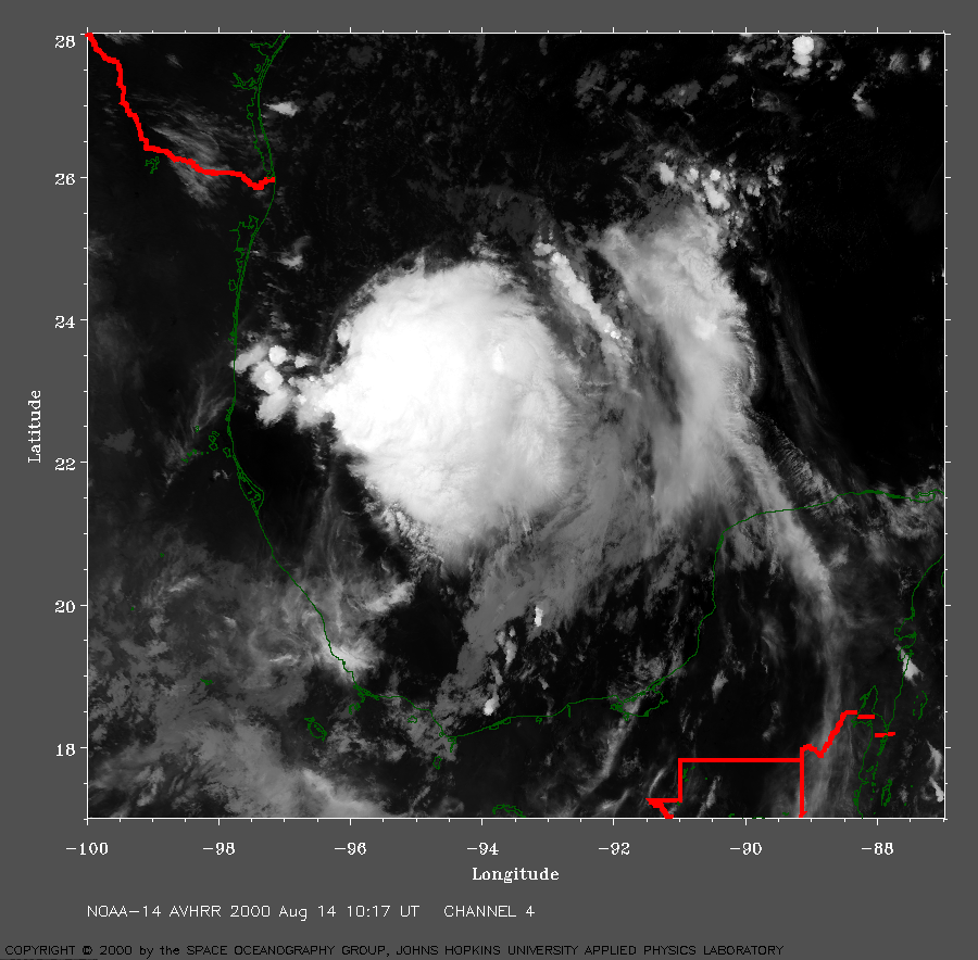 2000 August 14 10:17 UT
NOAA-14 satellite AVHRR channel 4 early morning image.
A closer view (470 Kb) is seen by clicking on this small image.
The maximum sustained winds are increasing from 35 to 50 mph.
A very large image
(944 Kb) is also available.
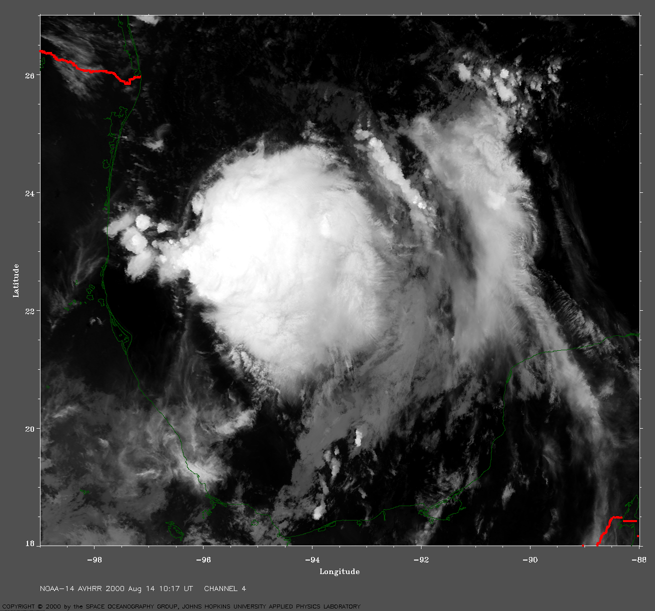
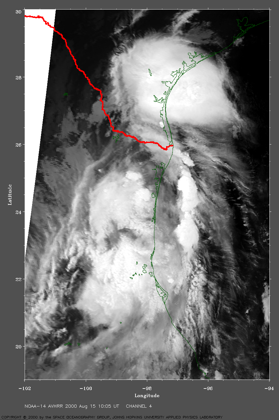
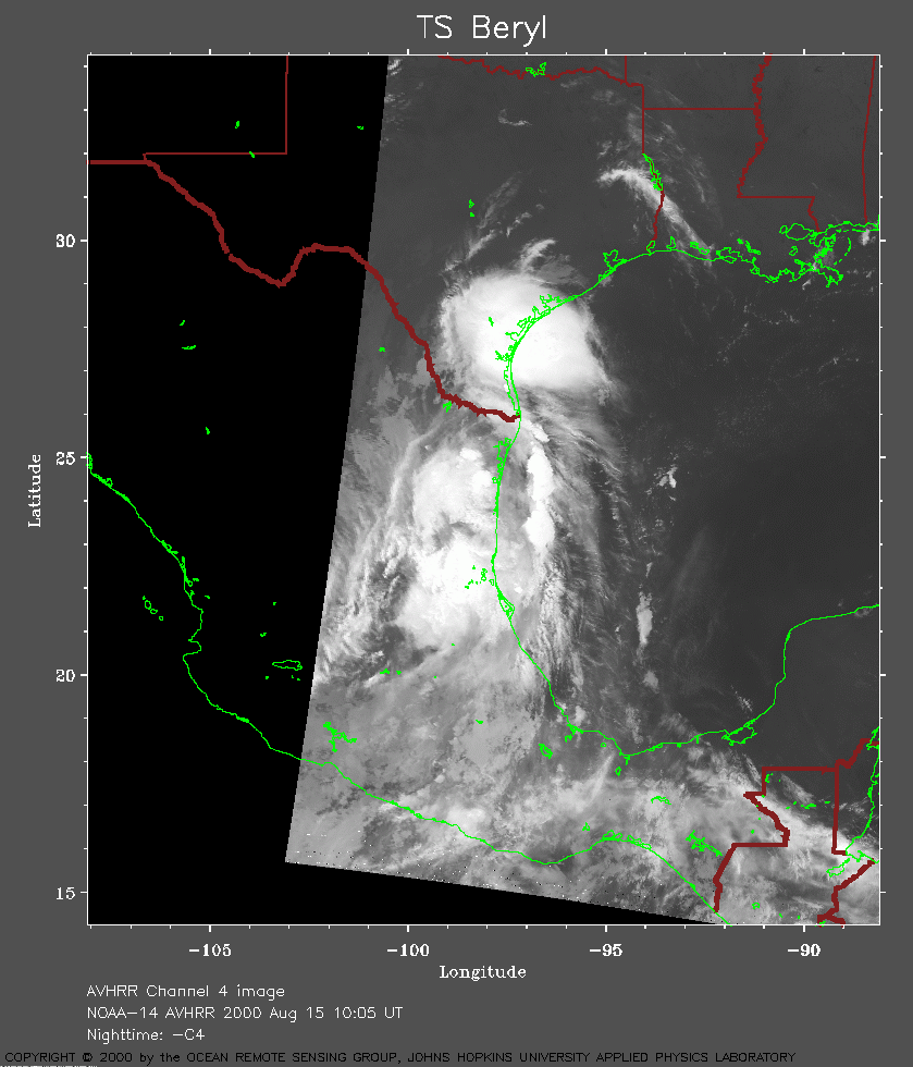 2000 August 15 10:05 UT
NOAA-14 satellite AVHRR channel 4 early morning image.
A closer view (205 Kb) is seen by clicking on this small image.
The storm center moved onto the coast of Mexico at about 0600 UT and the
winds have decreased to 45 mph.
A very large image
(586 Kb) is also available.