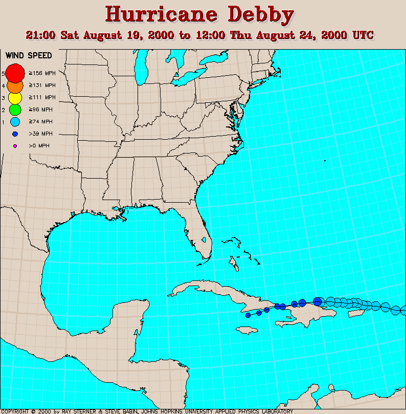
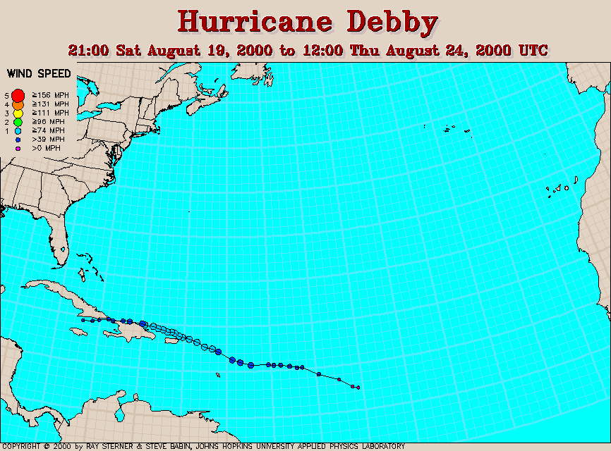
Track maps
Debby developed from Tropical Depression Seven in the tropical
Atlantic Ocean.
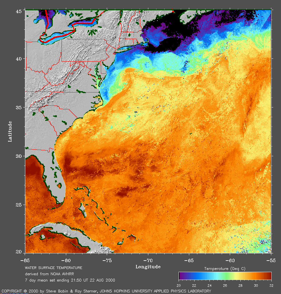 7 day average SST image from 22
August (276 Kb) This image is derived from the average composite
sea surface temperature (SST) data over 7 days ending 22 August 2000.
The averaging is done to remove clouds. The temperature scale for the
SST in this image is 20 to 32 C.
7 day average SST image from 22
August (276 Kb) This image is derived from the average composite
sea surface temperature (SST) data over 7 days ending 22 August 2000.
The averaging is done to remove clouds. The temperature scale for the
SST in this image is 20 to 32 C.
Track file
Track data (lat/lon, winds, etc.) in a text file.