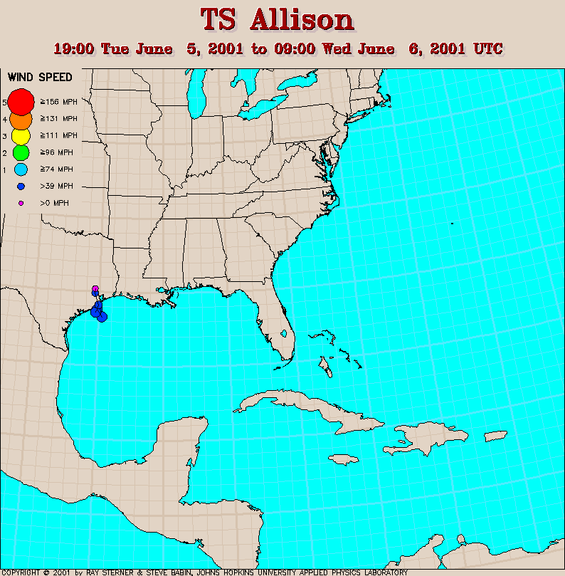
Track maps
Allison developed in the northwestern Gulf of Mexico.
A PDF file describing the impact of Allison can be found at NWS Service
Assessments
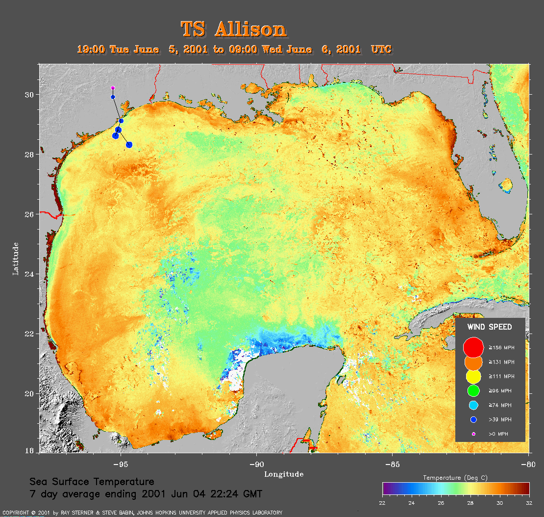 7 day average SST image from 4 June
(375 Kb) This image is derived from the average composite sea
surface temperature (SST) data over 7 days ending 4 June 2001. The
averaging is done to remove clouds. The temperature scale for the SST in
this image is 22 to 32 C. The track of Allison is overlaid on this image.
7 day average SST image from 4 June
(375 Kb) This image is derived from the average composite sea
surface temperature (SST) data over 7 days ending 4 June 2001. The
averaging is done to remove clouds. The temperature scale for the SST in
this image is 22 to 32 C. The track of Allison is overlaid on this image.
Track file
Track data (lat/lon, winds, etc.) in a text file.
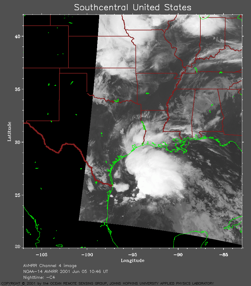 NOAA 14 AVHRR channel 4 image from 10:46
UT on 5 June showing Allison forming off the coast of Texas.
NOAA 14 AVHRR channel 4 image from 10:46
UT on 5 June showing Allison forming off the coast of Texas.
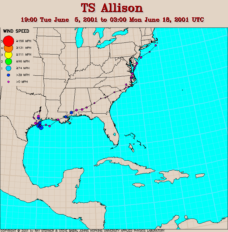
Click here for Allison track map including track after making landfall when Allison was no longer considered a tropical storm. The additional tracking was provided by the Hydrometeorological Prediction Center. Storm summaries can be found at the Hydrometeorological Prediction Center.