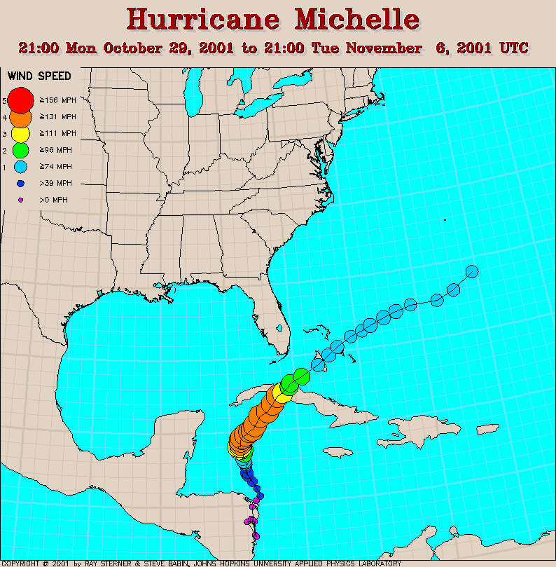
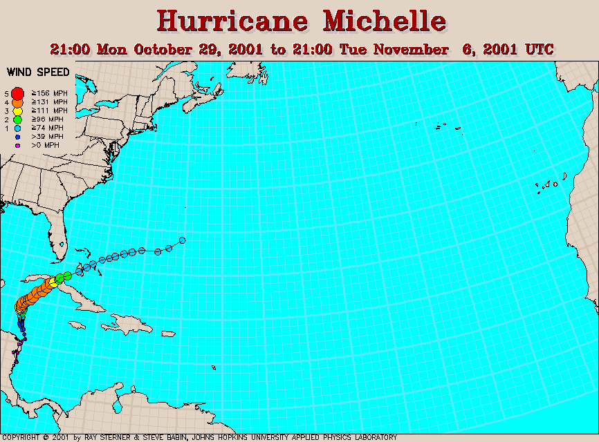
Track maps
Michelle developed from Tropical Depression Fifteen off the coast of
Nicaragua.
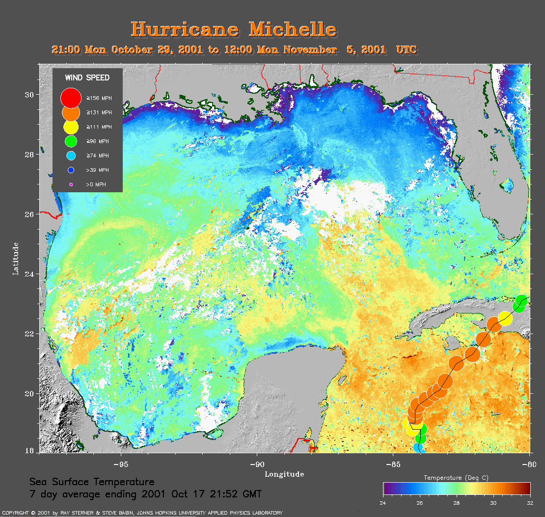 Gulf of Mexico 7-day average SST image
from 17 October
(360 Kb) This image is derived from the average composite sea
surface temperature (SST) data over 7 days ending 17 October 2001. The
averaging is done to remove clouds. The temperature scale for the SST
in this image is 24 to 32 C. The track of Michelle is overlaid on this
image.
Gulf of Mexico 7-day average SST image
from 17 October
(360 Kb) This image is derived from the average composite sea
surface temperature (SST) data over 7 days ending 17 October 2001. The
averaging is done to remove clouds. The temperature scale for the SST
in this image is 24 to 32 C. The track of Michelle is overlaid on this
image.
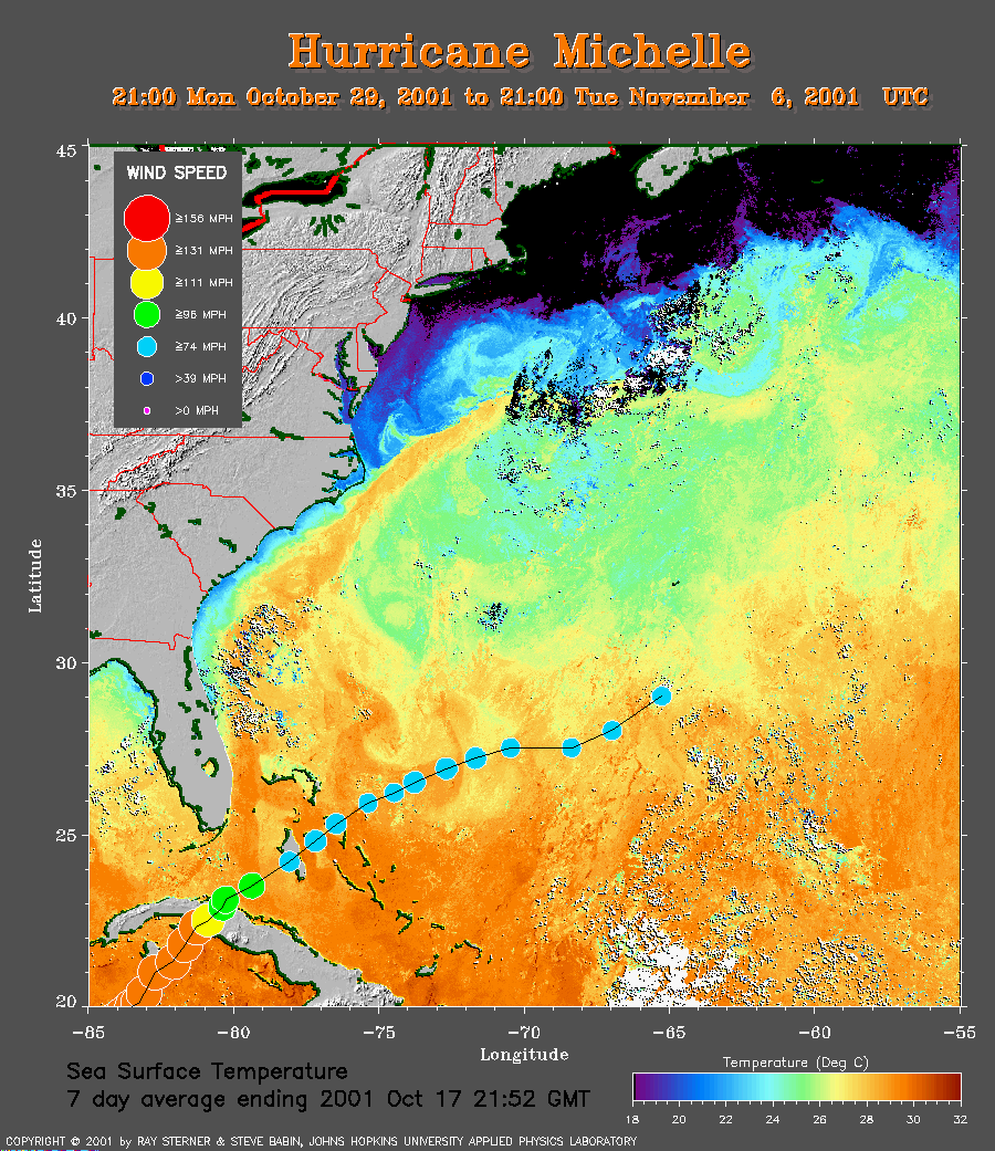 Western Atlantic Ocean 7-day average SST image
from 17 October
(279 Kb) This image is derived from the average composite sea
surface temperature (SST) data over 7 days ending 17 October 2001. The
averaging is done to remove clouds. The temperature scale for the SST
in this image is 18 to 32 C. The track of Michelle is overlaid on this
image.
Western Atlantic Ocean 7-day average SST image
from 17 October
(279 Kb) This image is derived from the average composite sea
surface temperature (SST) data over 7 days ending 17 October 2001. The
averaging is done to remove clouds. The temperature scale for the SST
in this image is 18 to 32 C. The track of Michelle is overlaid on this
image.
Track file
Track data (lat/lon, winds, etc.) in a text file.
GALLERY OF NOAA SATELLITE AVHRR IMAGES OF HURRICANE MICHELLE