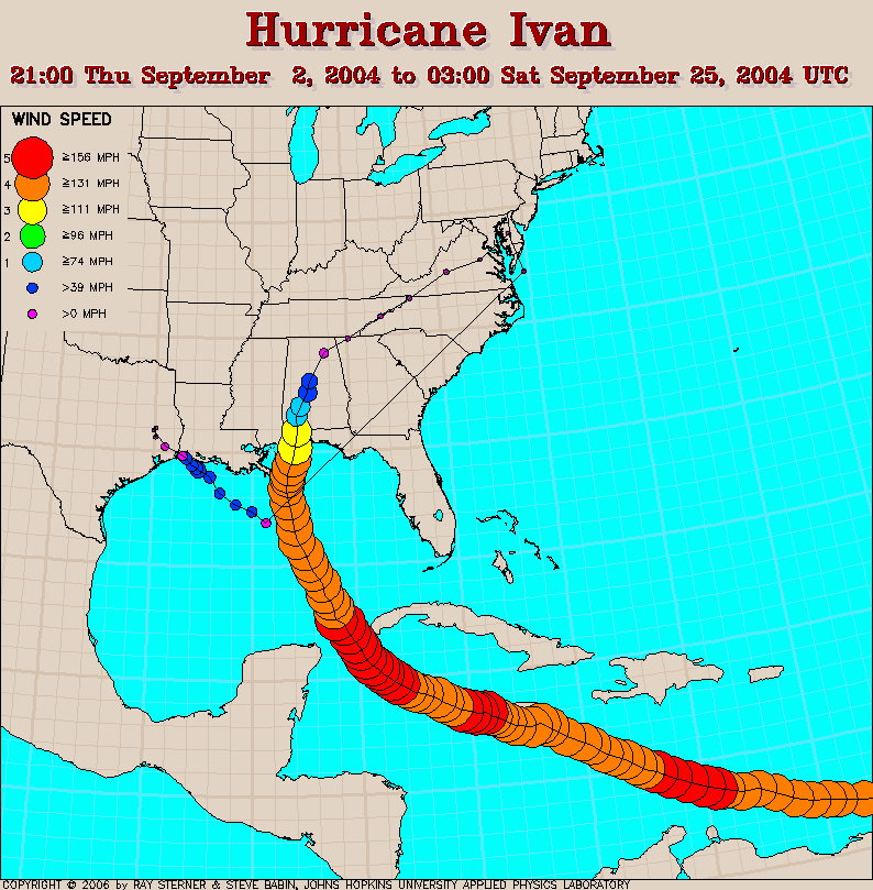
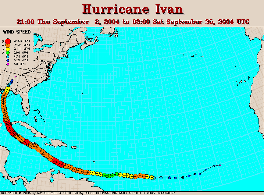
Track maps
Ivan developed from Tropical Depression Nine in the tropical Atlantic Ocean.
After dissipating on 18 September near the mouth of the Chesapeake Bay, it
re-formed as a tropical depression on 22 September in the Gulf of Mexico.
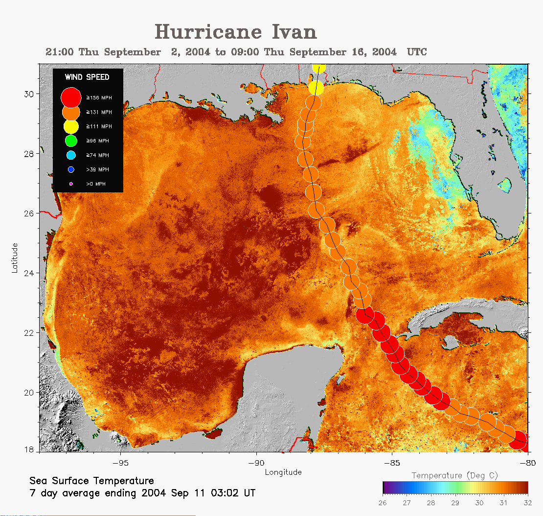 Ivan track on SST image of the western Caribbean Sea and Gulf of Mexico
from 11 September (321 Kb)
This image represents the average composite sea surface temperature (SST)
derived from NOAA satellite AVHRR data over the 7 days ending 11 September 2004.
The averaging is done to remove clouds. The temperature scale for SST is
26C to 32C. The track of Ivan is overlaid on this image.
Ivan track on SST image of the western Caribbean Sea and Gulf of Mexico
from 11 September (321 Kb)
This image represents the average composite sea surface temperature (SST)
derived from NOAA satellite AVHRR data over the 7 days ending 11 September 2004.
The averaging is done to remove clouds. The temperature scale for SST is
26C to 32C. The track of Ivan is overlaid on this image.
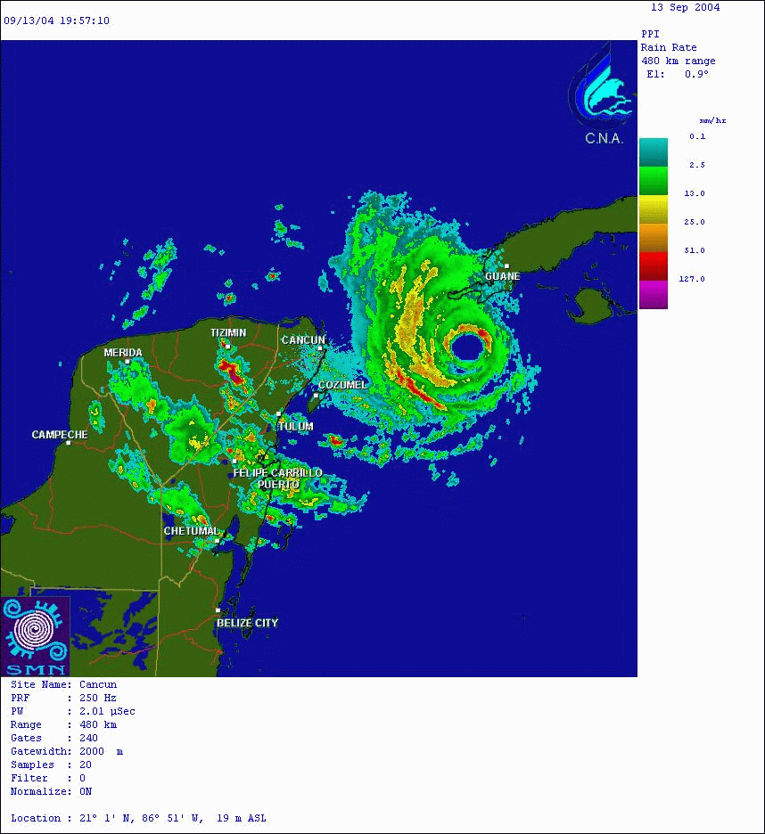
Servicio Meteorologico Nacional Cancun Radar image showing eye of Ivan at
19:57:10 UT on 13 September (160 Kb)
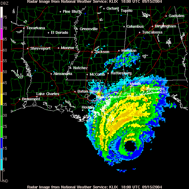
New Orleans NWS radar at 1800 UTC on 15 September showing eye of Ivan (37 Kb)
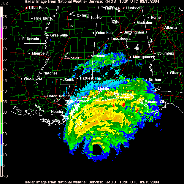
Mobile NWS radar at 1801 UTC on 15 September showing eye of Ivan (41 Kb)
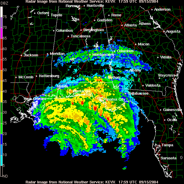
Tallahasse NWS radar at 1759 UTC on 15 September showing eye of Ivan (48 Kb)
Track file
Track data (lat/lon, winds, etc.) in a text file.