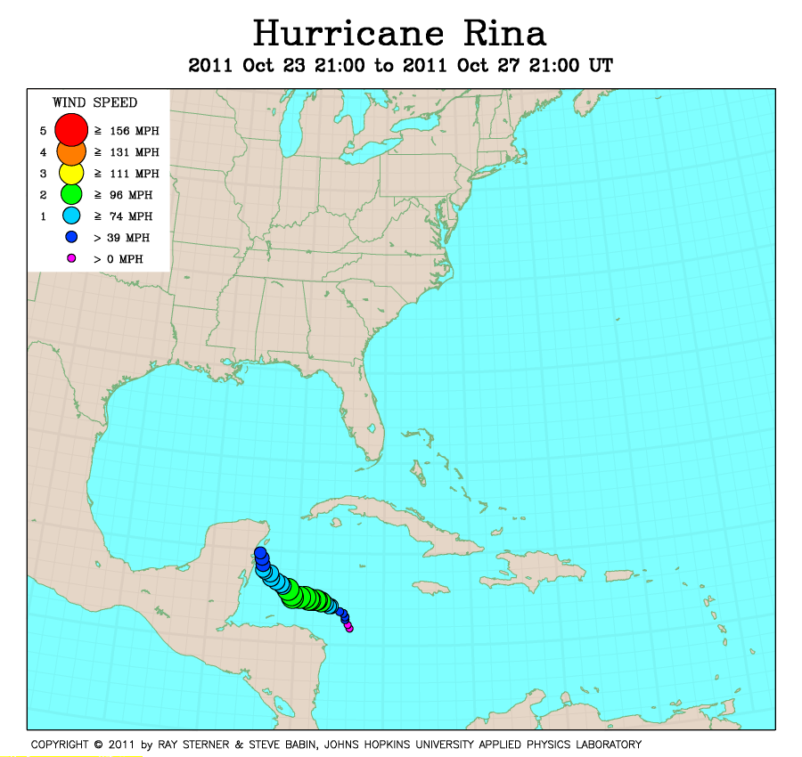
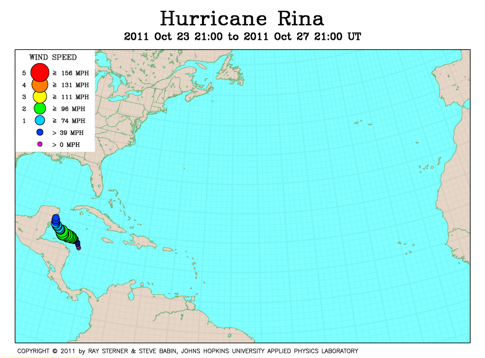
Track maps
Rina formed as Tropical Depression Eighteen in the western Caribbean Sea and became a hurricane while southwest of Grand Cayman.
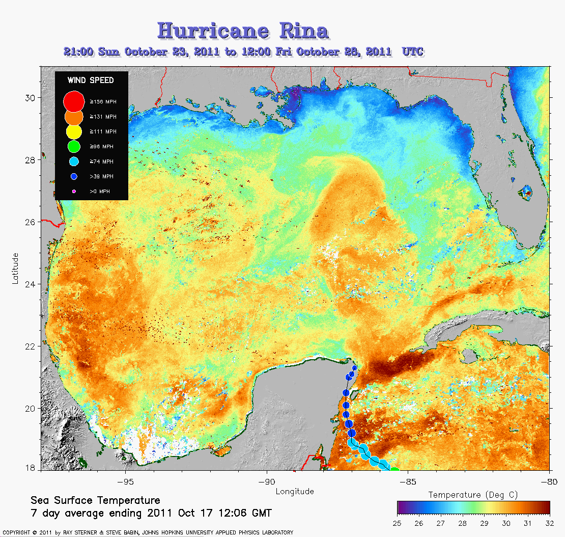 Rina track on SST image of 17 October (333 Kb) This image
represents the average composite sea surface temperature (SST) derived from
NOAA satellite AVHRR data over the 7 days ending 17 October 2011. The
averaging is done to remove clouds. The temperature scale for SST is
25C to 32C. The track of Rina is overlaid on this image.
Rina track on SST image of 17 October (333 Kb) This image
represents the average composite sea surface temperature (SST) derived from
NOAA satellite AVHRR data over the 7 days ending 17 October 2011. The
averaging is done to remove clouds. The temperature scale for SST is
25C to 32C. The track of Rina is overlaid on this image.
Track file
Track data (lat/lon, winds, etc.) in a text file.