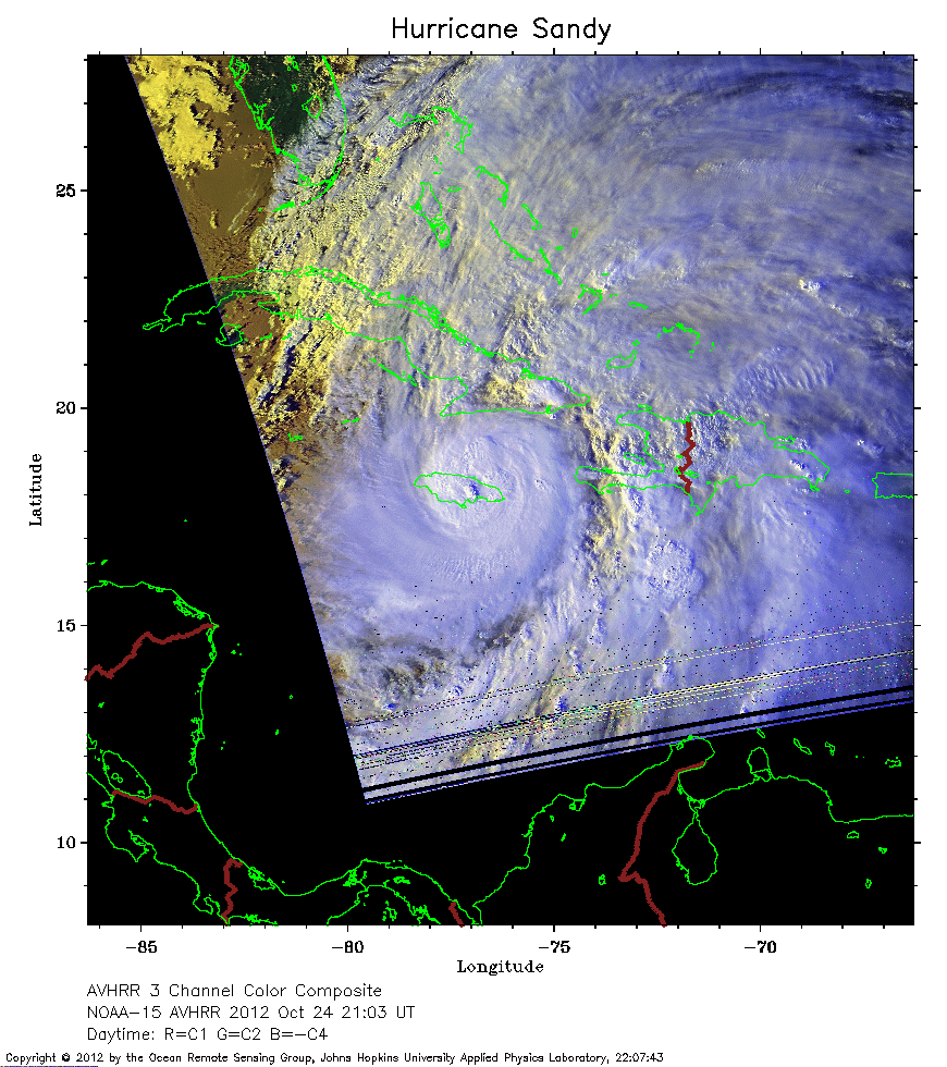
 2012 October 24 21:03 UT
NOAA-15 satellite AVHRR 3 channel color composite daytime image.
A closer view (264 Kb) is seen by clicking on this small image.
The maximum sustained winds are 80 mph. The eye of the hurricane is over Jamaica.
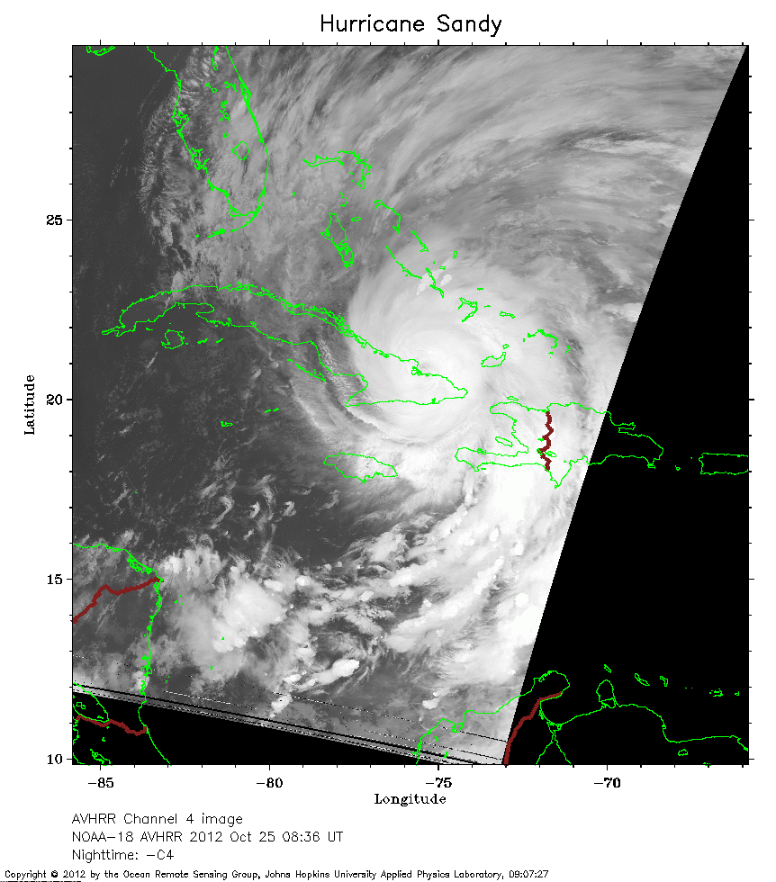 2012 October 25 08:36 UT
NOAA-18 satellite AVHRR channel 4 nighttime image.
A closer view (241 Kb) is seen by clicking on this small image.
The maximum sustained winds have increased to 110 mph.
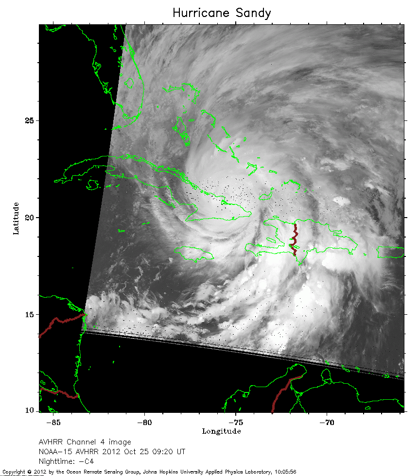 2012 October 25 09:20 UT
NOAA-15 satellite AVHRR channel 4 nighttime image.
A closer view (221 Kb) is seen by clicking on this small image.
The maximum sustained winds have decreased to 105 mph.
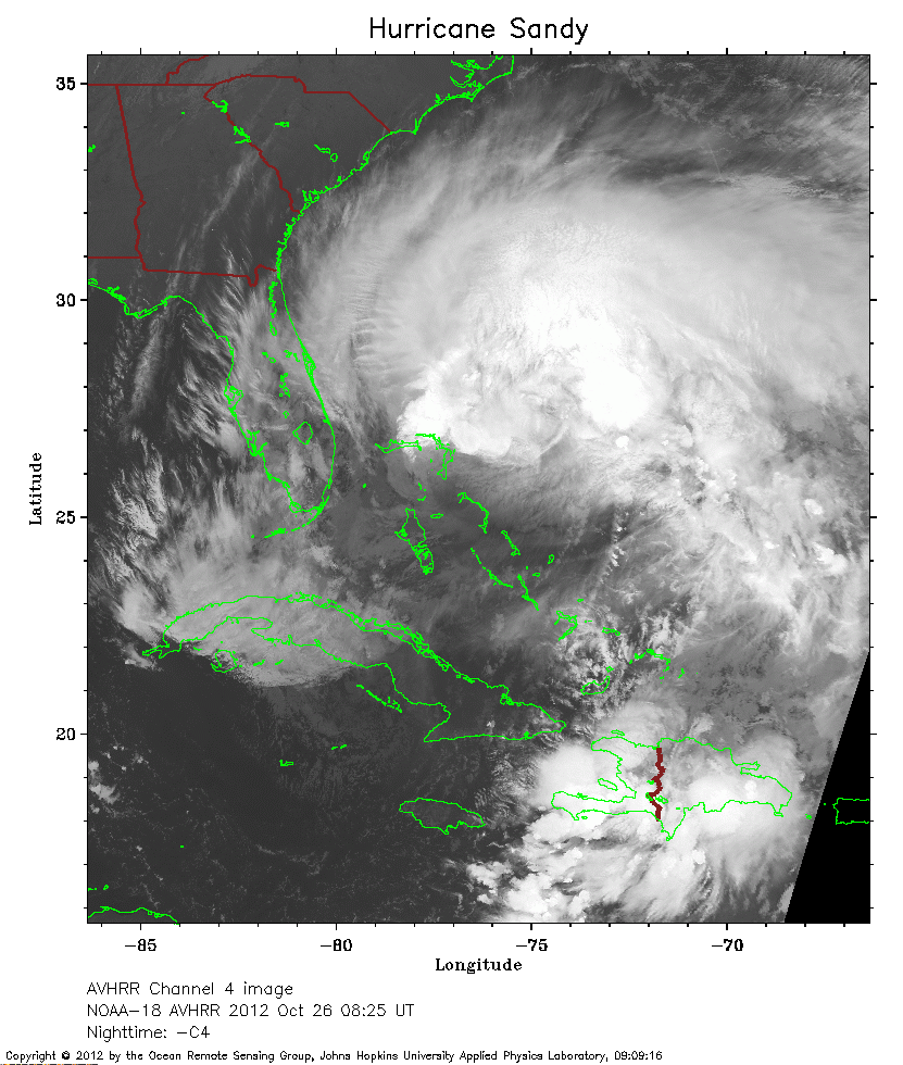 2012 October 26 08:25 UT
NOAA-18 satellite AVHRR channel 4 nighttime image.
A closer view (284 Kb) is seen by clicking on this small image.
The maximum sustained winds have decreased to 80 mph, and Sandy is expanding in areal extent.
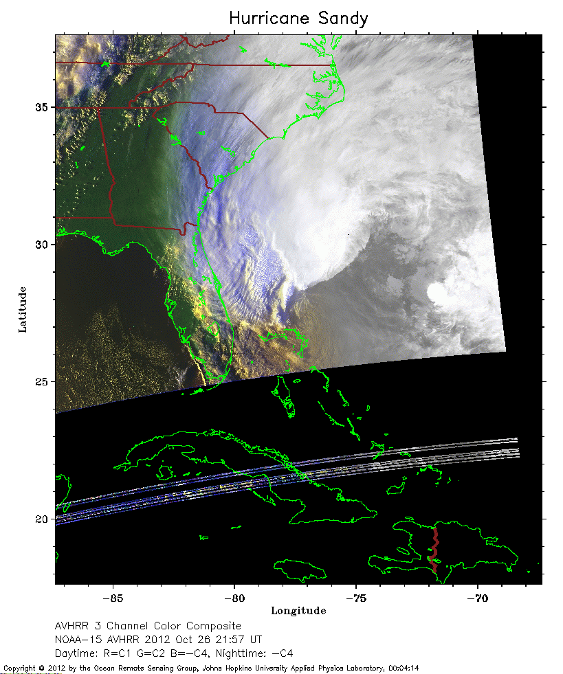 2012 October 26 21:57 UT
NOAA-15 satellite AVHRR 3 channel color composite daytime image.
A closer view (182 Kb) is seen by clicking on this small image.
The maximum sustained winds have decreased to 75 mph.
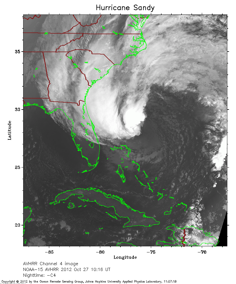 2012 October 26 10:16 UT
NOAA-15 satellite AVHRR channel 4 nighttime image.
A closer view (272 Kb) is seen by clicking on this small image.
The maximum sustained winds have decreased to 70 mph, and Sandy grows larger.
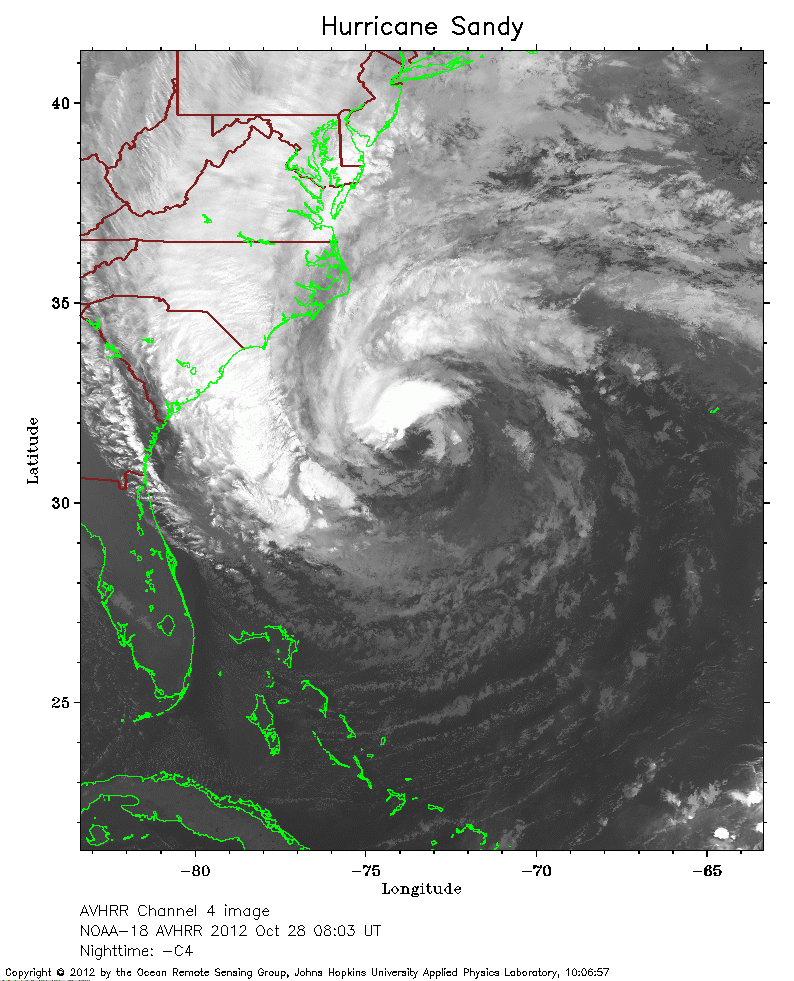 2012 October 28 08:03 UT
NOAA-18 satellite AVHRR channel 4 nighttime image.
A closer view (278 Kb) is seen by clicking on this small image.
The maximum sustained winds have increased to 75 mph.
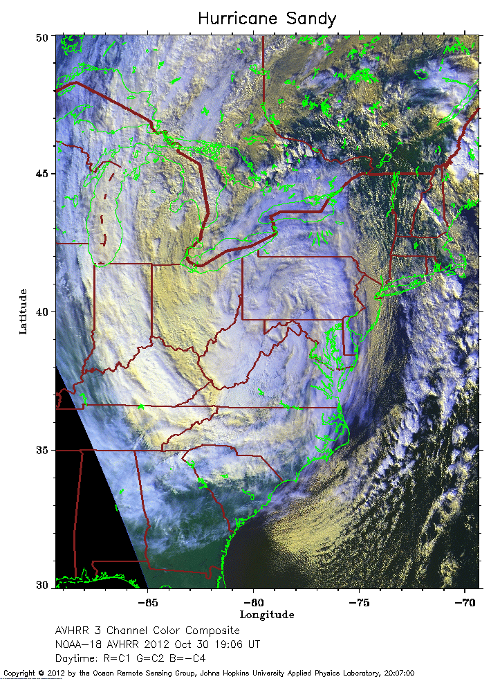 2012 October 30 19:06 UT
NOAA-18 satellite AVHRR 3 channel color composite daytime image.
A closer view (378 Kb) is seen by clicking on this small image.
Sandy made landfall near Atlantic City, New Jersey, and is no longer a tropical system, having merged with a cold front.