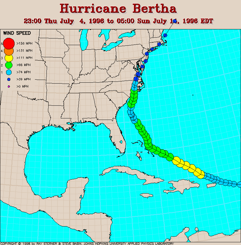
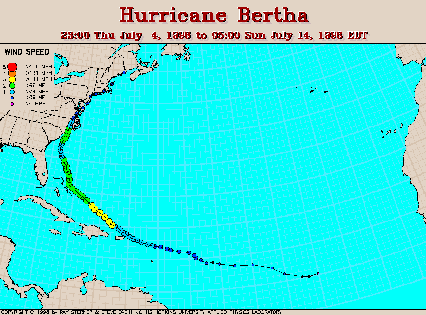
Track maps.
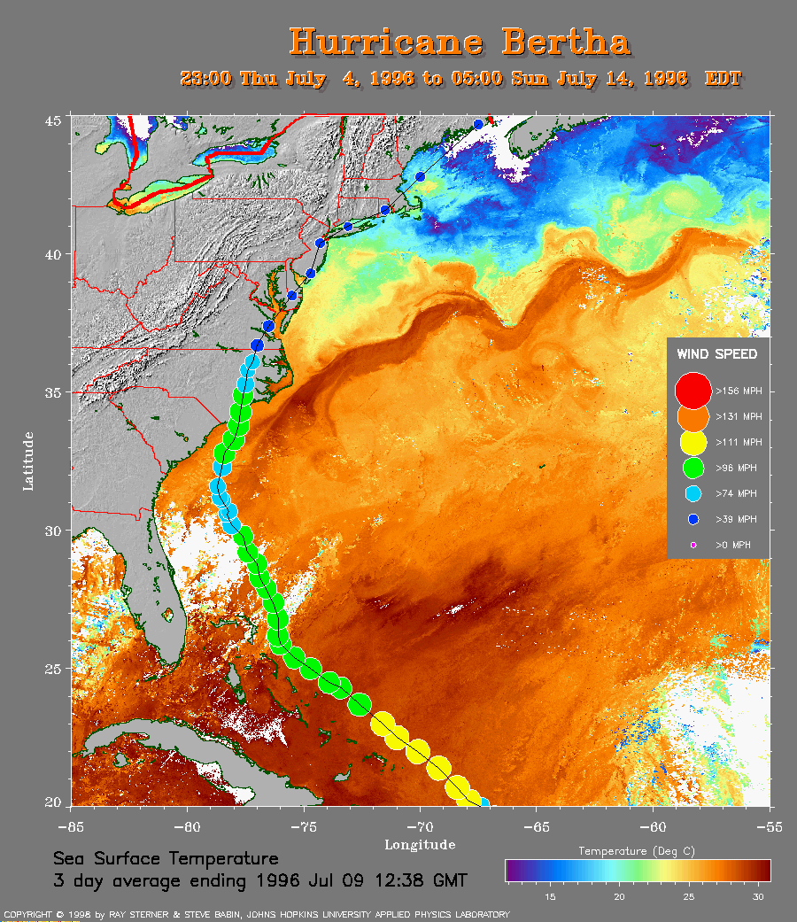 SST Map
Track plotted on average sea surface temperature.
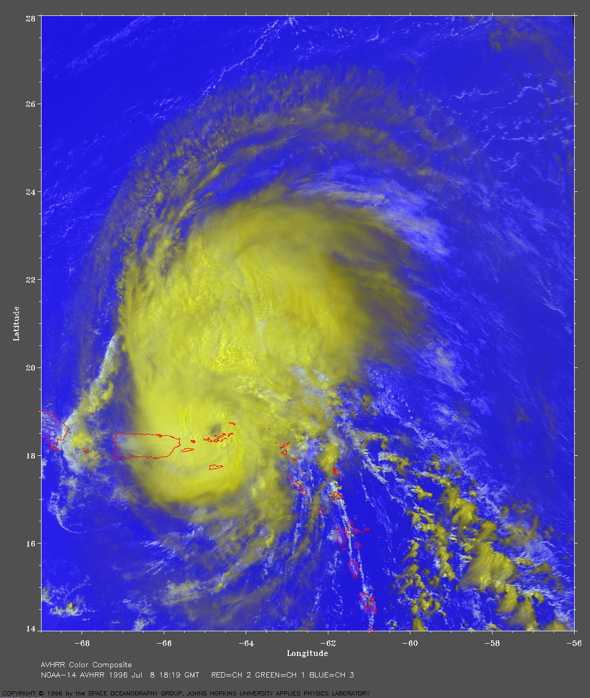 AVHRR Image at 2:19 PM EDT 1996 Jul 8
NOAA-14 AVHRR 3 channel color composite image.
This image shows the storm as it crosses the Virgin Islands.
Puerto Rico is the large island on the west side of the storm.
Warmer temperatures appear blue and cooler appear yellow in this
image.
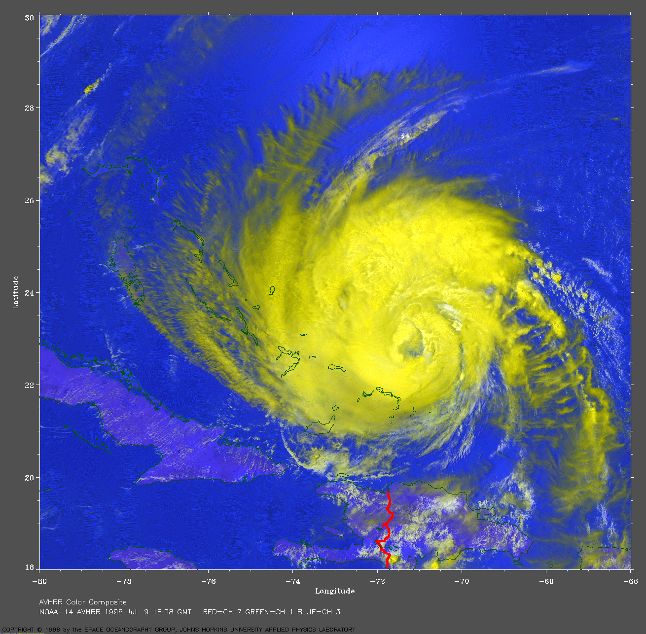 AVHRR Image at 2:08 PM EDT
 1996 Jul 9
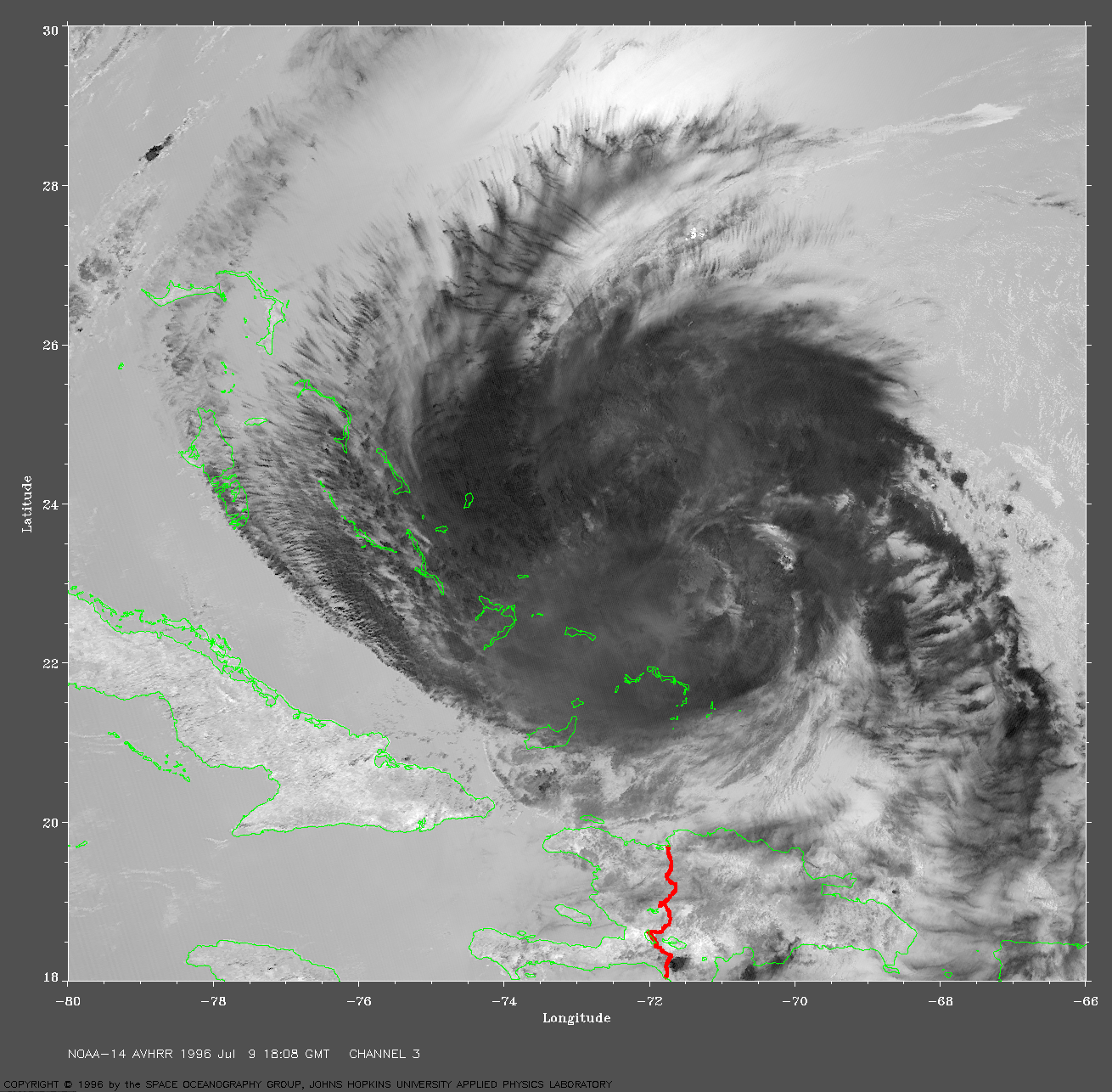
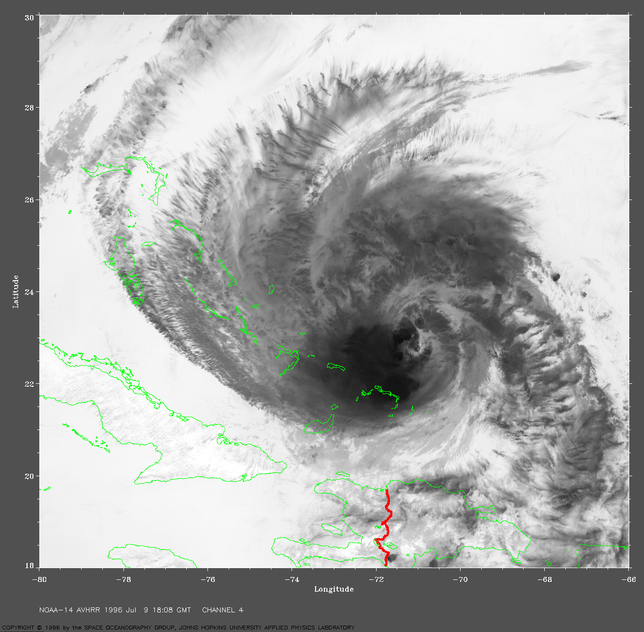
NOAA-14 AVHRR 3 channel color composite image. This image shows the storm as it skims along the northeast border of the Bahama Islands. Warmer clouds near the surface appear whiter. Some idea of the magnitude of this storm becomes apparent when it is remembered that 1 degree of latitude is 60 nautical miles (69 Statute miles or 111 km), the storms extends about 5.5 degrees north/south before ocean is visible through the clouds.
Fine details may be seen in the individual AVHRR channels. Channel 3 shows numerous thin clouds on the northern edge casting shadows in the bright sun glitter pattern below. Channel 4 shows a dark region just southwest of the center of the spiral pattern. This is a higher and thus colder area of clouds.
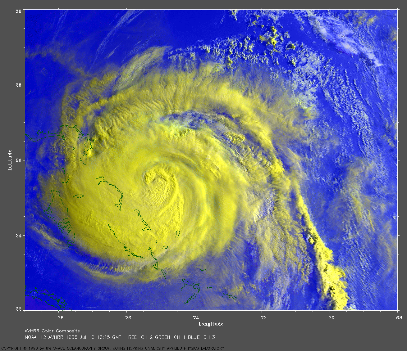 AVHRR Image at 8:15 AM EDT
 1996 July 10
NOAA-12 AVHRR 3 channel color composite image. This image shows many details of the storm clouds in the low morning sunlight as Bertha skims along the edge of the Bahama Islands chain. The southwestern edge of the cloud cover just catches Andros Island.
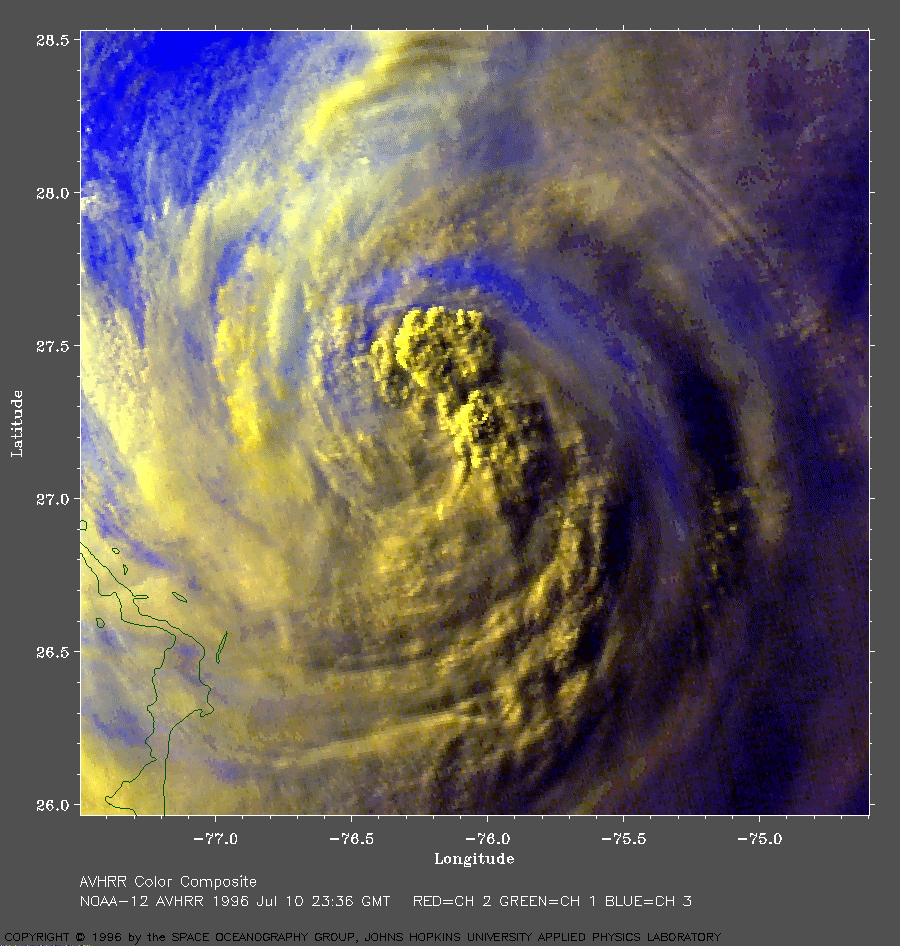
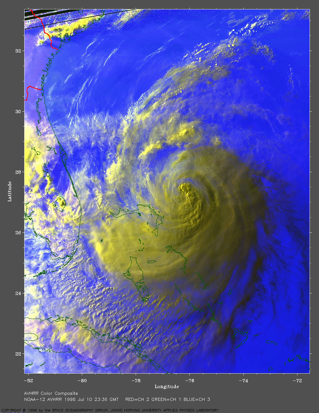 AVHRR Image at 7:36 PM EDT
 1996 July 10
NOAA-12 AVHRR 3 channel color composite image. This image shows Bertha as it completes its Atlantic side pass of the Bahama Islands. The sun was very low in the western sky for this view, and has already set for the eastern side of the storm which is still visible silhouetted dark against the warm infrared glow of the sea below (here colored blue). A close-up of the center shows the strong spiral pattern and some wave-like cloud features in the northeast part of the image.
 AVHRR Image at 7:54 AM EDT
 1996 July 11
NOAA-12 AVHRR 3 channel color composite image. This is an interesting view showing two levels in the storm. The colder (yellow) higher level clouds are offset to the south and east, revealing a warmer (white) lower level spiral structure nearer the surface. The low morning sunlight casts a blue shadow of the higher clouds on the whiter clouds below.
A wide area view gives the context of this storm and shows a massive cloud band to the north and east of Bertha. Clear cool morning air covers New England south to northern Virginia, note the early morning fog (whiter areas) in some of the valleys of West Virginia, Pennsylvania, and southern New York.
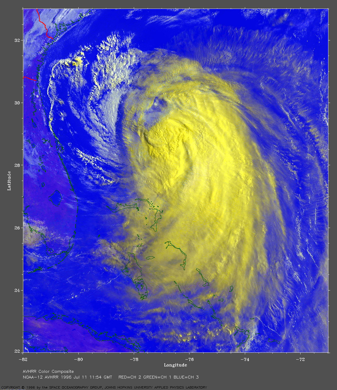
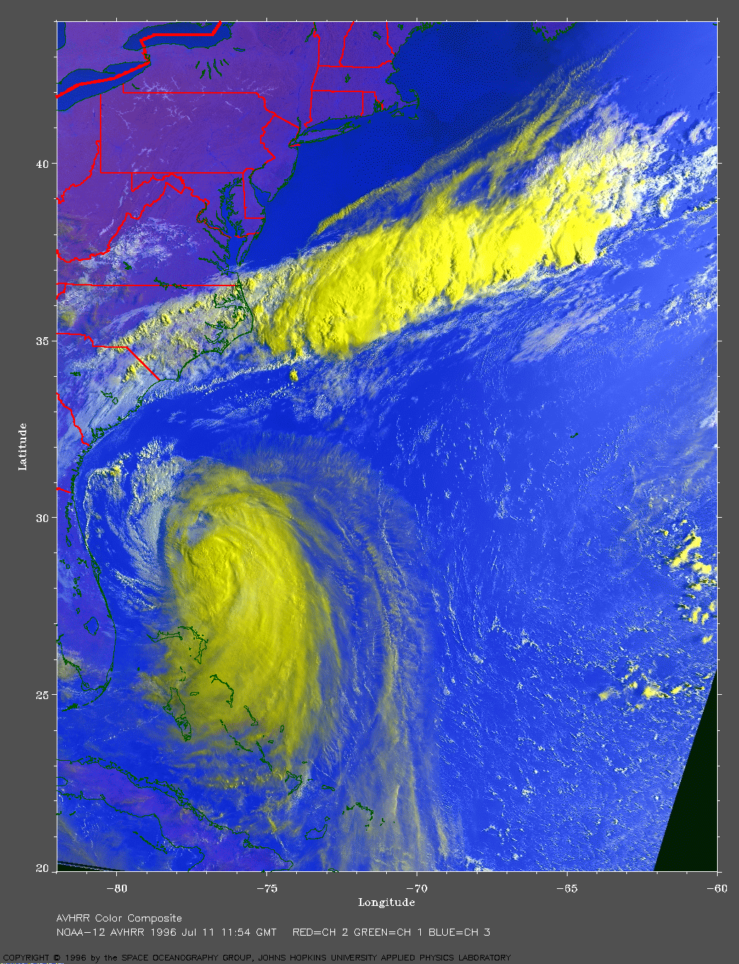
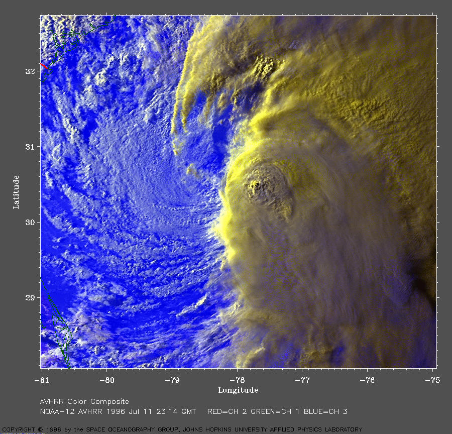
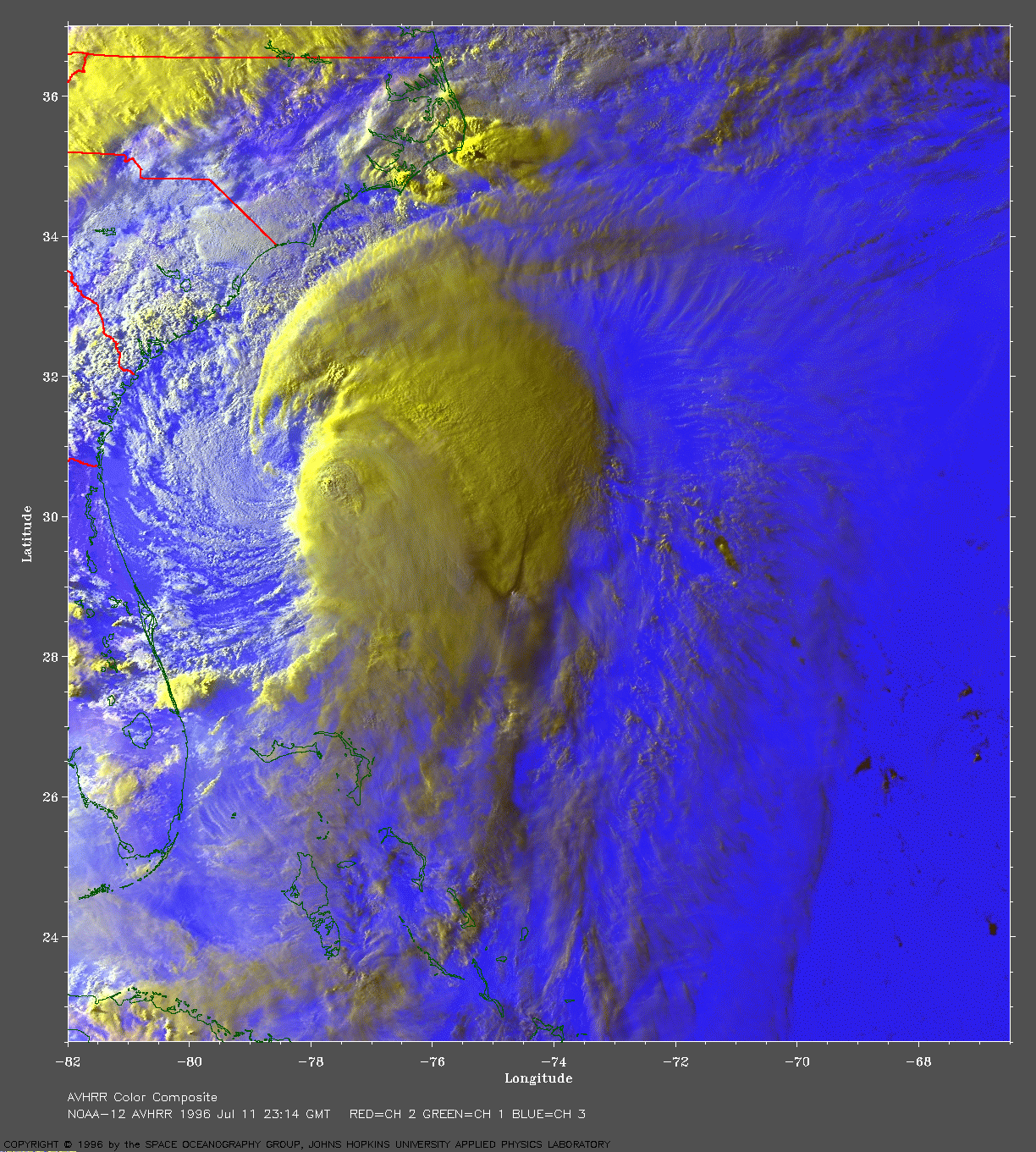 AVHRR Image at 7:14 PM EDT
 1996 July 11
NOAA-12 AVHRR 3 channel color composite image. The two clouds levels (warm low white, high cold yellow) show well in this view in the low evening sunlight as the storm slowly makes it way toward the Carolina coast.
A close-up shows the storm center. Cape Canaveral is in the south west corner of this close-up.
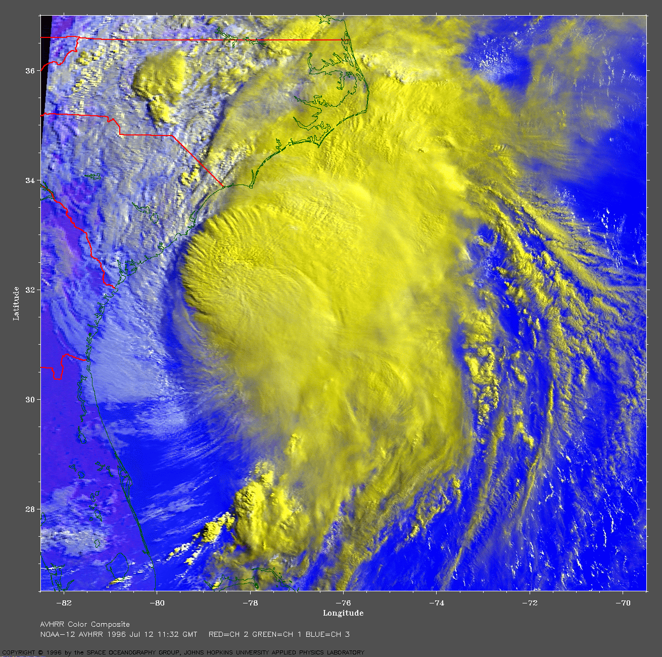 AVHRR Image at 7:32 AM EDT
1996 July 12
NOAA-12 AVHRR 3 channel color composite image. This image shows Bertha approaching the coast in the Myrtle Beach area (Myrtle Beach, South Carolina is on the coast, just southwest of the boundary between North and South Carolina).
Track file
Track data in a text file.