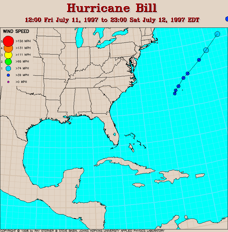
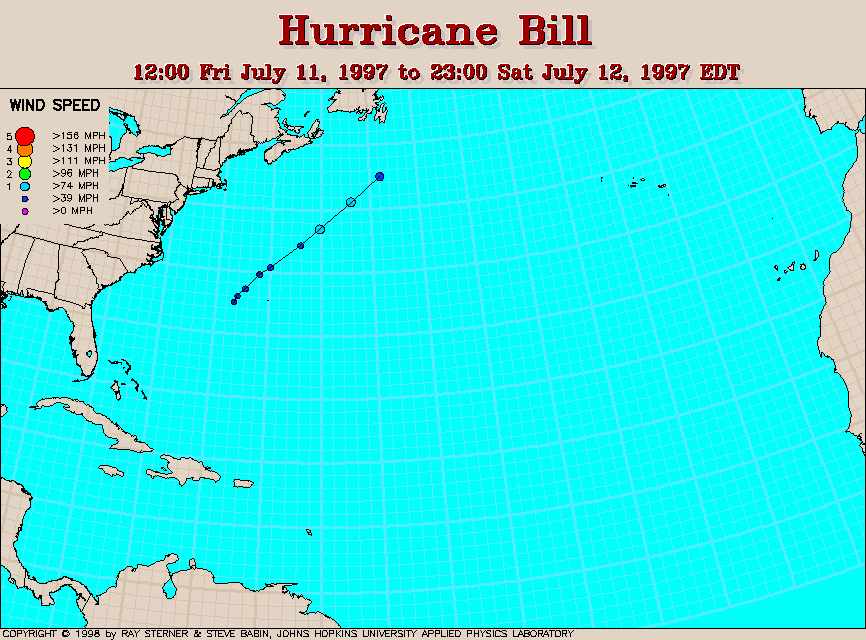
Track maps
Track file
Track data in a text file.
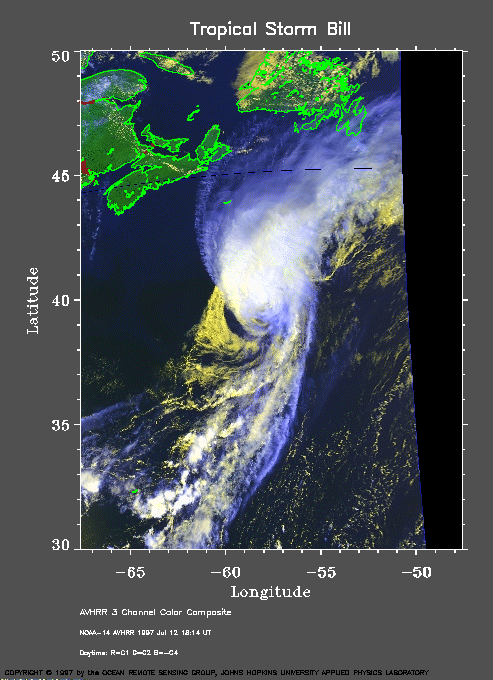
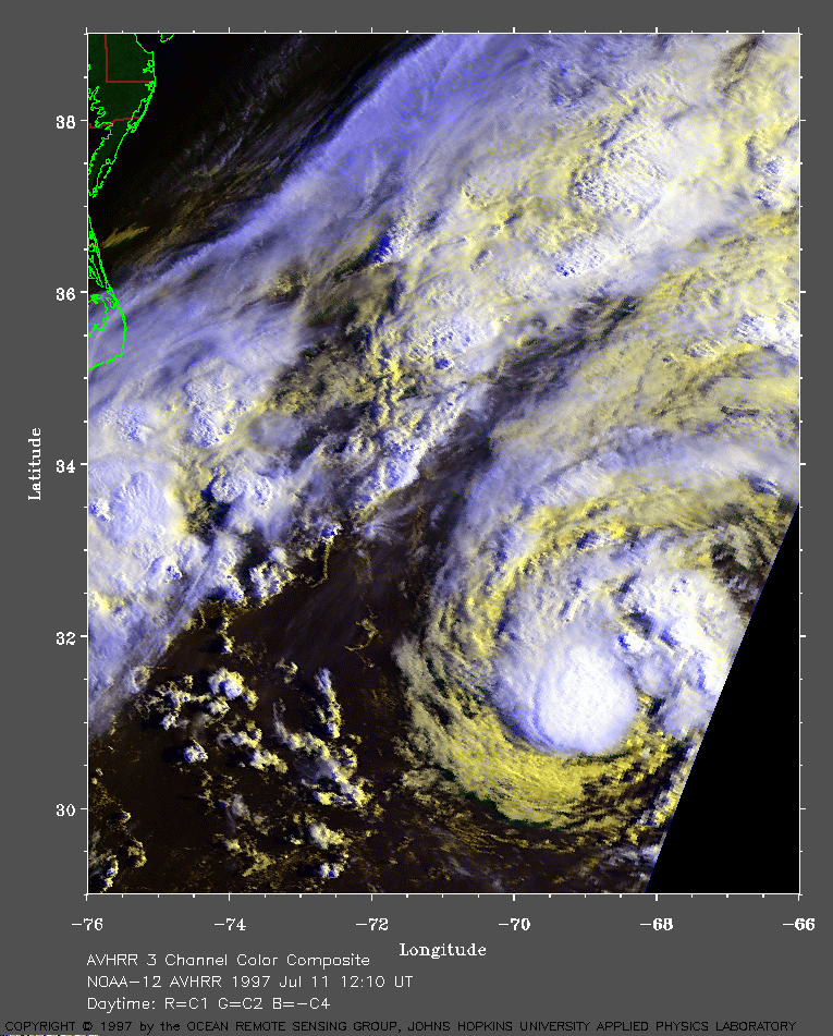 1997 July 11 12:10 UT
NOAA-12 AVHRR 3
channel composite daytime image. The cooler clouds are white and the
warmer clouds are yellow. A closer view (381 Kb) is seen by clicking on
this small image. Bill is a weak tropical storm and is moving toward
the northeast at the time of this image. A very large image (810
Kb) is also available.
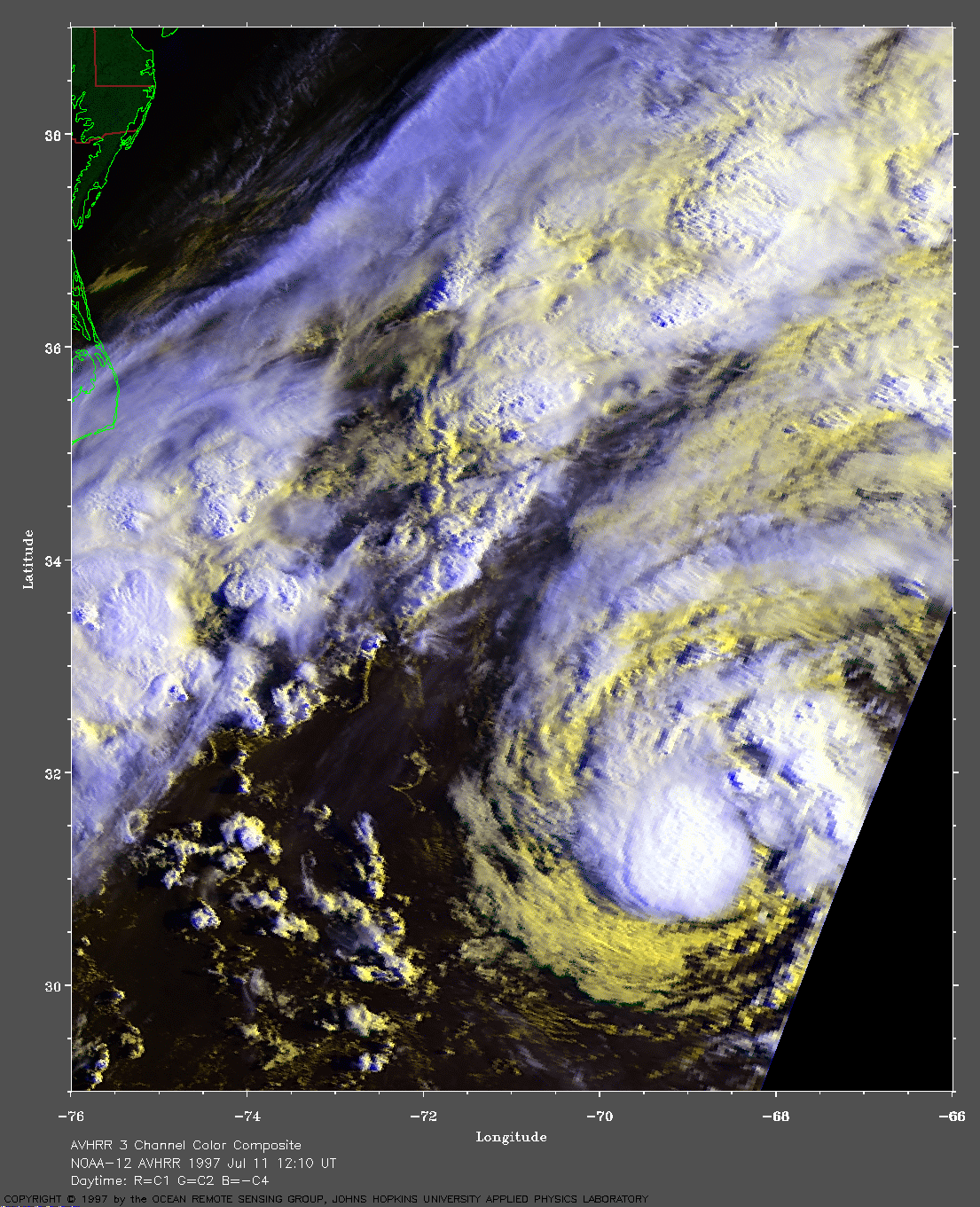
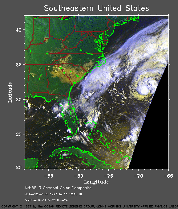
For reference, here is a
regional view (162 Kb) of the Southeast US at 1997 July 11
12:10 UT showing TS Bill off the South Carolina coast.
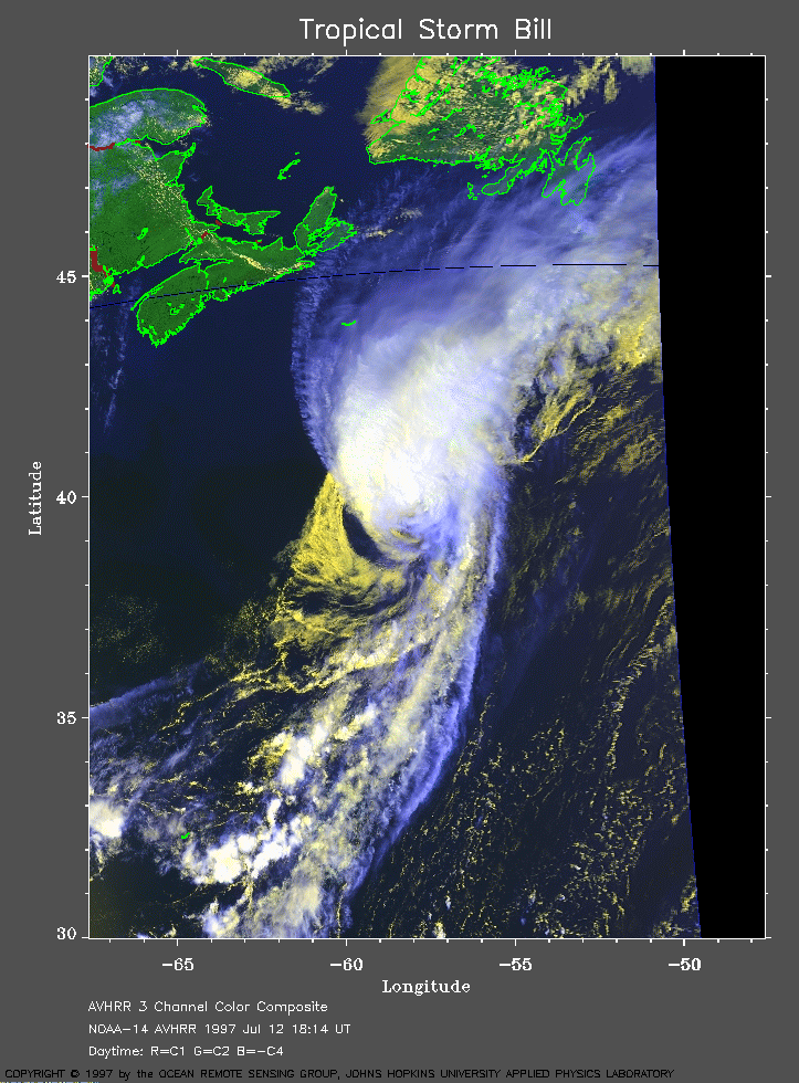
 1997 July 12 18:14 UT
NOAA-14 AVHRR 3
channel composite daytime image. The cooler clouds are white and the
warmer clouds are yellow. A closer view (121 Kb) is seen by clicking on
this small image. Bill is a hurricane with 75 mph winds at the time of
this image. A very large image (292
Kb) is also available.