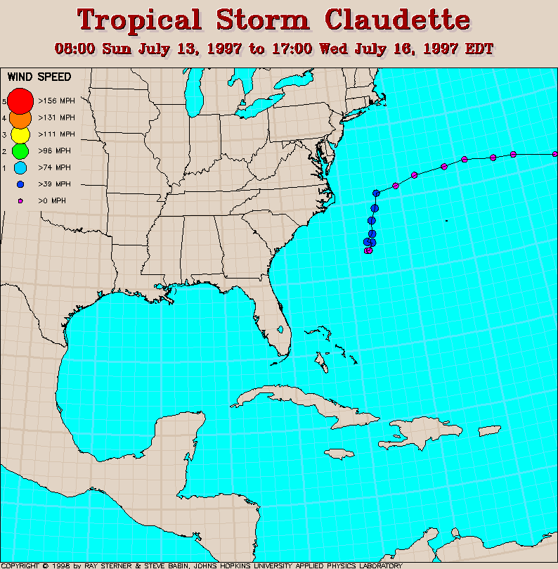
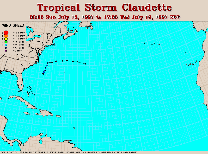
Track maps
Track file
Track data in a text file.
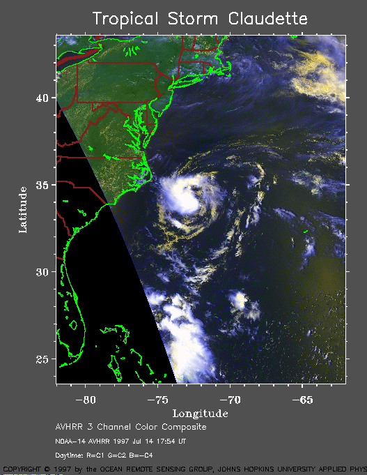 1997 July 14 17:54
UT
1997 July 14 17:54
UT
NOAA-14 AVHRR 3 channel composite daytime image. The cooler
clouds are white and the warmer clouds are yellow. A closer view (120
Kb) is seen by clicking on this small image. Claudette has maximum
sustained winds of 45 mph.
A very large image (280
Kb) is also available.
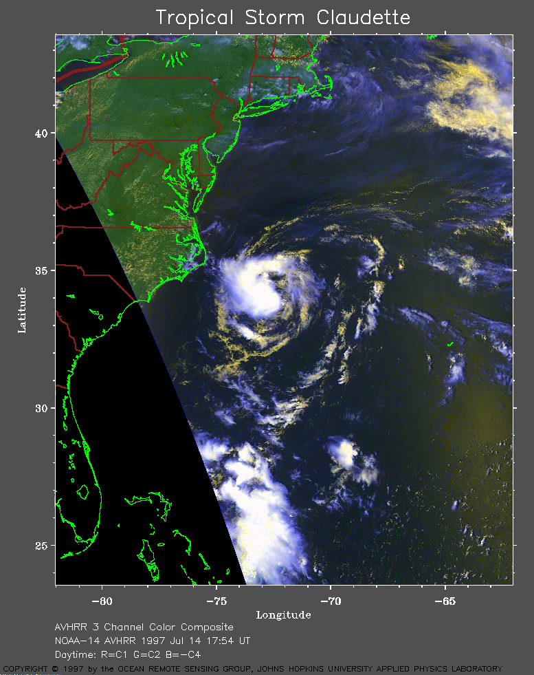
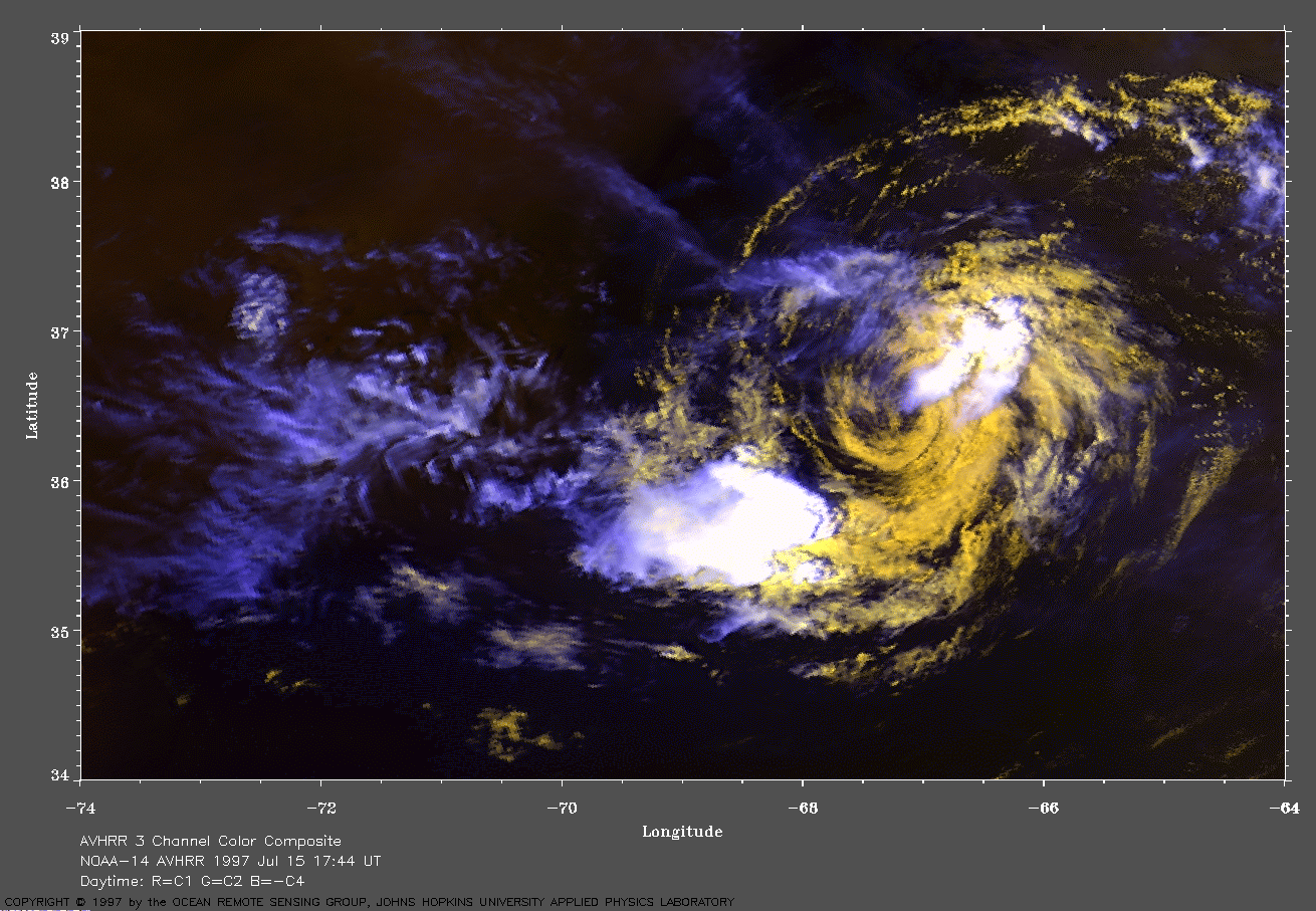
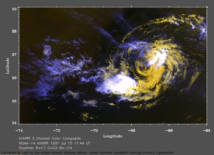 1997 July 15 17:44
UT
1997 July 15 17:44
UT
NOAA-14 AVHRR 3 channel composite daytime image. The cooler
clouds are white and the warmer clouds are yellow. A closer view (223
Kb) is seen by clicking on this small image. Claudette has weakened
into a tropical depression. Shearing of the upper level clouds reveals
the low level circulation in this image.
A very large image (471
Kb) is also available.