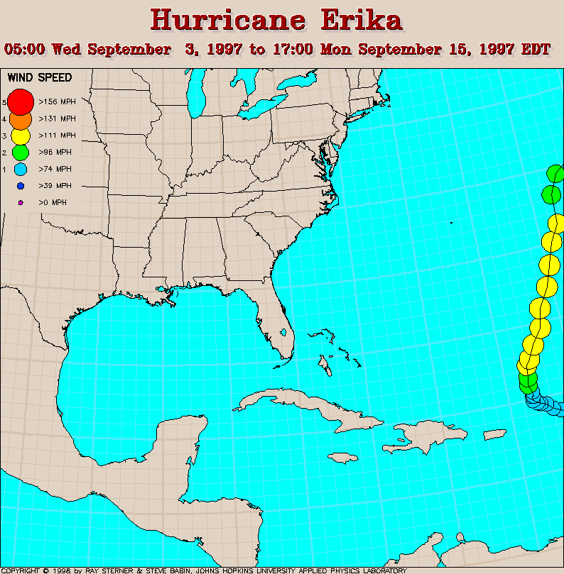
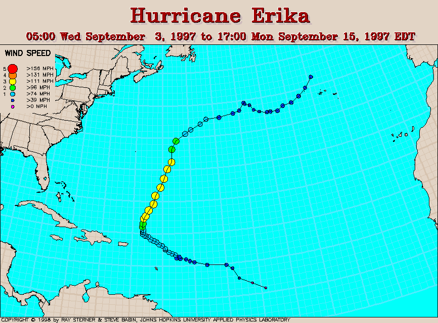
Track maps
Track file
Track data in a text file.
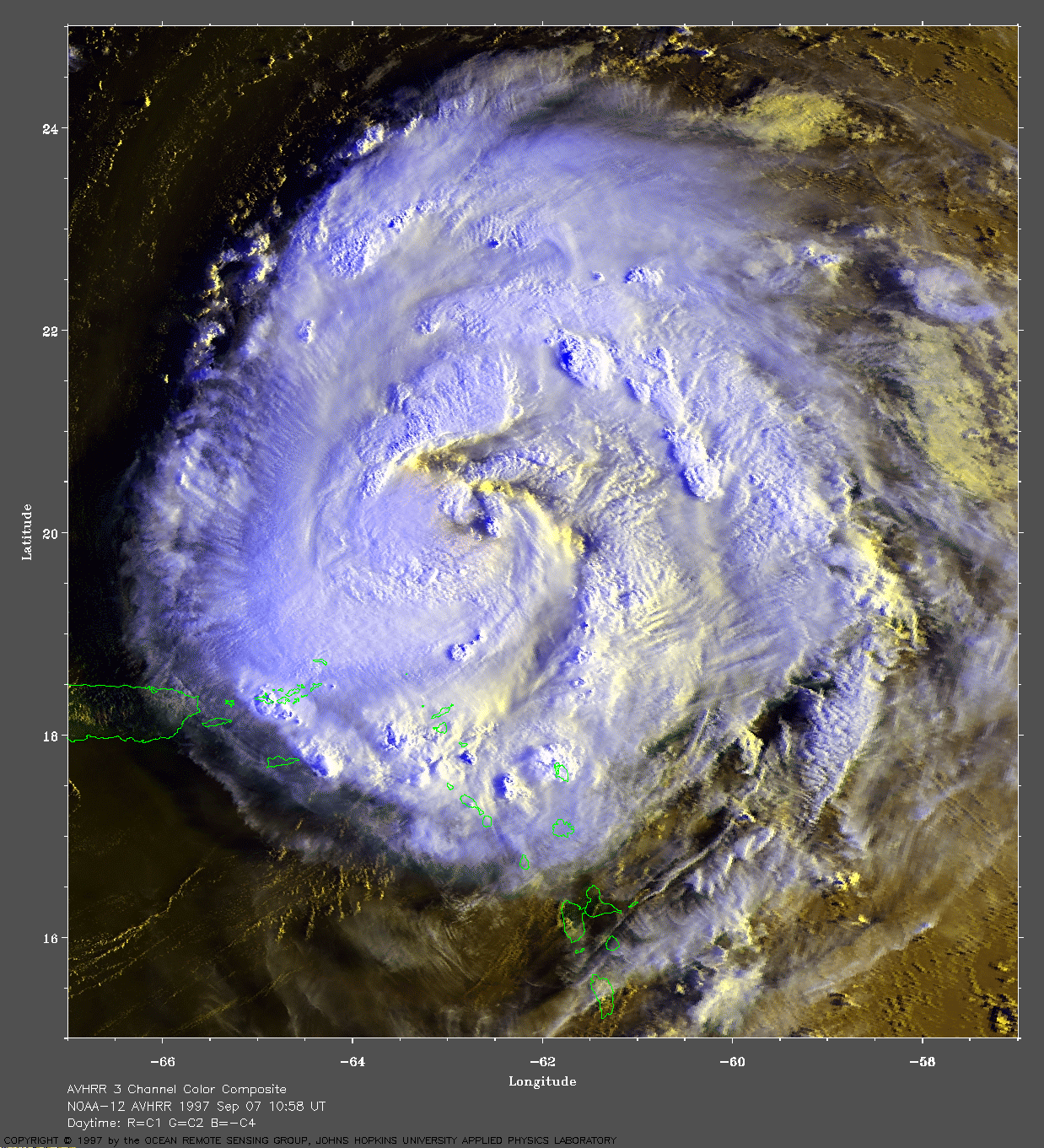
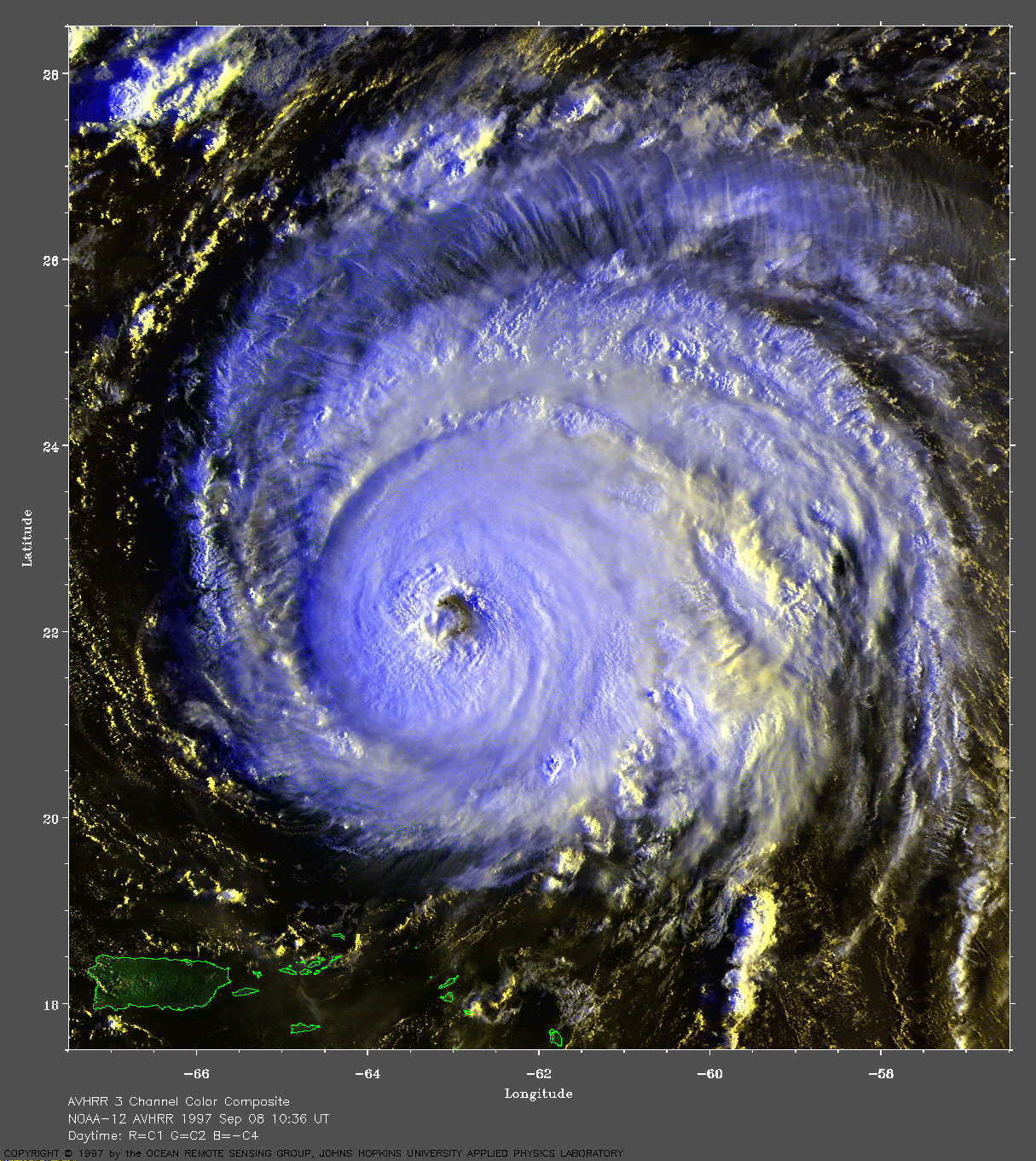
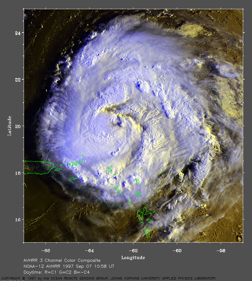 1997 September 7 10:58 UT
NOAA 12 AVHRR 3 channel composite daytime image. The cooler clouds
are white and the warmer clouds are yellow. A closer view (452 Kb) of
Hurricane Erika is seen by clicking on this small image.
Erika is a Category 1 Hurricane with 85 mph maximum sustained
winds. Notice the rain bands just brushing the northeast coast of
Puerto Rico.
A very large image (971
Kb) is also available.
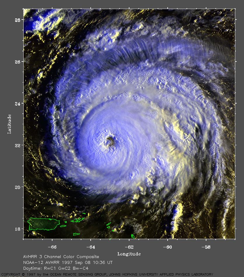 1997 September 8 10:36 UT
NOAA 12 AVHRR 3 channel composite daytime image. The cooler clouds
are white and the warmer clouds are yellow. A closer view (468 Kb) of
Hurricane Erika is seen by clicking on this small image.
Erika is now a Category 3 Hurricane with 120 mph maximum sustained
winds. Notice that a well-defined eye has formed.
A very large image (960
Kb) is also available.