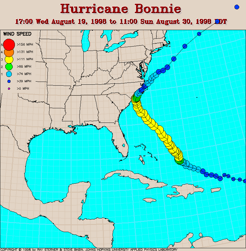
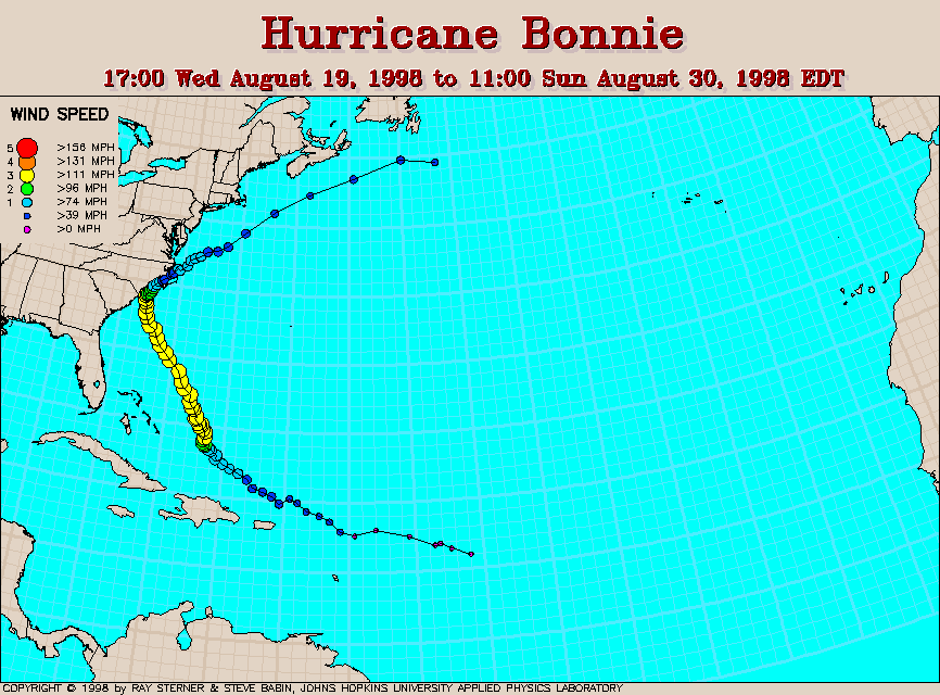
Track maps
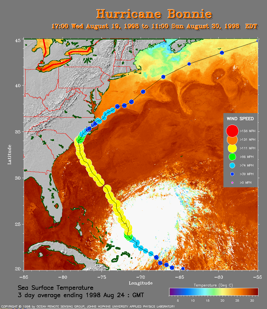 SST Track Map
Track superimposed on sea surface temperature (SST).
A closer view (292 Kb) is seen by clicking on this small image.
The warmer SST indicates the Gulf Stream. The SST in this image is
derived from averaging images over 3 days ending August 24 in order to
remove cloud cover. Because Bonnie was nearly stationary during most of
that period, the clouds associated with the earlier positions of Bonnie
remain.
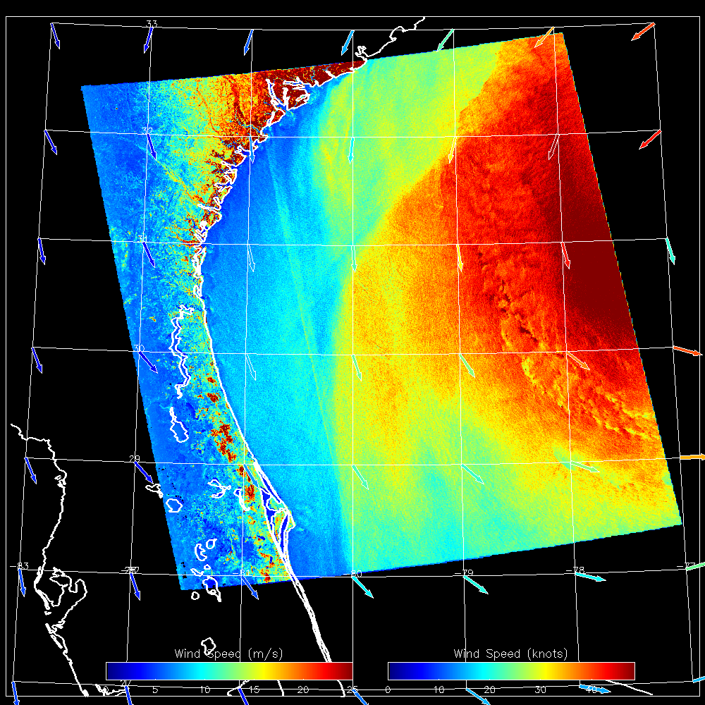 1998 August 25 10:53 UT
RADARSAT SAR-derived wind speeds (578 Kb).
These images were produced as part of the
StormWatch
project. At 23:00 UT (19:00 EDT) on 25 August, Bonnie had
maximum sustained winds of 115 mph (about 52 m/s) and the center was
located at 31.6N, 76.8W.
1998 August 25 10:53 UT
RADARSAT SAR-derived wind speeds (578 Kb).
These images were produced as part of the
StormWatch
project. At 23:00 UT (19:00 EDT) on 25 August, Bonnie had
maximum sustained winds of 115 mph (about 52 m/s) and the center was
located at 31.6N, 76.8W.
Track file
Track data in a text file.
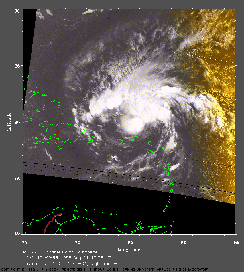 1998 August 21 10:06 UT
NOAA-12 AVHRR 3 channel composite early
morning image. A closer view (277 Kb) is seen by clicking on this small
image. Bonnie is a developing tropical storm and is moving toward the
northwest at the time of this image. A
very large image (677 Kb) is also available.
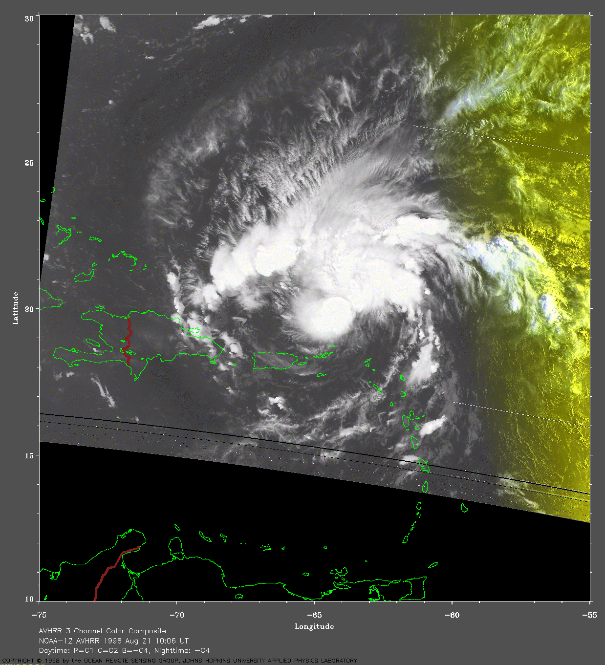
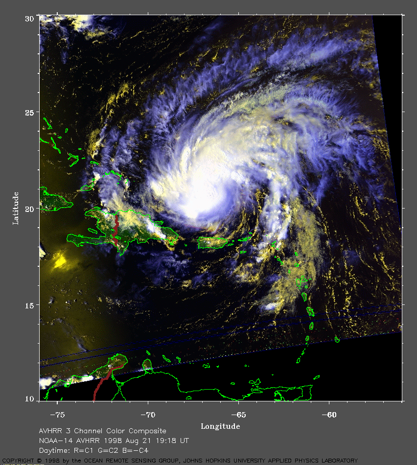 1998 August 21 19:18 UT
NOAA-14 AVHRR 3 channel composite daytime
image. A closer view (364 Kb) is seen by clicking on this small
image. Bonnie has intensified with 65 mph winds and is moving toward the
Bahamas at the time of this image. A
very large image (751 Kb) is also available.
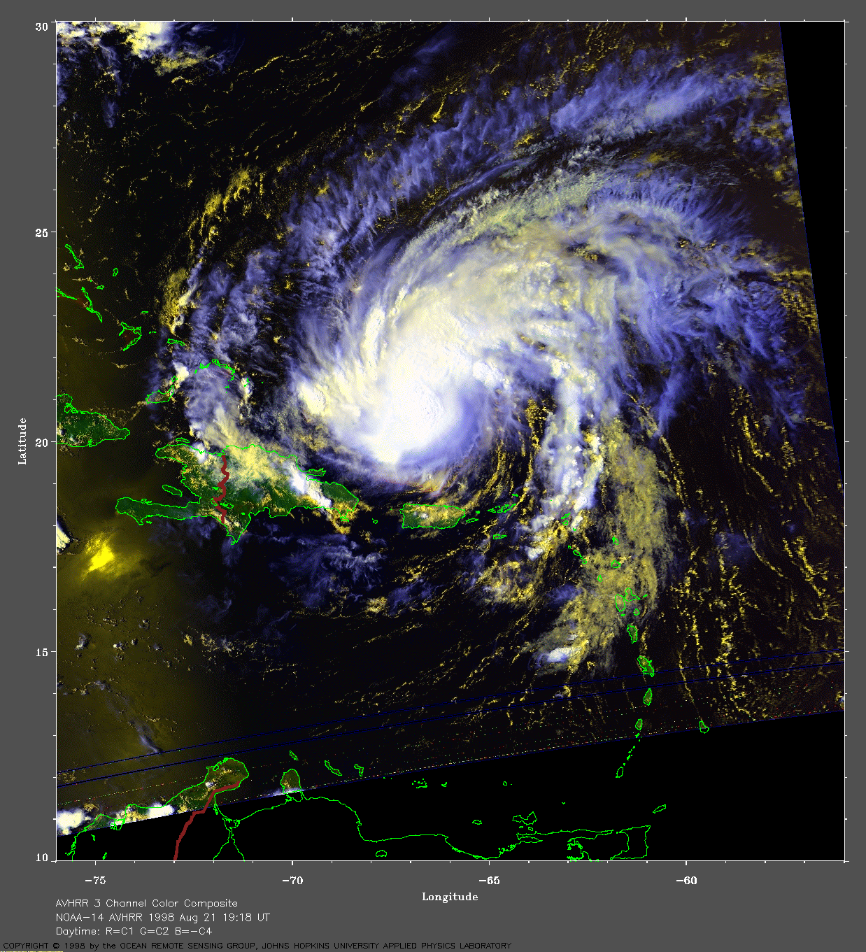
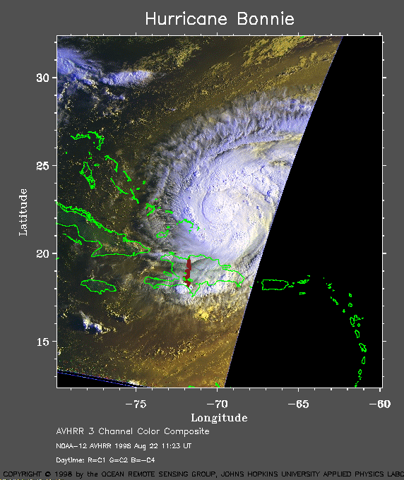 1998 August 22 11:23 UT
NOAA-12 AVHRR 3 channel composite early
morning image. A closer view (132 Kb) is seen by clicking on this small
image. Bonnie is now a hurricane and is moving toward the Bahamas at
the time of this image.
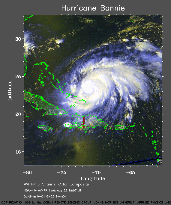 1998 August 22 19:07 UT
NOAA-14 AVHRR 3 channel composite daytime
image. A closer view (168 Kb) is seen by clicking on this small
image. Bonnie has intensified with 85 mph maximum sustained winds.
The eye is forming but not yet seen on this satellite image. Bonnie is
moving toward the Bahamas at the time of this image.
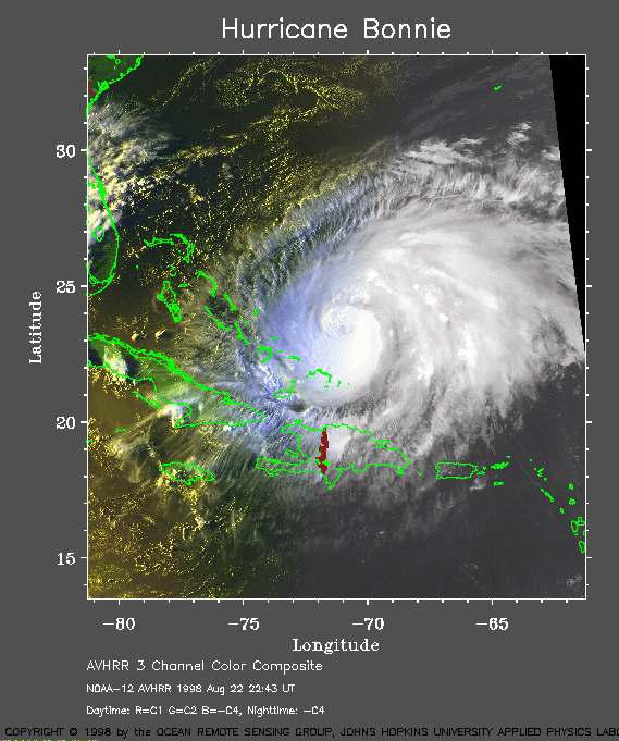 1998 August 22 22:43 UT
NOAA-12 AVHRR 3 channel composite evening
image. A closer view (171 Kb) is seen by clicking on this small
image. Because the maximum sustained winds have increased to 90 mph,
Bonnie is now a Category 2 on the Saffir-Simpson Scale. An eye has just
become visible on this satellite image. The forward motion of Bonnie is
slowing.
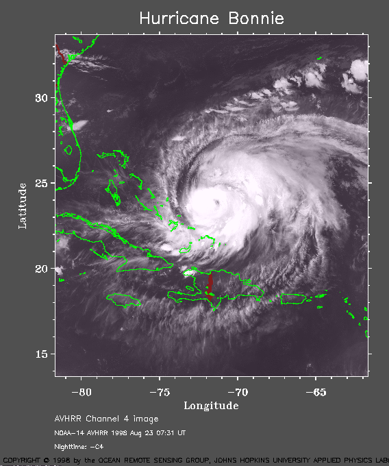 1998 August 23 07:31 UT
NOAA-14 AVHRR channel 4 nighttime
image. A closer view (122 Kb) is seen by clicking on this small
image. The maximum sustained winds have increased to 105 mph.
The eye is now clearly visible.
Steering currents have weakened and Bonnie is continuing to slow in its
forward motion.
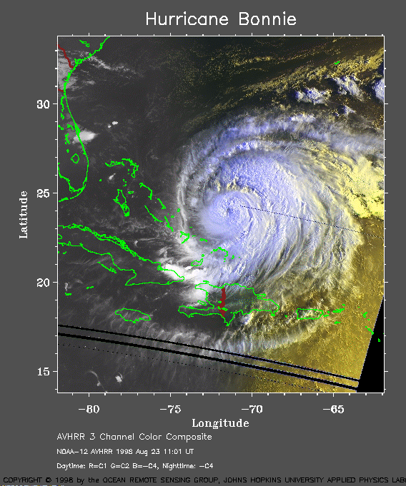 1998 August 23 11:01 UT
NOAA-12 AVHRR 3 channel composite early
morning image. A closer view (171 Kb) is seen by clicking on this small
image. Bonnie is becoming stationary.
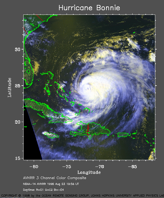 1998 August 23 18:56 UT
NOAA-14 AVHRR 3 channel composite daytime
image. A closer view (167 Kb) is seen by clicking on this small
image. With 115 mph maximum sustained winds, Bonnie has now become
a Category 3 hurricane on the Saffir-Simpson Scale. However, the
forward motion is nearly stationary. Model forecasts of its track are
highly divergent.
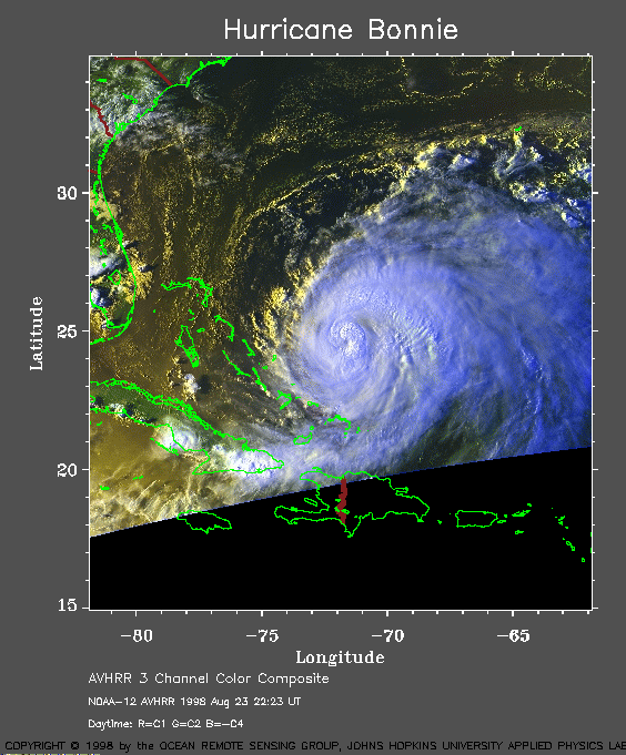 1998 August 23 22:23 UT
NOAA-12 AVHRR 3 channel composite evening
image. A closer view (146 Kb) is seen by clicking on this small
image. Because Bonnie has been stationary, it may have cooled the
surface waters sufficiently to slow its strengthening. However, it is
maintaining its 115 mph winds.
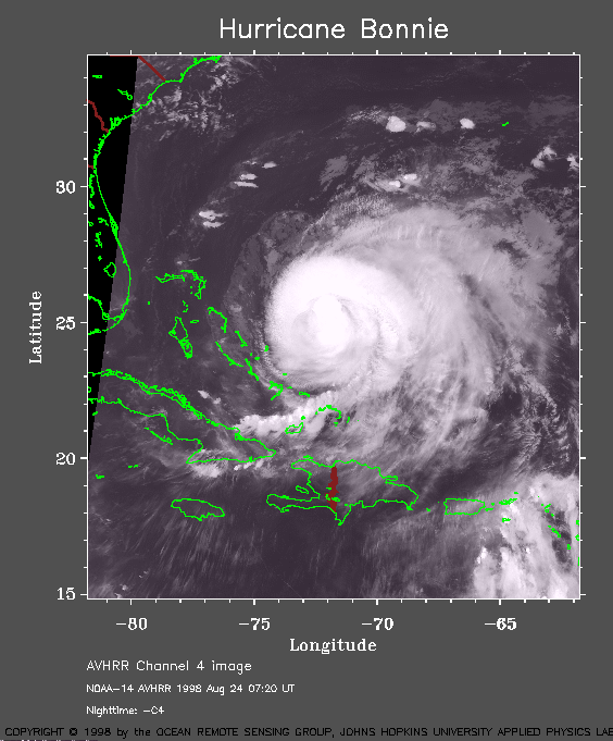 1998 August 24 07:20 UT
NOAA-14 AVHRR channel 4 nighttime
image. A closer view (122 Kb) is seen by clicking on this small
image. The eye of Bonnie can no longer be seen.
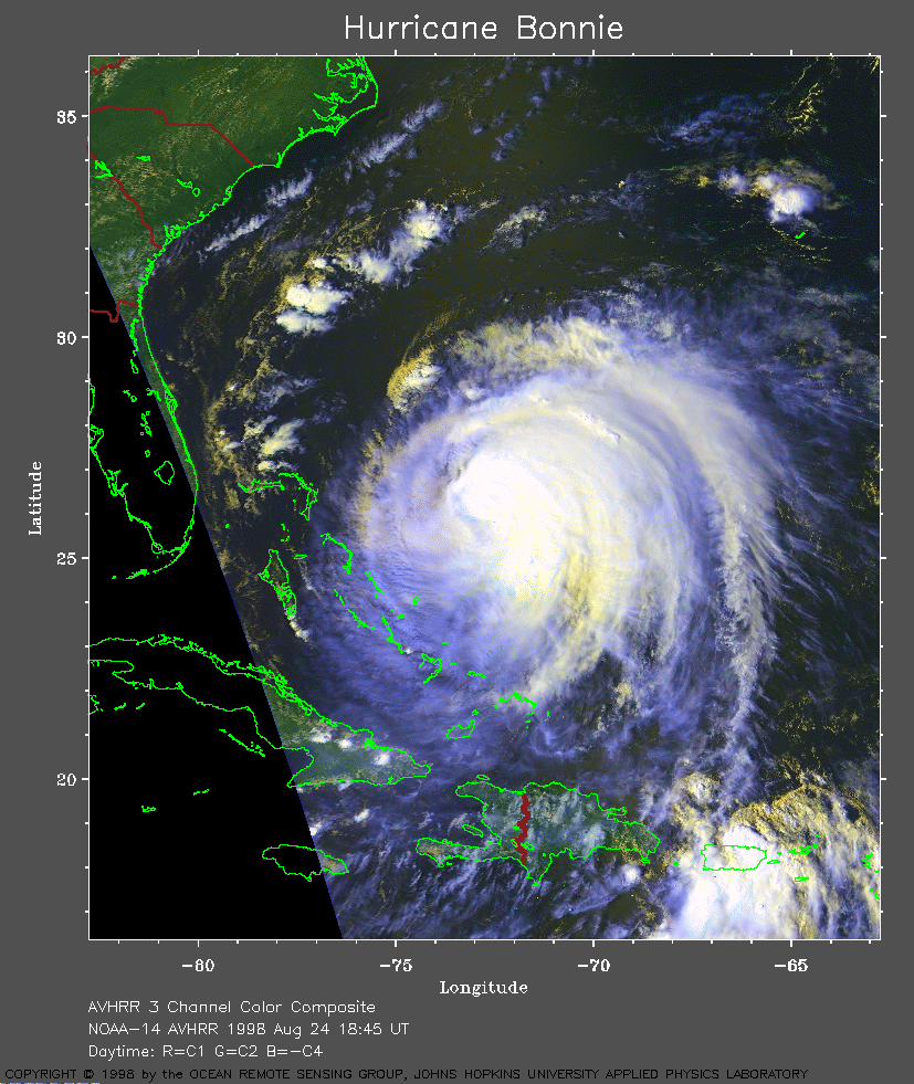 1998 August 24 18:45 UT
NOAA-14 AVHRR 3 channel composite
daytime image. A closer view (367 Kb) is seen by clicking on this small
image. Bonnie is drifting very slowly to the northwest, but maintaining
its 115 mph winds.
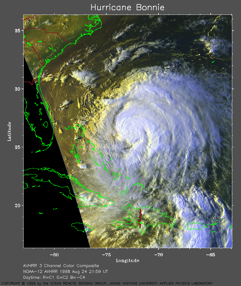 1998 August 24 21:59 UT
NOAA-12 AVHRR 3 channel composite
daytime image. A closer view (417 Kb) is seen by clicking on this small
image. At this time, the forecast models are not in agreement as to the
future of Bonnie.
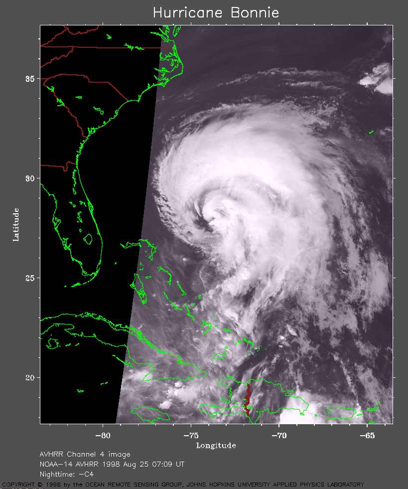 1998 August 25 07:09 UT
NOAA-14 AVHRR channel 4 nighttime
image. A closer view (230 Kb) is seen by clicking on this small
image. Bonnie continues to move toward the northwest and its forward
motion is increasing.
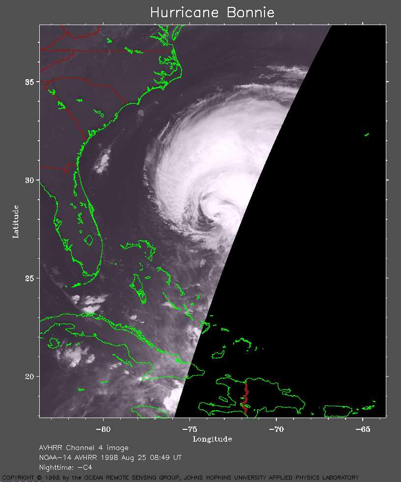 1998 August 25 08:49 UT
NOAA-14 AVHRR channel 4 nighttime
image. A closer view (146 Kb) is seen by clicking on this small
image. A hurricane warning has been issued for the North Carolina
coast.
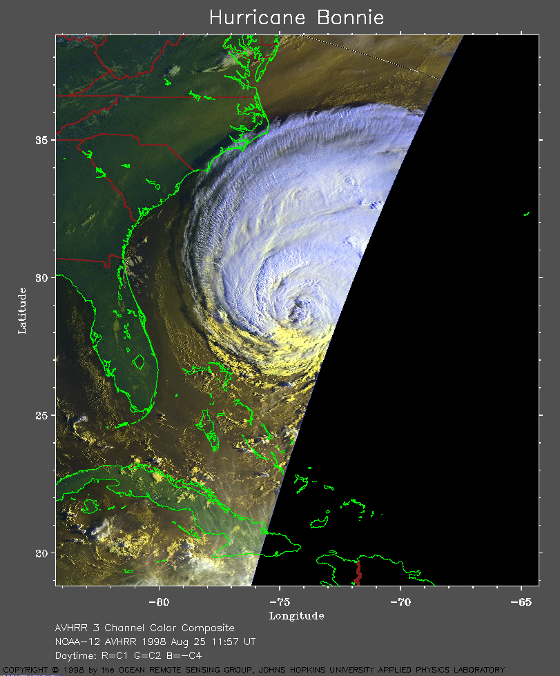 1998 August 25 11:57 UT
NOAA-12 AVHRR 3 channel composite early
morning image. A closer view (240 Kb) is seen by clicking on this small
image. A hurricane watch has been issued for the coast from the North
Carolina/Virginia border north to Cape Henlopen, Delaware.
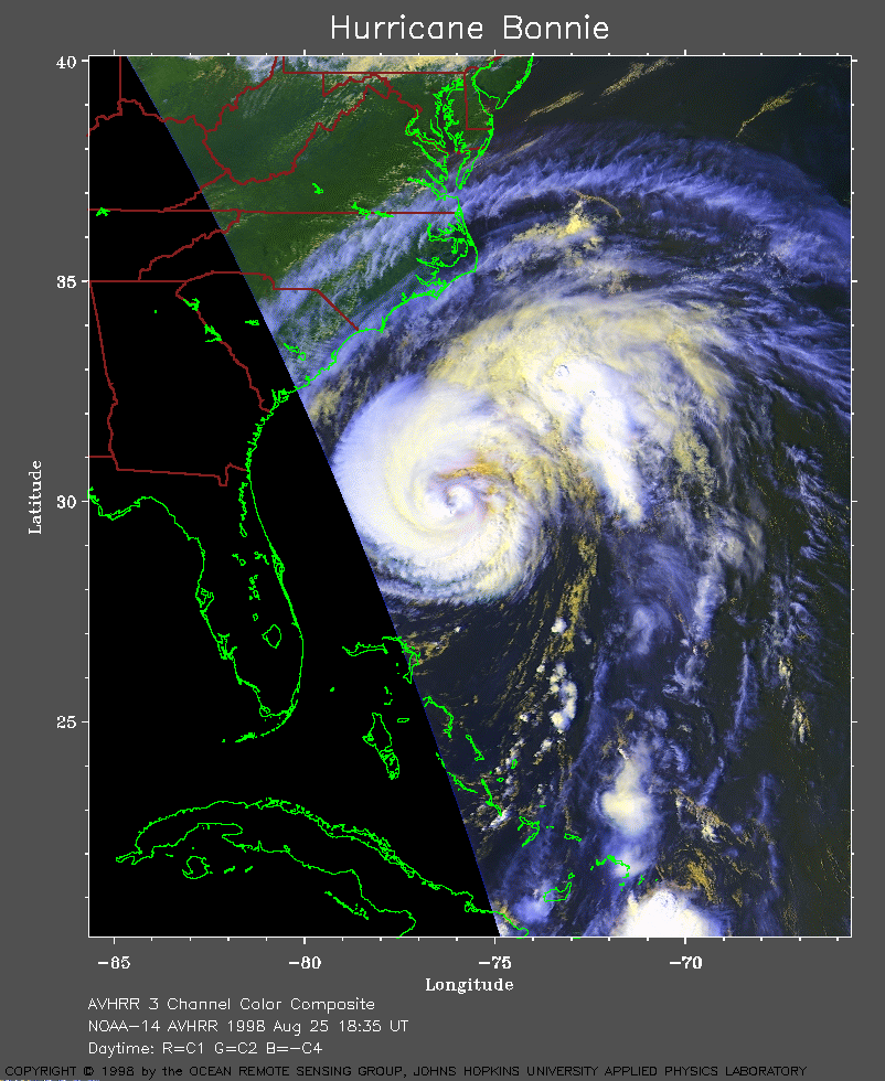 1998 August 25 18:35 UT
NOAA-14 AVHRR 3 channel composite daytime
image. A closer view (284 Kb) is seen by clicking on this small
image. The forward motion of Bonnie continues to increase to 10-14
knots. The hurricane warning is extended north from North Carolina to
Chincoteague, Virginia, and the Chesapeake Bay south of Smith Point.
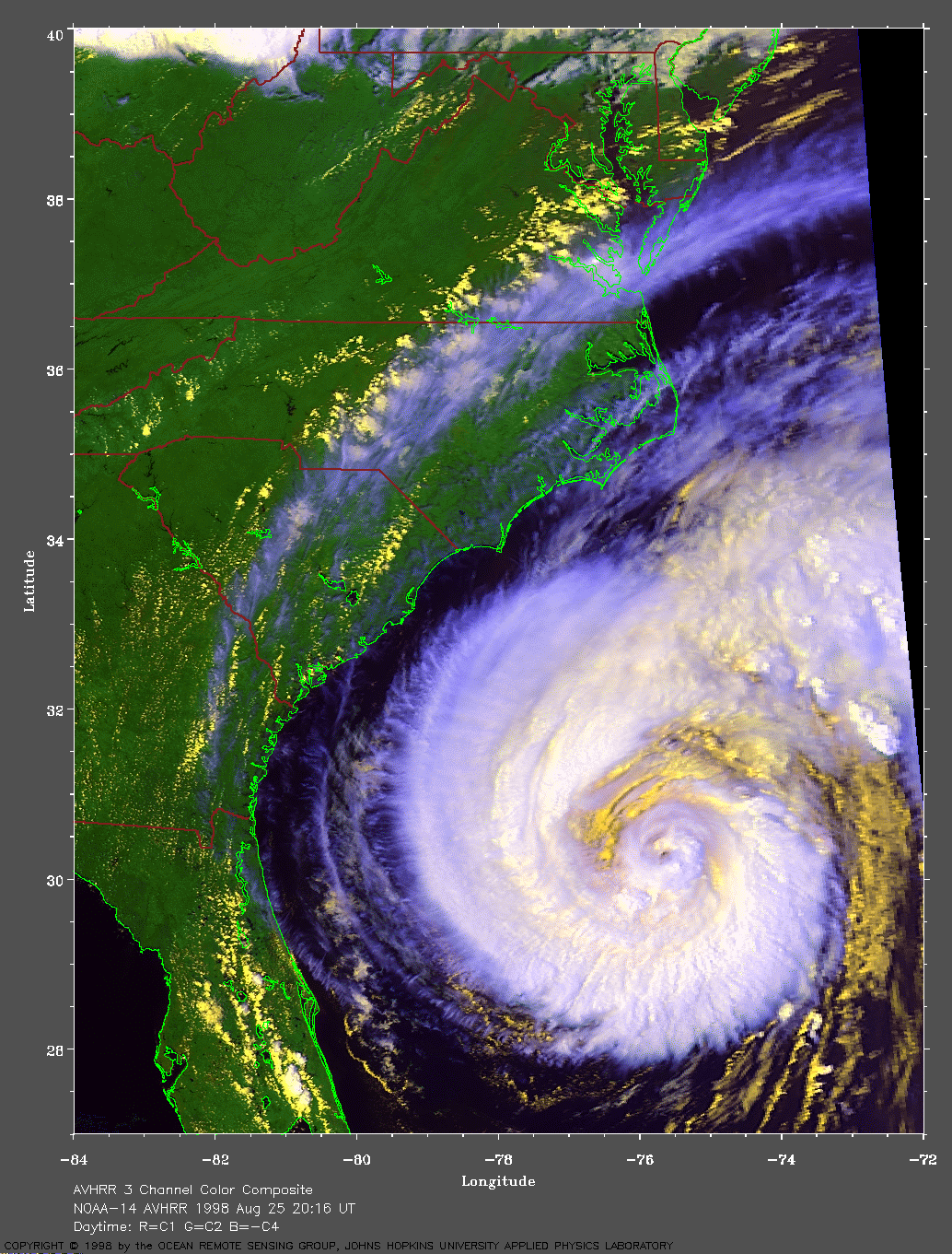
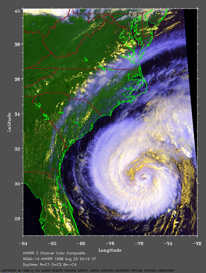 1998 August 25 20:16 UT
NOAA-14 AVHRR 3 channel composite daytime
image. A closer view (311 Kb) is seen by clicking on this small
image. Here Bonnie is seen approaching the
Carolina coast. Rainbands began spreading across the coast during the
previous evening.
A
very large image (674 Kb) is also available.
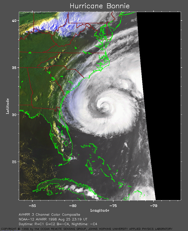 1998 August 25 23:19 UT
NOAA-12 AVHRR 3 channel composite daytime
image. A closer view (279 Kb) is seen by clicking on this small
image. The forecast models are now more consistent in their
predictions. However, there is some concern that Bonnie has not yet turned
to the north.
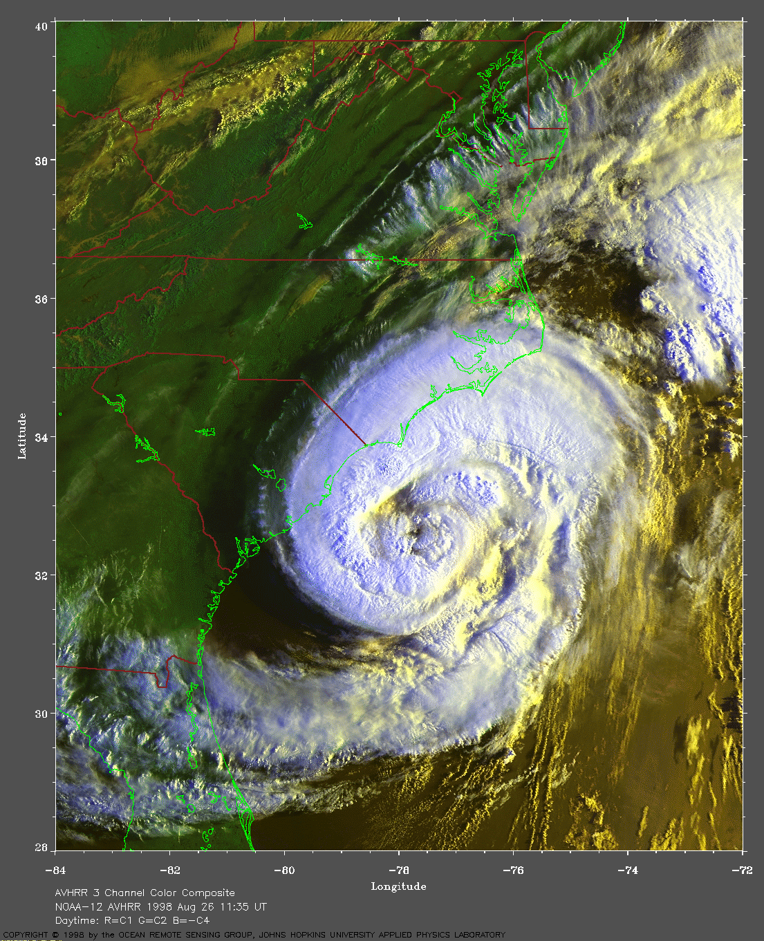
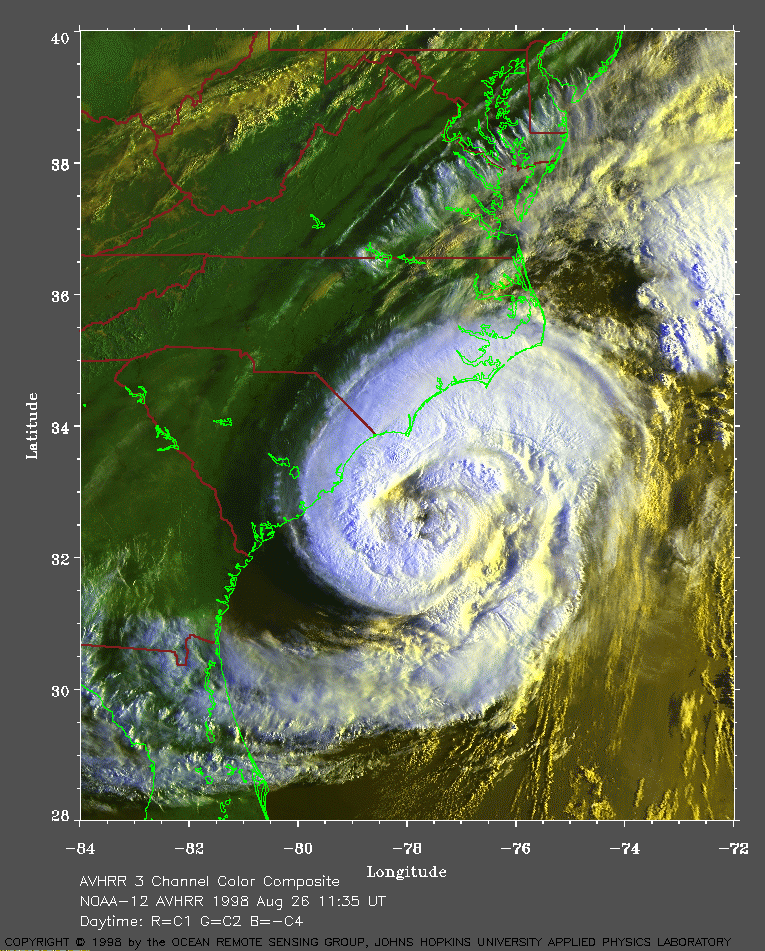 1998 August 26 11:35 UT
NOAA-12 AVHRR 3 channel composite morning
image. A closer view (412 Kb) is seen by clicking on this small
image. Bonnie is approaching the coast at a forward speed of about 14
mph. The maximum sustained winds remain at 115 mph.
A
very large image (899 Kb) is also available.
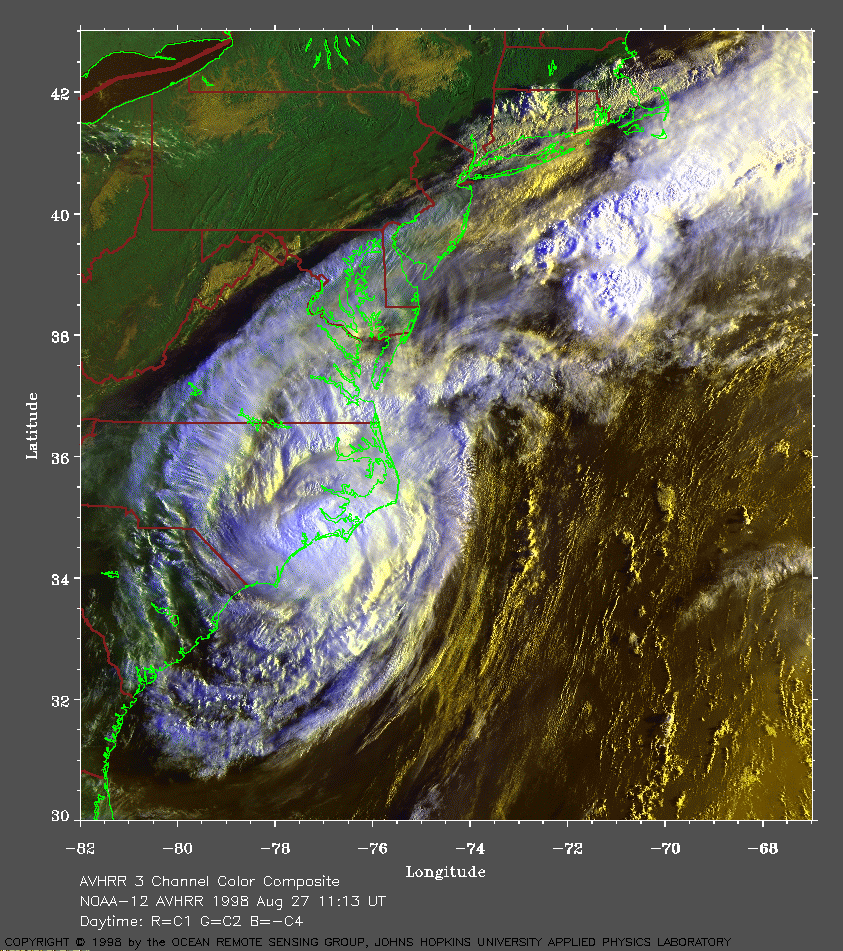 1998 August 27 11:13 UT
NOAA-12 AVHRR 3 channel composite morning
image. A closer view (479 Kb) is seen by clicking on this small
image. The eye of Bonnie has crossed the Carolina coast near Cape Fear.
The winds have now decreased to about 85 mph. (Note also the fog in the
valleys on the Pennsylvania/New York border).
A
very large image (1045 Kb) is also available.
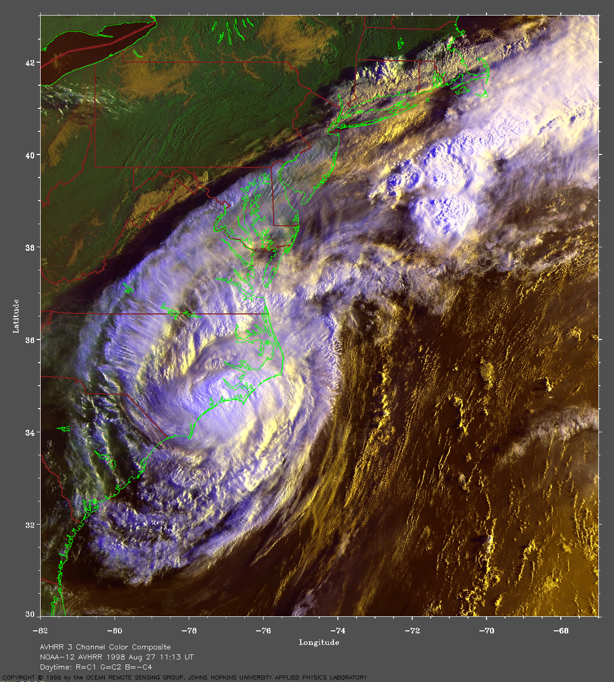