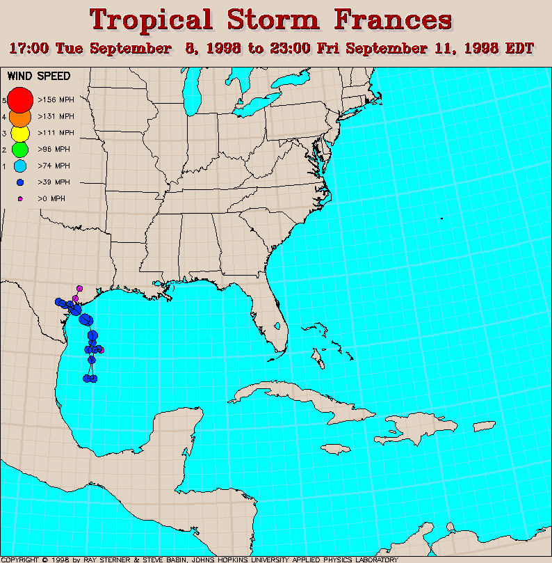
Track map
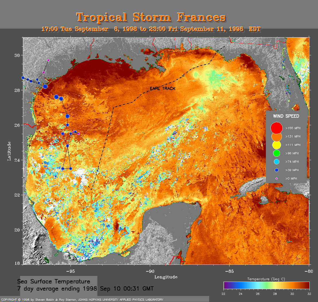 7 day SST Track Map Track map
overlaid on sea surface temperature (SST) image (408 Kb). This image
is derived from averaging SST data over 7 days ending 10 September 1998
to remove clouds. Because conditions over the Gulf were so cloudy during
this time, a 3 day average was insufficient to remove the clouds and a 7
day average was required. The previous track of Earl is also shown
(dash-dot line). Note the cool wake of Earl to the east of its track.
7 day SST Track Map Track map
overlaid on sea surface temperature (SST) image (408 Kb). This image
is derived from averaging SST data over 7 days ending 10 September 1998
to remove clouds. Because conditions over the Gulf were so cloudy during
this time, a 3 day average was insufficient to remove the clouds and a 7
day average was required. The previous track of Earl is also shown
(dash-dot line). Note the cool wake of Earl to the east of its track.
Track file
Track data (lat/lon, winds, etc.) in a text file.
 1998 September 9 09:24 UT
NOAA-14 AVHRR
channel 4 nighttime image. A closer view (539 Kb) is seen by clicking
on this small image. At this time, Frances is still a disorganized
tropical depression.
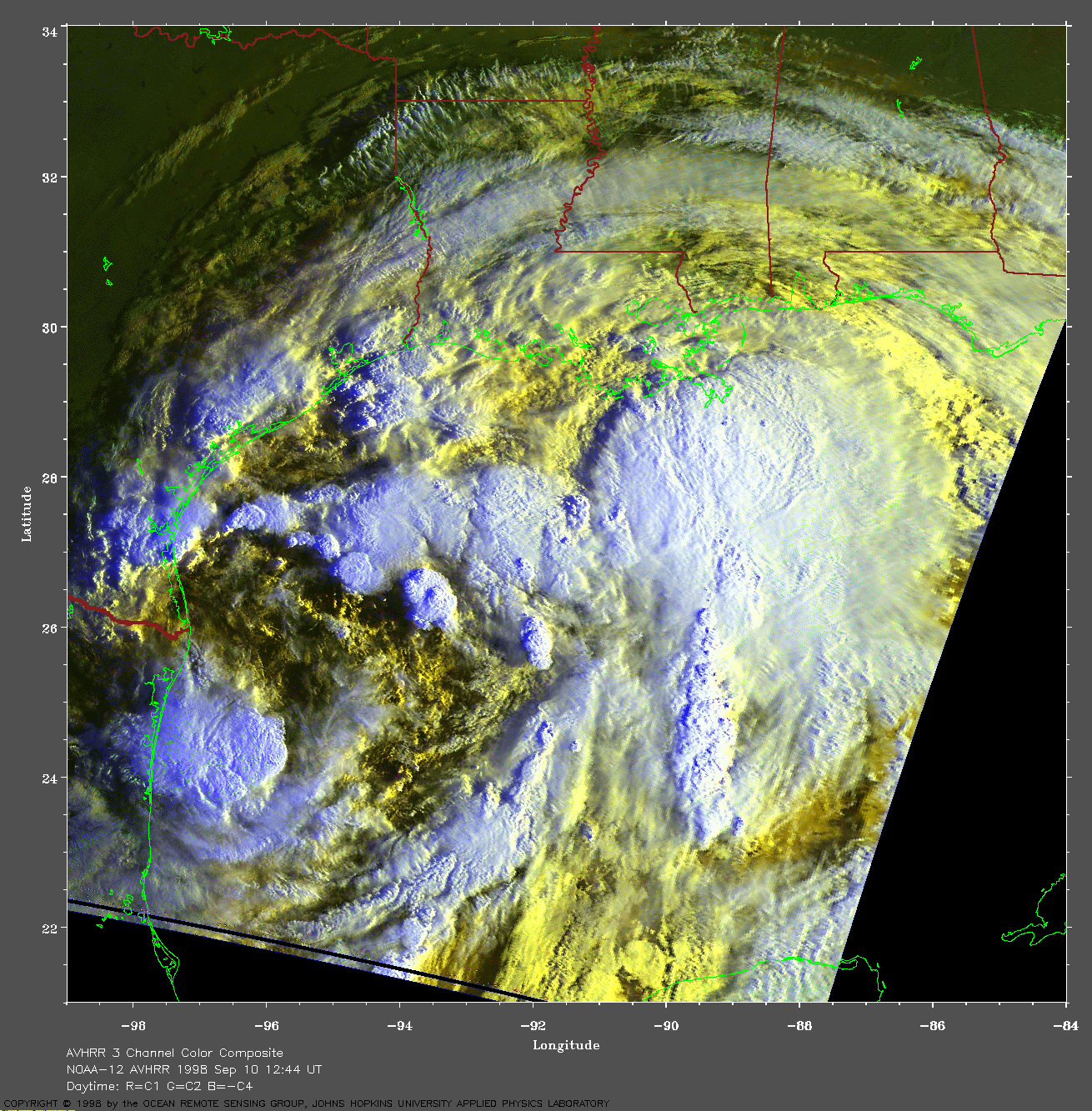
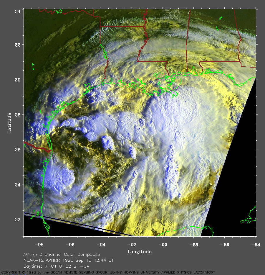 1998 September 10 12:44 UT
NOAA-12 AVHRR
3 channel composite morning image. A closer view (463 Kb) is seen by clicking
on this small image. Frances is now a tropical storm with 45
mph maximum sustained winds. It is gradually becoming more organized.
A very large image (992 Kb)
is also available.
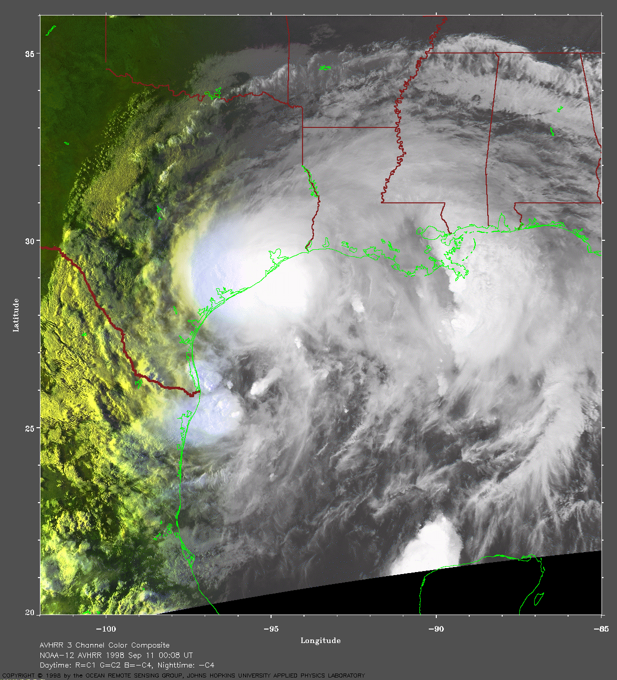
 1998 September 11 00:08 UT
NOAA-12 AVHRR
3 channel composite late evening image. A closer view (394 Kb) is seen
by clicking on this small image. In this image, Frances is slowly
crossing the coast of Texas. The maximum sustained winds at the time of
this image are about 60 mph. However, these winds will reach 65 mph
within the next few hours. A very large image (866 Kb)
is also available.
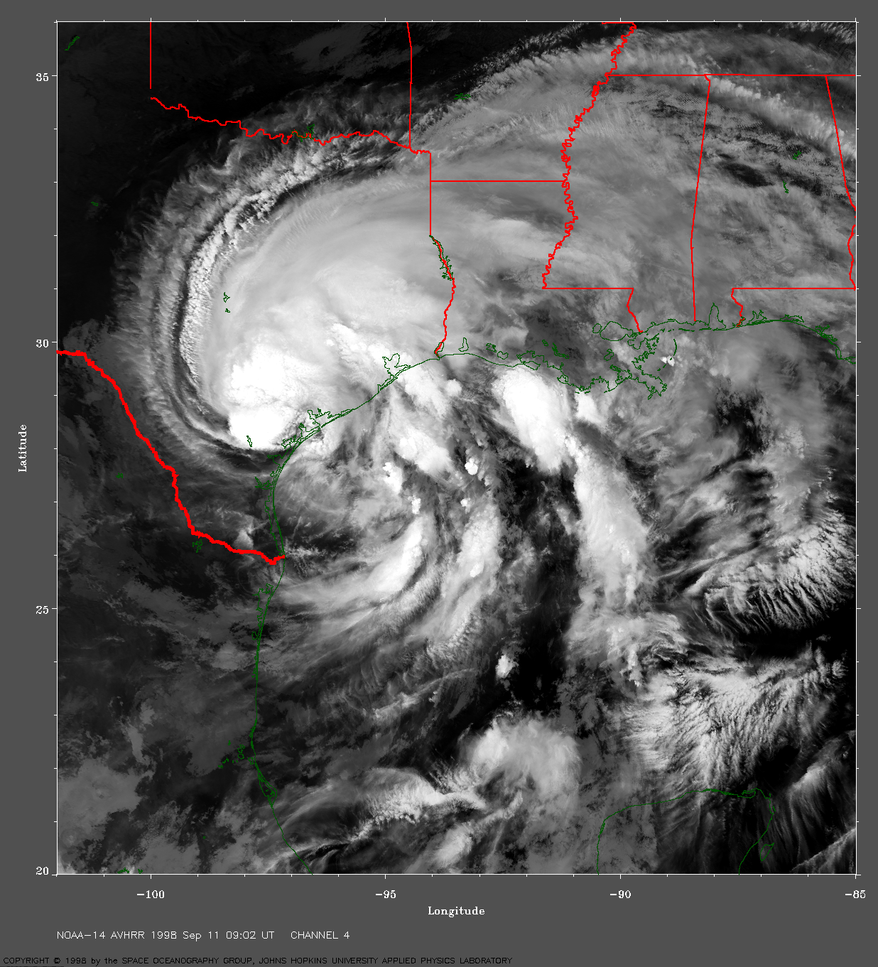
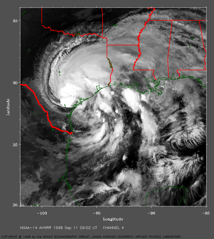 1998 September 11 09:02 UT
NOAA-14 AVHRR
channel 4 nighttime image. A closer view (604 Kb) is seen by clicking
on this small image. Radar and aircraft observations showed the center
of Frances making landfall just north of Corpus Christi, Texas, between
Port Aransas and Port O'Connor at about 06:00 UT. The forward motion of
Frances is continuing to decrease and the maximum sustained winds have
now dropped from 65 mph to 45 mph.
A very large image (1307 Kb)
is also available.
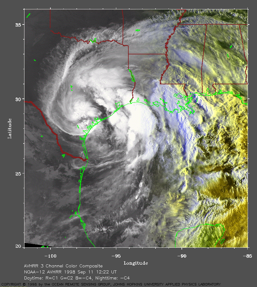 1998 September 11 12:22 UT
NOAA-12 AVHRR
3 channel composite early morning image. A closer view (444 Kb) is seen
by clicking on this small image. Frances is nearly stationary and is
continuing to cause extensive flooding near the Texas coast.
A very large image (948 Kb)
is also available.
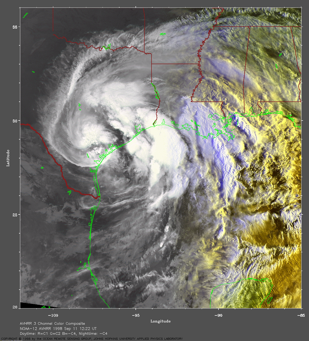
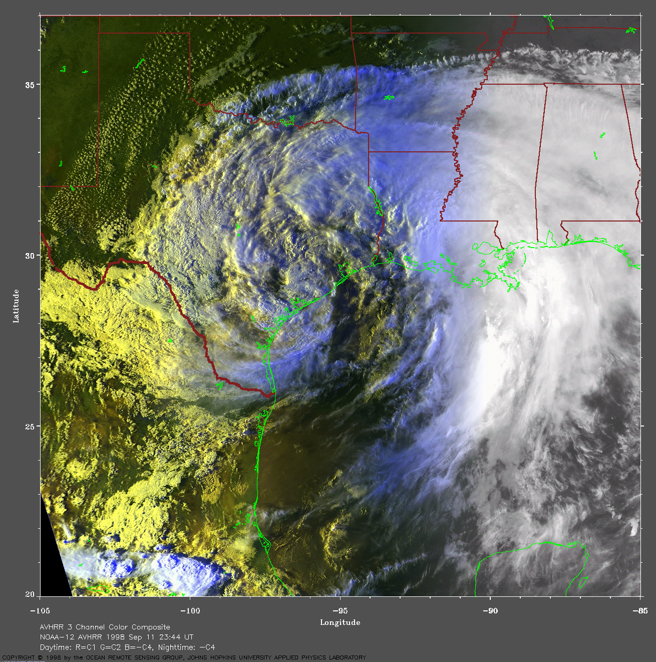
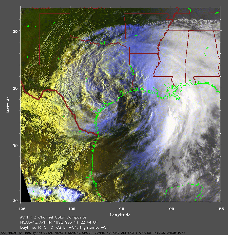 1998 September 11 23:44 UT
NOAA-12 AVHRR
3 channel composite late evening image. A closer view (496 Kb) is seen
by clicking on this small image. Frances is now moving slowly toward
the north-northeast. The maximum sustained winds have dropped to 35
mph.
A very large image (1062 Kb)
is also available.