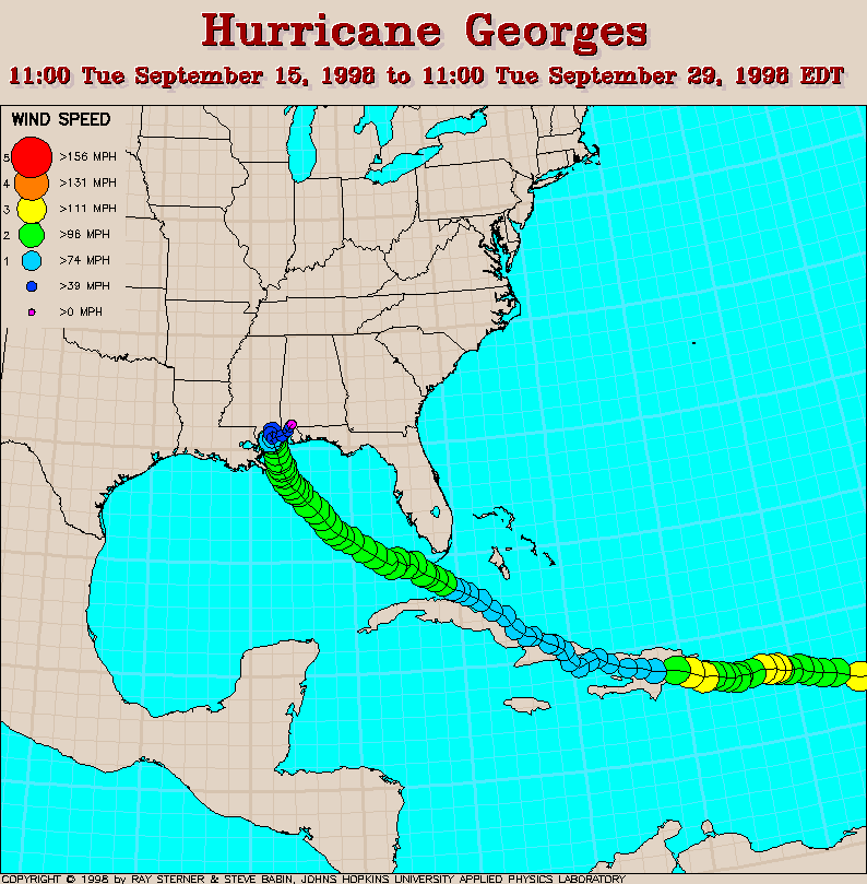
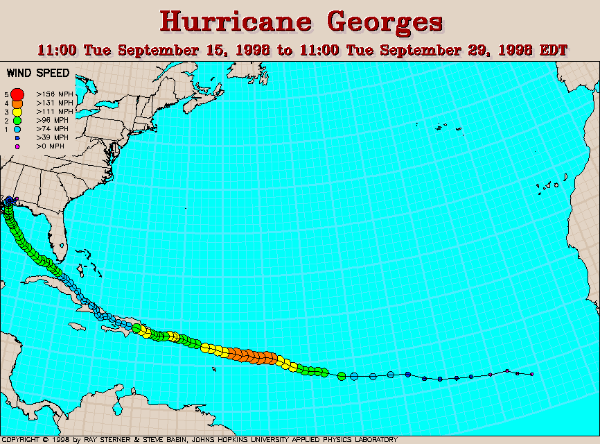
Track maps
 SST image from 23 September
11:17 UT This image (300 Kb) shows the sea surface temperature (SST)
derived from NOAA-12 AVHRR satellite data.
Georges appears at the lower right of this image.
SST image from 23 September
11:17 UT This image (300 Kb) shows the sea surface temperature (SST)
derived from NOAA-12 AVHRR satellite data.
Georges appears at the lower right of this image.
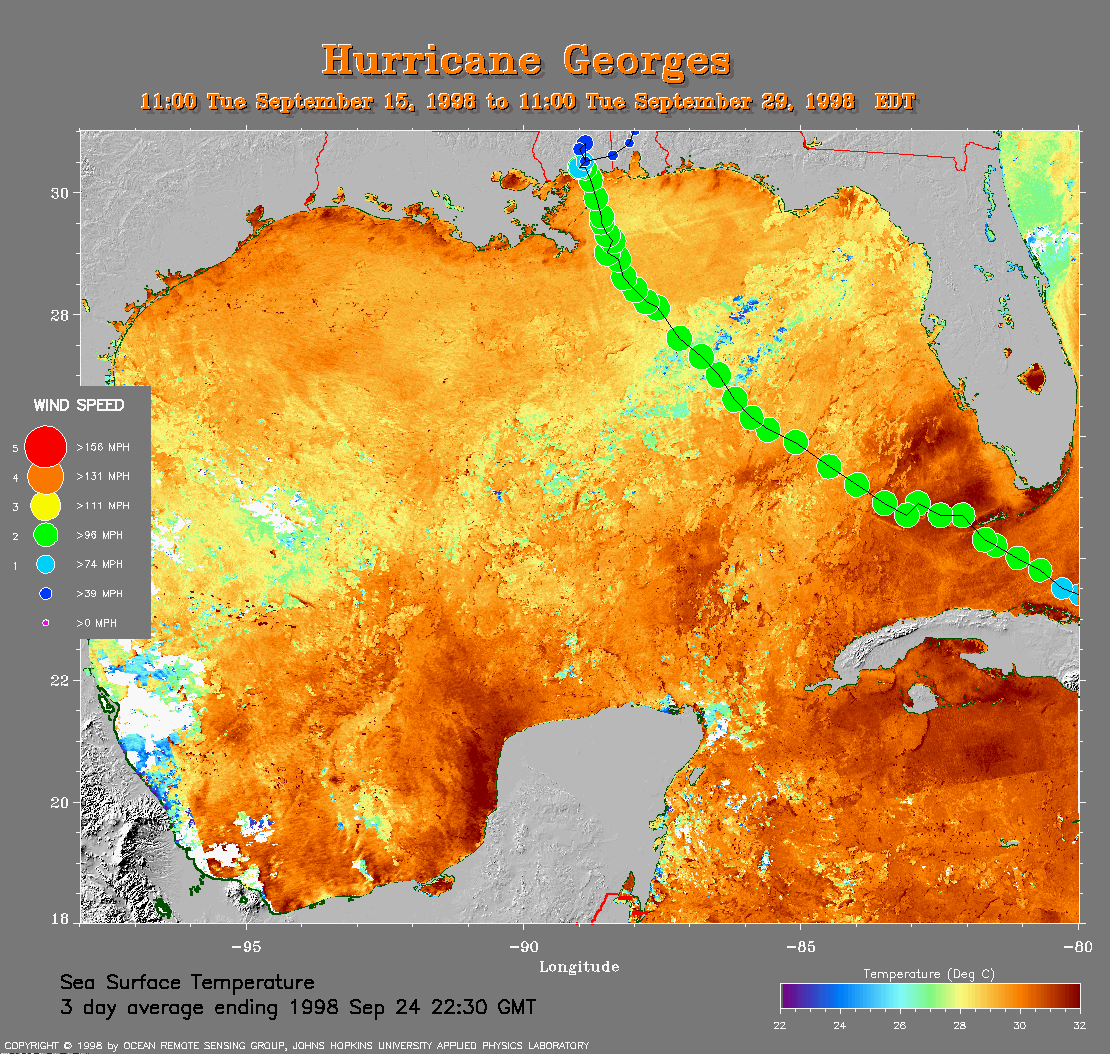 3 day average SST
image with track This image (382 Kb) shows the Gulf of Mexico
SST averaged over 3 days ending on 24 September 1998 with Georges' track
overlaid.
3 day average SST
image with track This image (382 Kb) shows the Gulf of Mexico
SST averaged over 3 days ending on 24 September 1998 with Georges' track
overlaid.
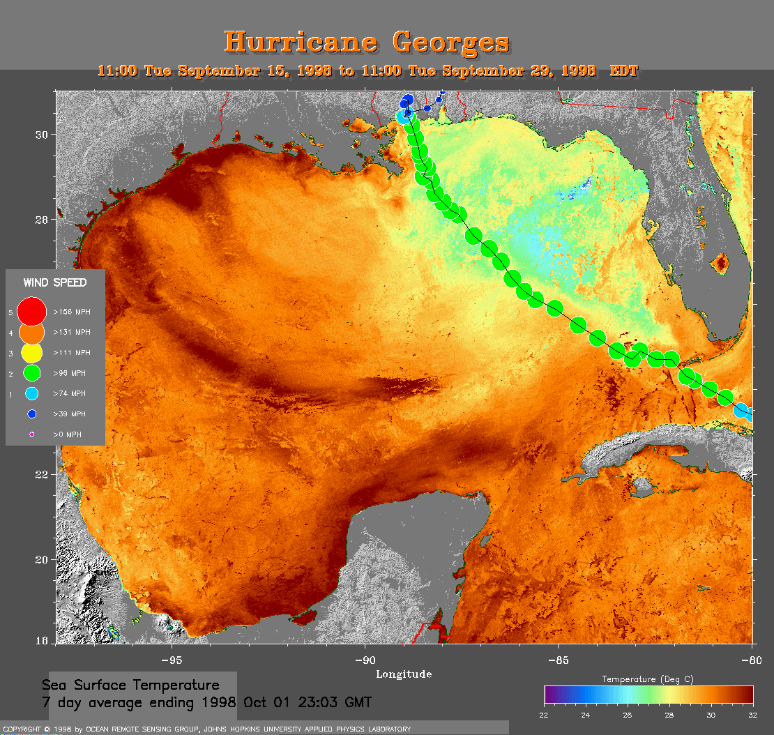
7 day average SST image with track This image (341 Kb) shows the Gulf of Mexico SST averaged over 7 days ending on 1 October 1998 with Georges' track overlaid. The cool wake of Georges is plainly visible to the left of this track.
Track file
Track data (lat/lon, winds, etc.) in a text file.
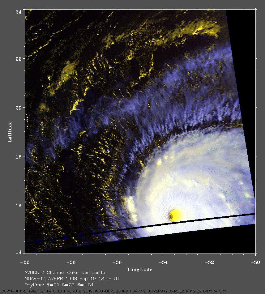 1998 September 19 18:59 UT
NOAA-14 AVHRR 3 channel color
composite afternoon image. A closer view (331 Kb) is seen by clicking
on this small image. At this time, Georges has 125 mph winds and is
strengthening. A well-defined eye is apparent in this image. Note the
lower warmer clouds are yellow and the higher cooler clouds are white.
A very large image (713 Kb)
is also available.
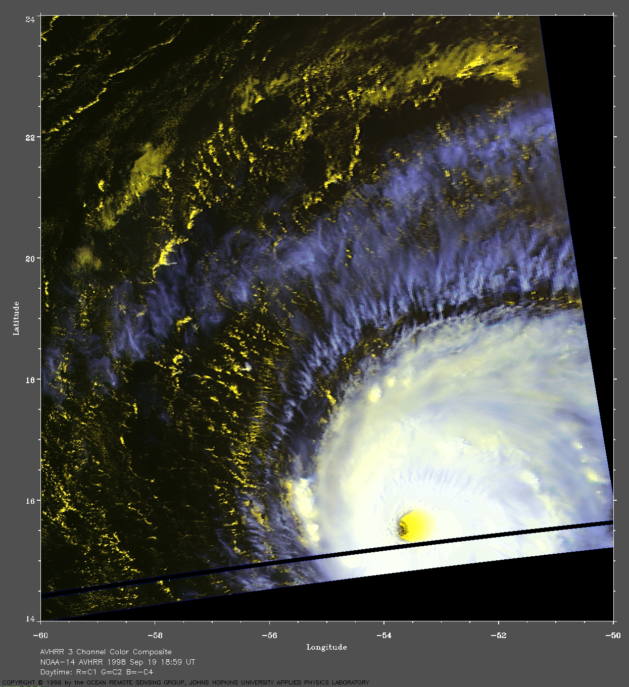
 1998 September 20 18:48 UT
NOAA-14 AVHRR 3 channel composite
afternoon image. A closer view (238 Kb) is seen by clicking on this small
image. In this image, the maximum sustained winds in Georges have
decreased from 150 mph to 135 mph.
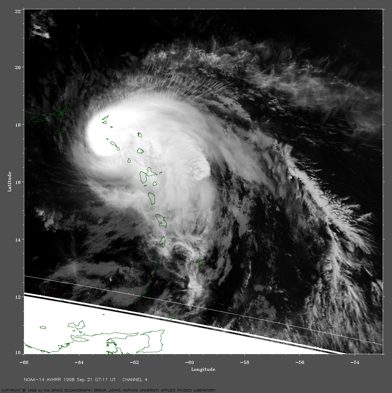
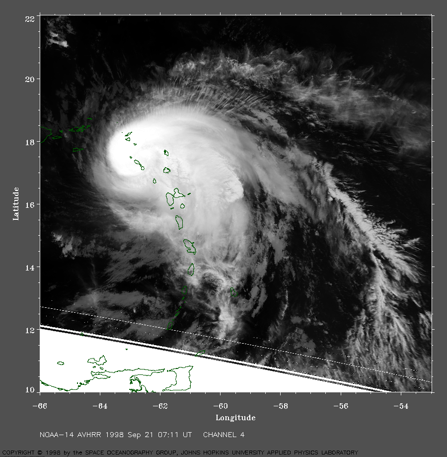 1998 September 21 07:11 UT
NOAA-14 AVHRR channel 4 nighttime
image. A closer view (481 Kb) is seen by clicking
on this small image. In this image, the maximum sustained winds have
decreased to about 115 mph.
A very large image (975 Kb)
is also available.
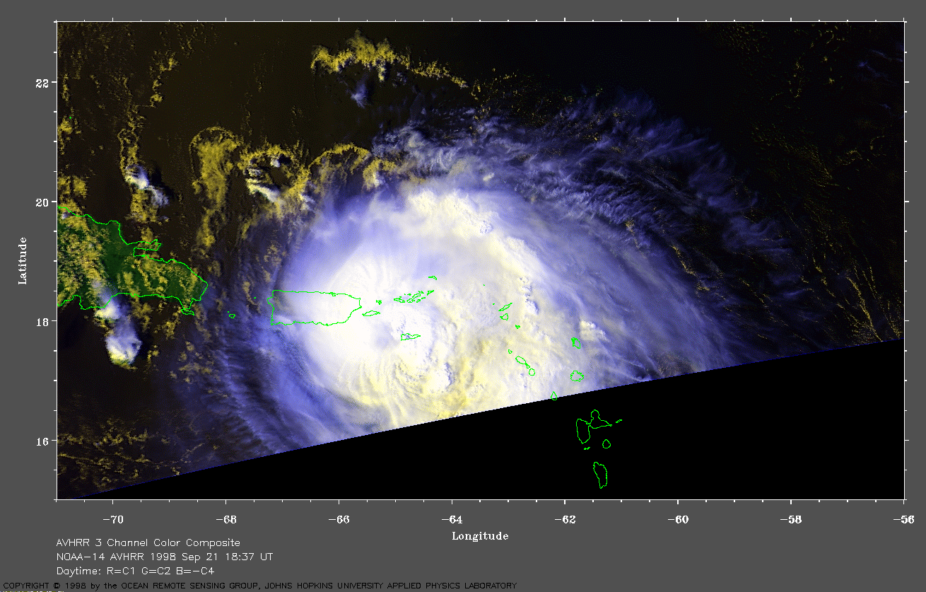
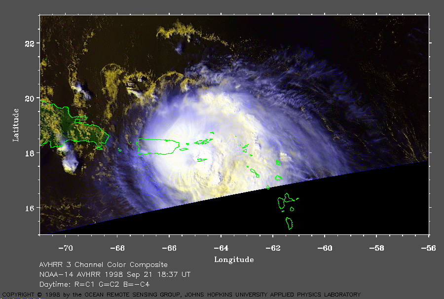 1998 September 21 18:37 UT
NOAA-14 AVHRR 3 channel color
composite daytime image. A closer view (188 Kb) is seen by clicking
on this small image. Although the maximum sustained winds had
decreased to about 110 mph, they caused extensive property damage in
the Leeward Islands.
A very large image (397 Kb)
is also available.
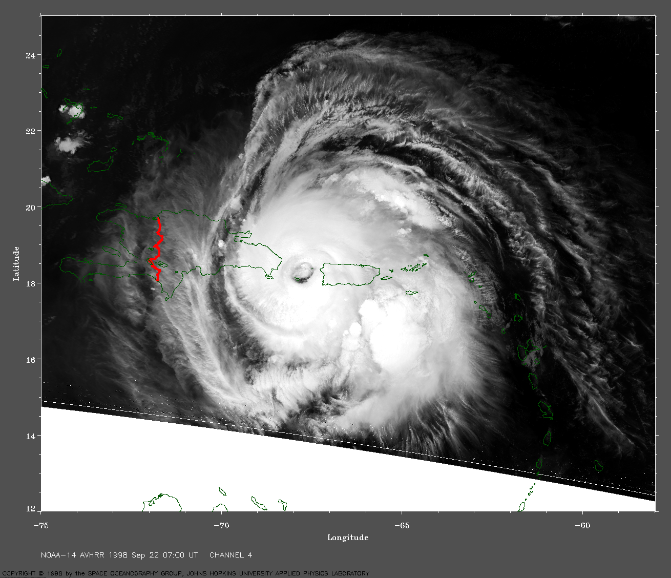
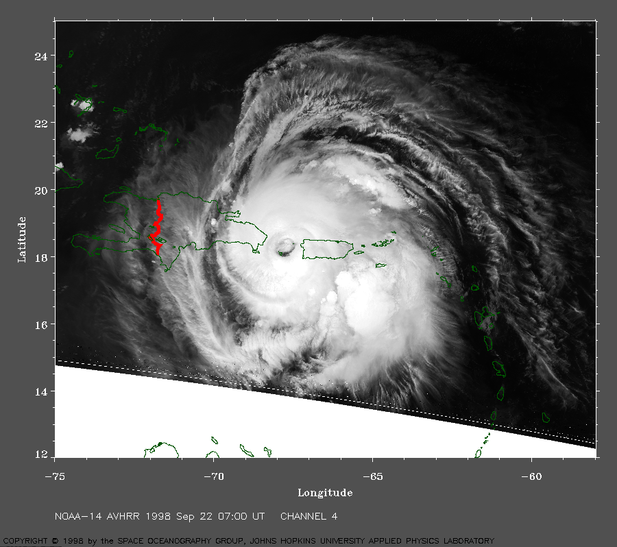 1998 September 22 07:00 UT
NOAA-14 AVHRR channel 4 nighttime
image. A closer view (401 Kb) is seen by clicking
on this small image. The eye of Georges is centered over the Mona
Passage between the islands of Puerto Rico and Hispaniola. Note the
low-level clouds present inside the eye.
A very large image (849 Kb)
is also available.
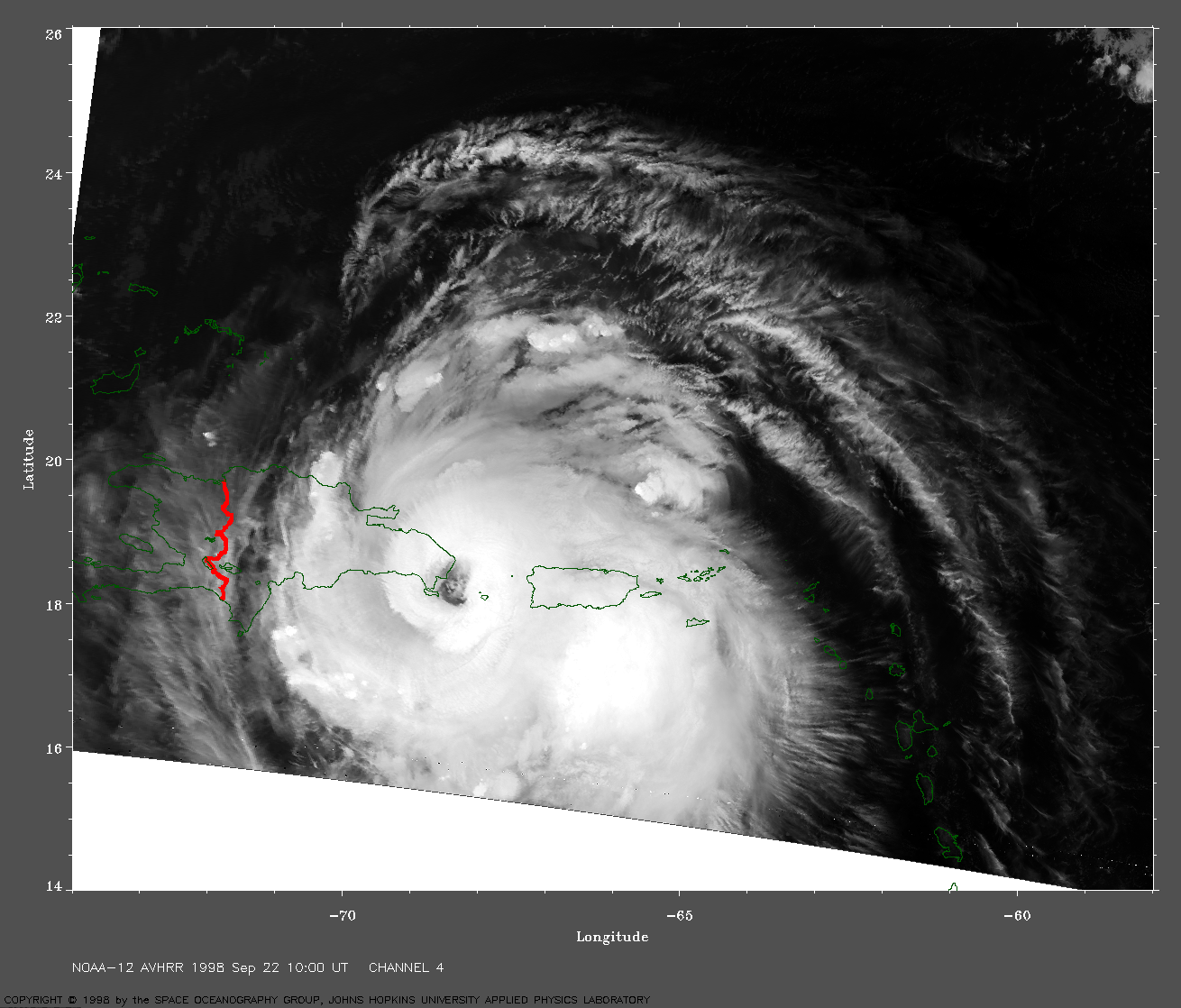
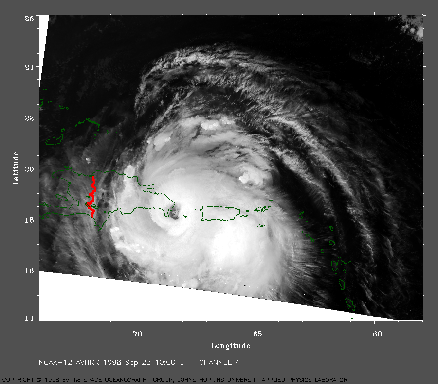 1998 September 22 10:00 UT
NOAA-12 AVHRR channel 4
early morning image. A closer view (386 Kb) is seen by clicking
on this small image. In this image, the eye of Georges is making landfall
on the island of Hispaniola. The maximum sustained winds are about 110
mph. A very large image (815 Kb)
is also available.
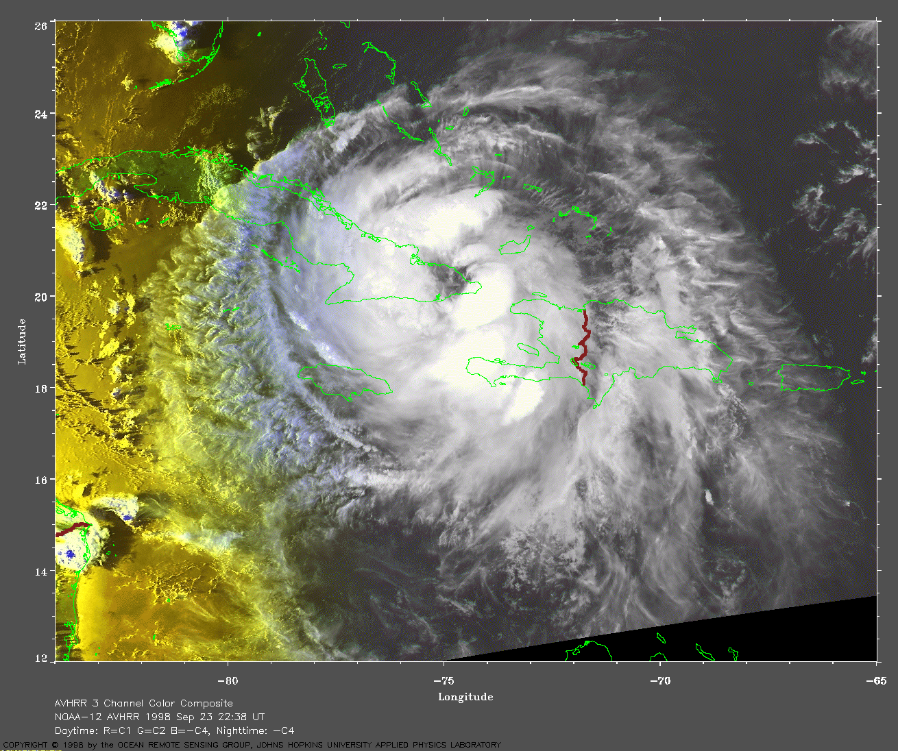
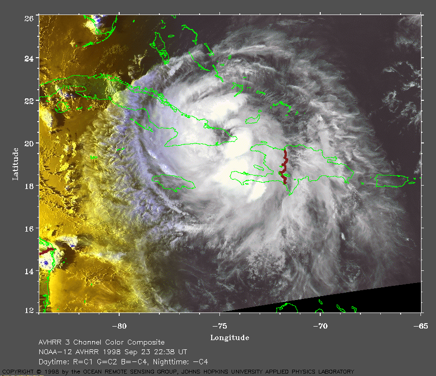 1998 September 23 22:38 UT
NOAA-12 AVHRR 3 channel color
composite late evening image. A closer view (324 Kb) is seen by clicking
on this small image. Georges is making landfall on the southeast coast
of Cuba. After passing over the mountains of Hispaniola, the maximum
sustained winds have dropped to about 75 mph.
A very large image (724 Kb)
is also available.
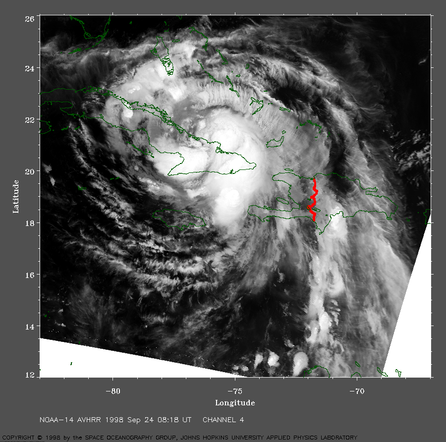 1998 September 24 08:18 UT
NOAA-14 AVHRR channel 4
nighttime image. A closer view (547 Kb) is seen by clicking
on this small image. As Georges moves over eastern Cuba,
the eye is becoming poorly defined.
A very large image (1150 Kb)
is also available.
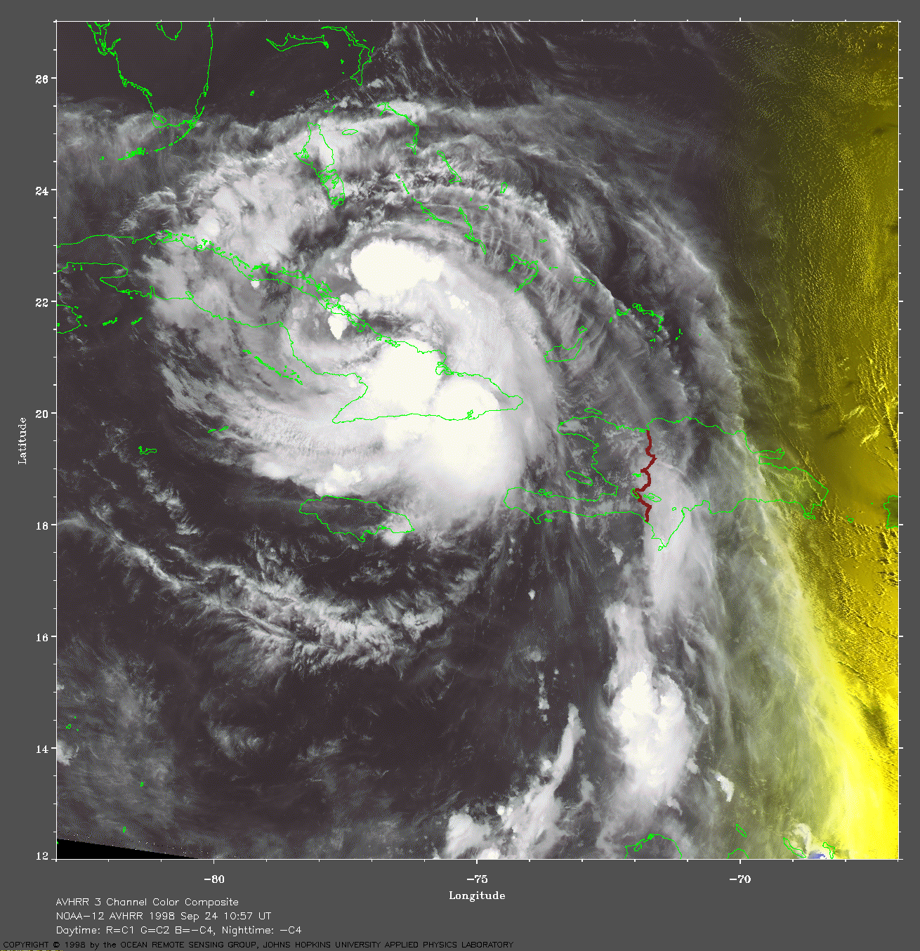
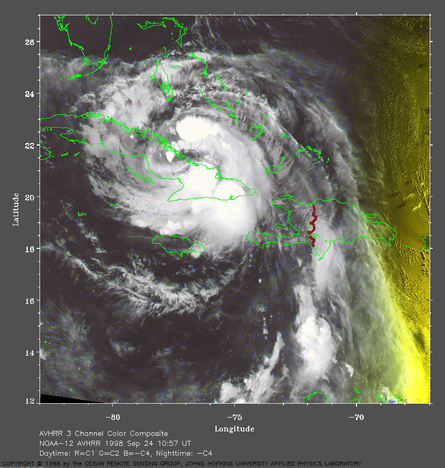 1998 September 24 10:57 UT
NOAA-12 AVHRR 3 channel color
composite early morning image. A closer view (400 Kb) is seen by clicking
on this small image. Georges is slowly moving along the north coast
of Cuba.
A very large image (830 Kb)
is also available.
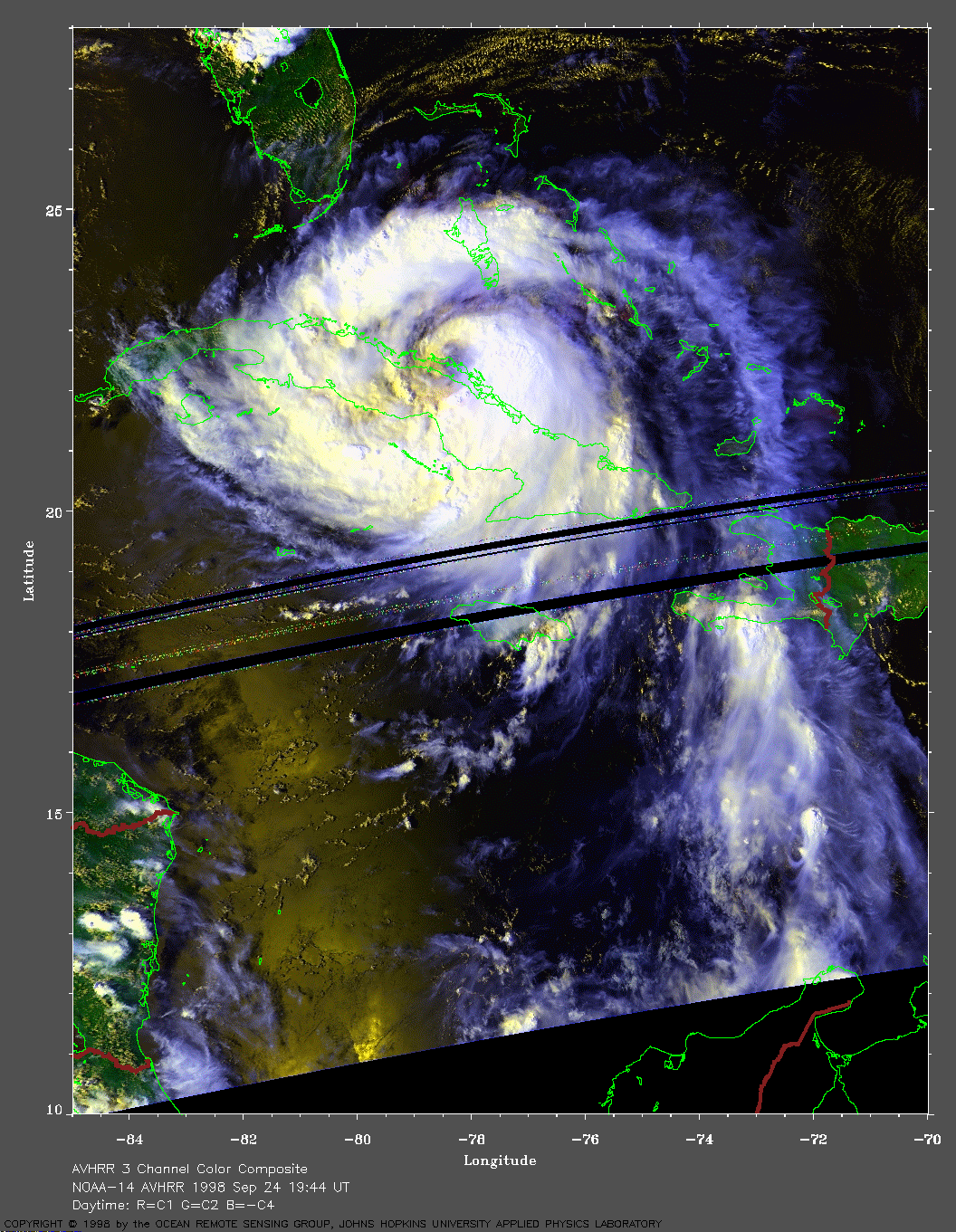
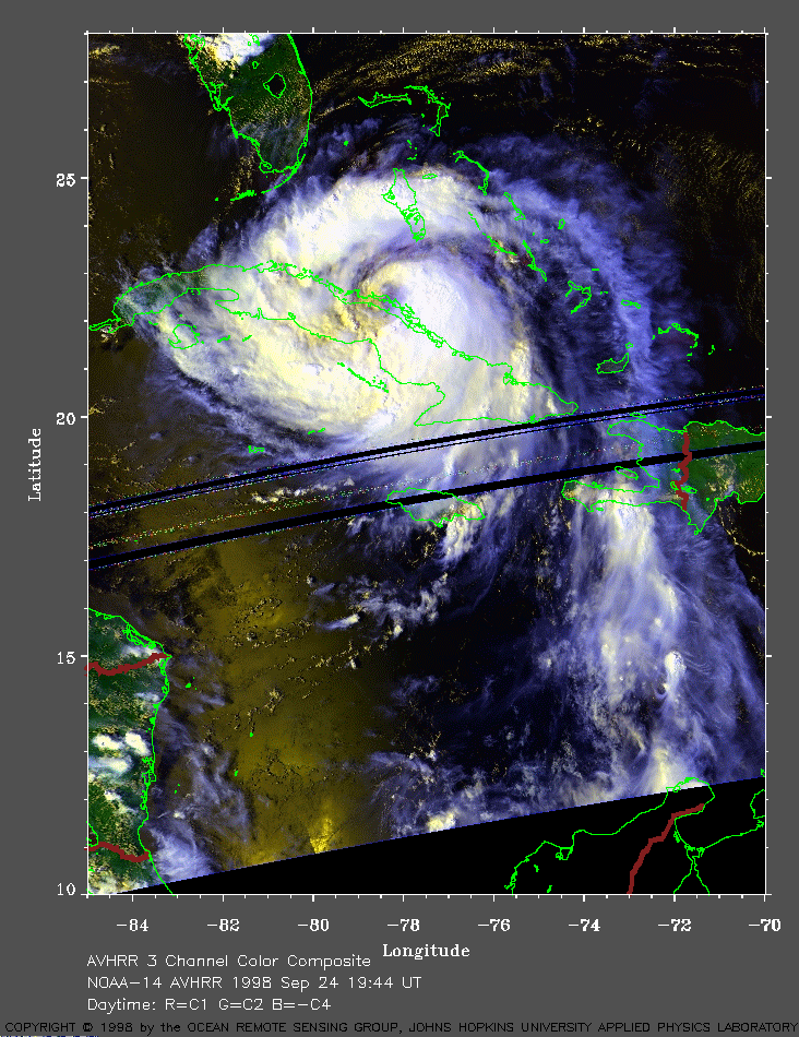 1998 September 24 19:44 UT
NOAA-14 AVHRR 3 channel color
composite daytime image. A closer view (310 Kb) is seen by clicking
on this small image. Georges is hugging the north coast
of Cuba. Note the long outflow trail of clouds that extends toward
South America. The black semi-circular bands near the bottom of the
image are data drop-outs.
A very large image (614 Kb)
is also available.
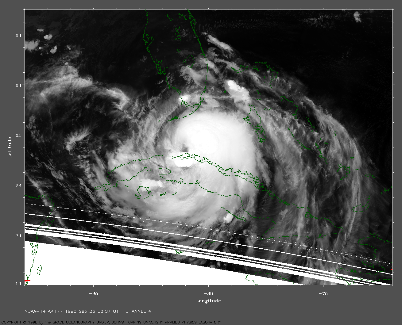
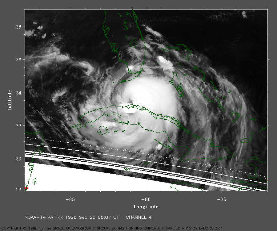 1998 September 25 08:07 UT
NOAA-14 AVHRR channel 4 nighttime
image. A closer view (391 Kb) is seen by clicking
on this small image. Georges is moving toward the Florida keys.
The maximum sustained winds are now 100 mph.
A very large image (839 Kb)
is also available.
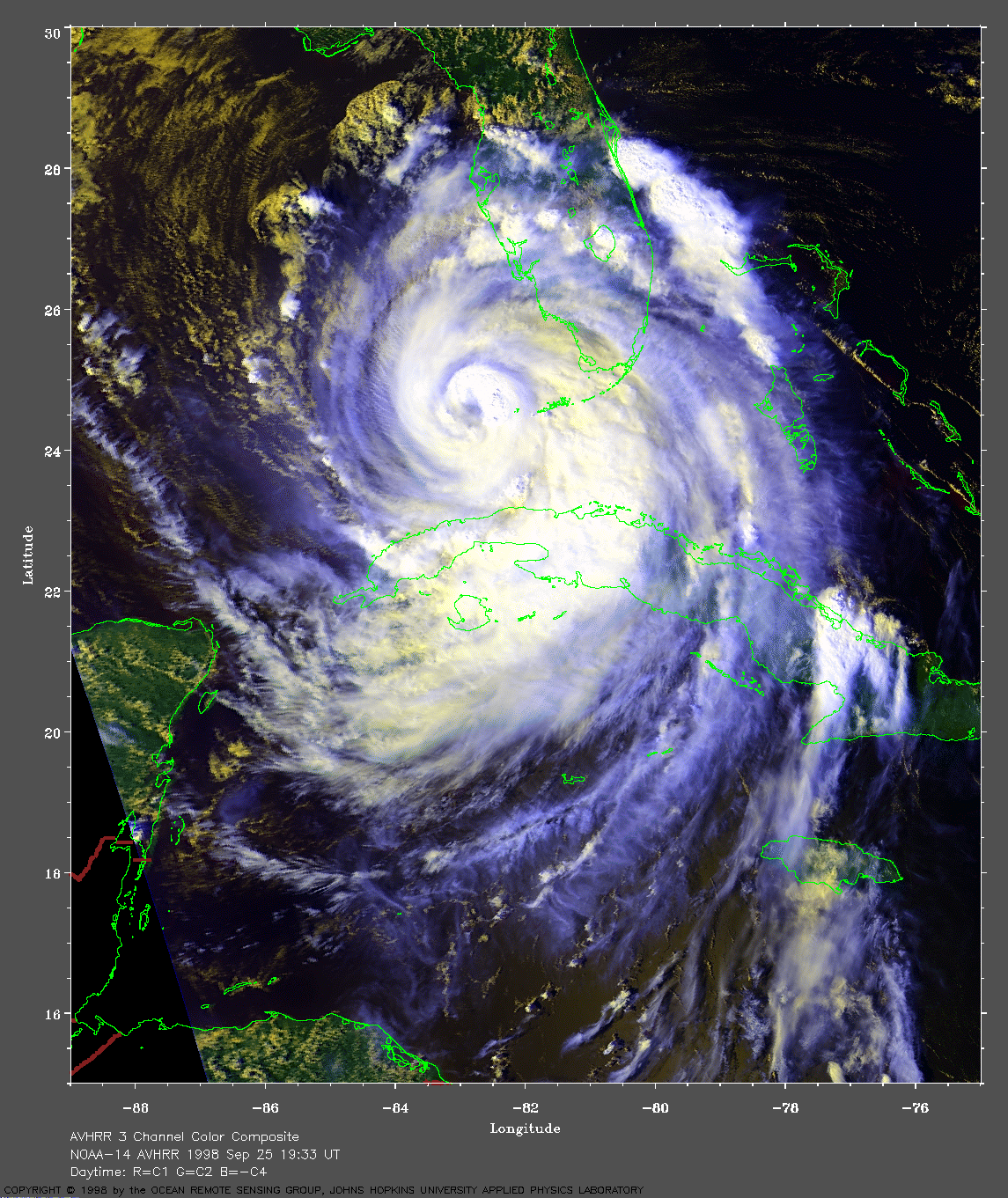
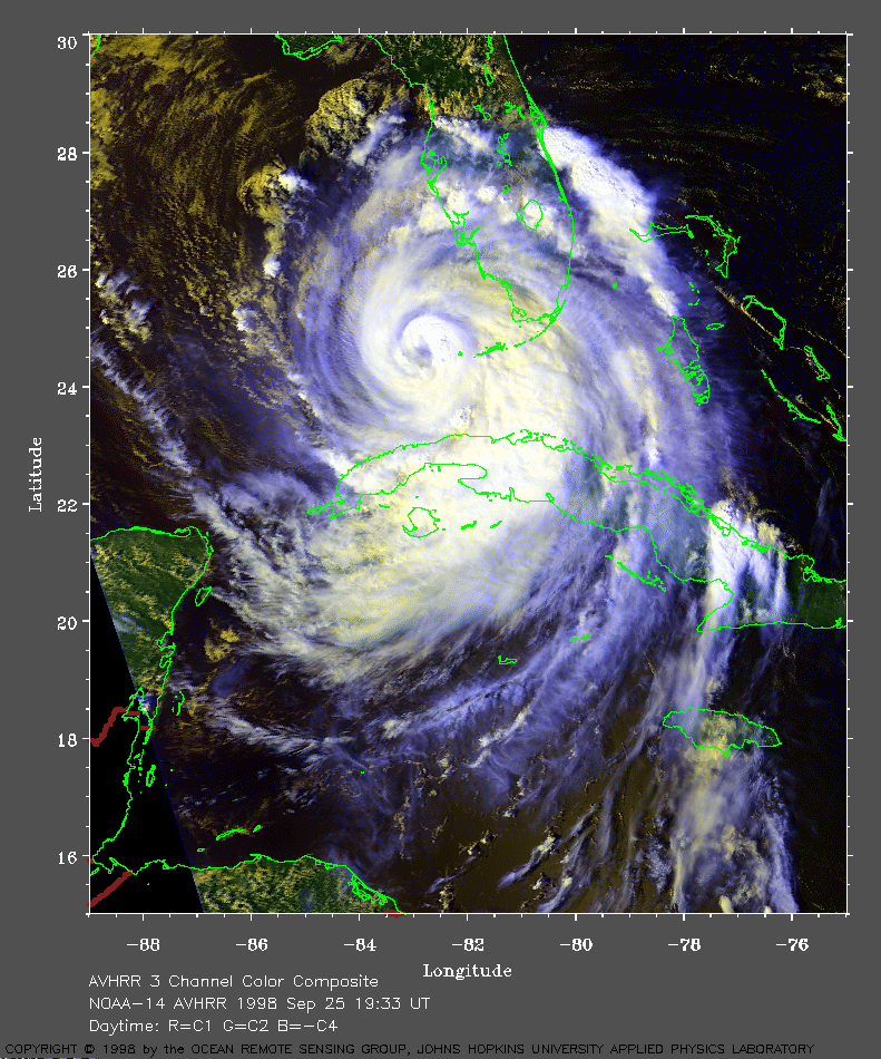 1998 September 25 19:33 UT
NOAA-14 AVHRR 3 channel color
composite daytime image. A closer view (399 Kb) is seen by clicking
on this small image.
Georges has intensified after leaving Cuba for the
warm water of the Florida Straits. In this image, Georges has crossed
the Florida Keys and moved into the Gulf of Mexico. Note how the cloud
structure is becoming better organized. The maximum sustained winds are
now 105 mph.
A very large image (855 Kb)
is also available.
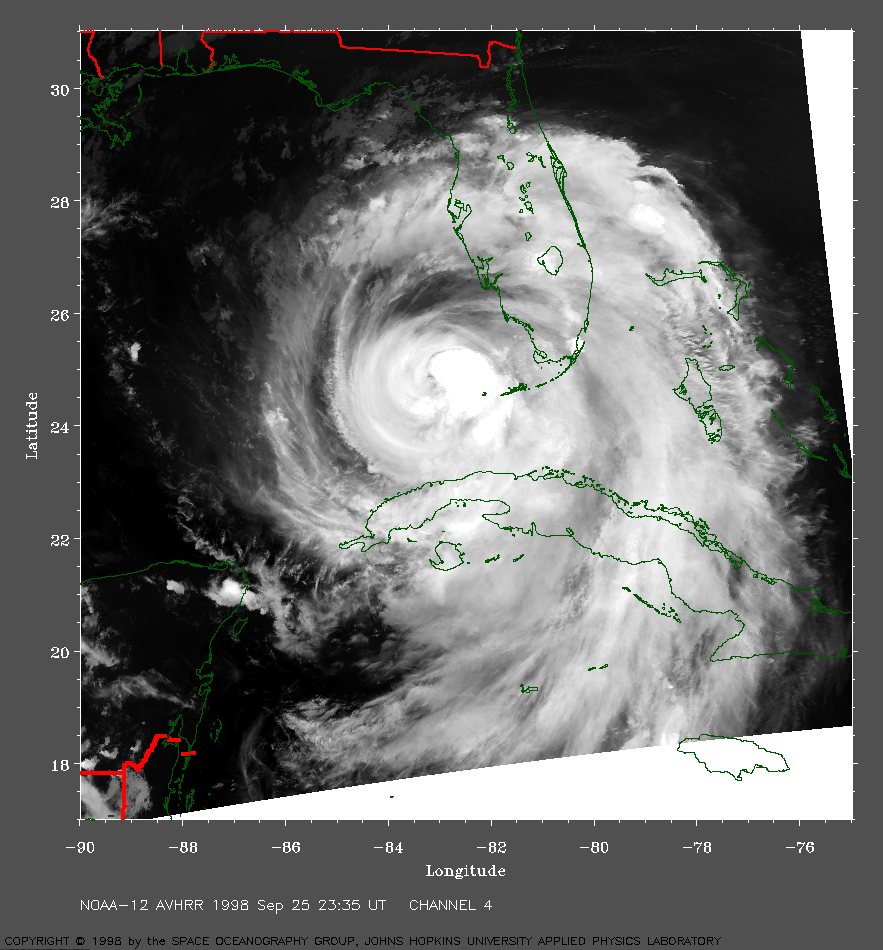 1998 September 25 23:35 UT
NOAA-12 AVHRR channel 4 nighttime
image. A closer view (497 Kb) is seen by clicking
on this small image. Georges is moving over the warm waters of the Gulf
of Mexico. The maximum sustained winds have increased to 105 mph.
A very large image (1025 Kb)
is also available.
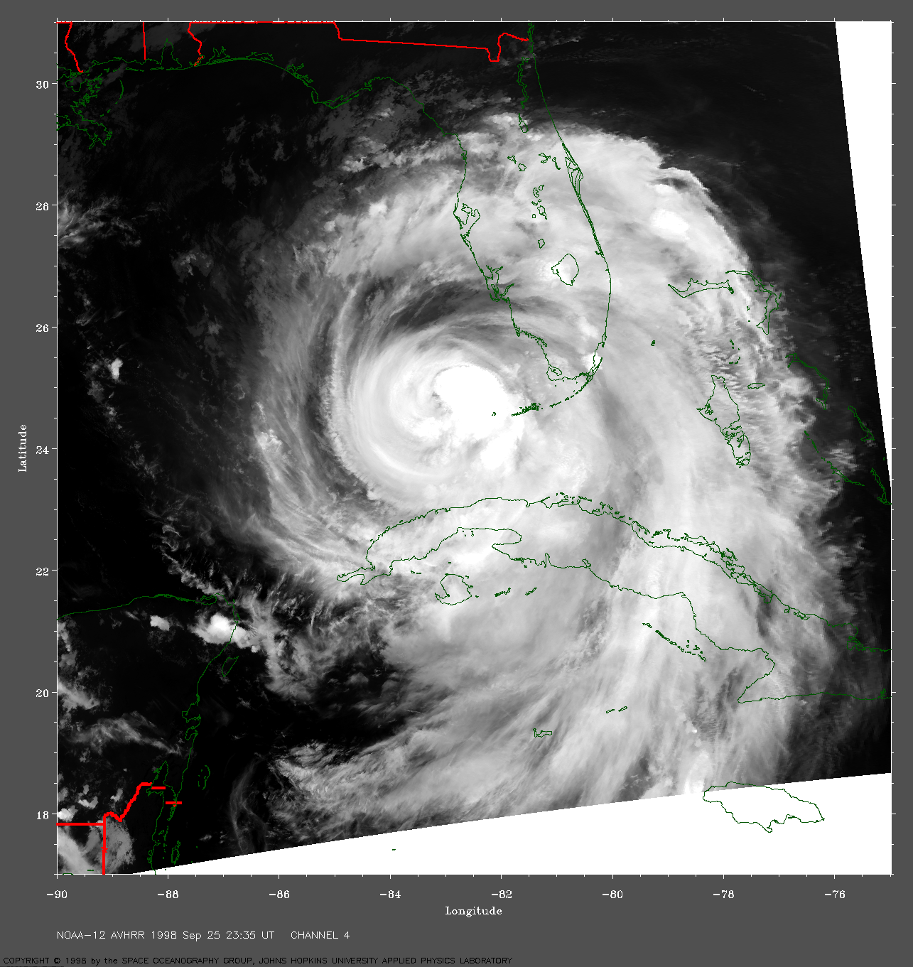
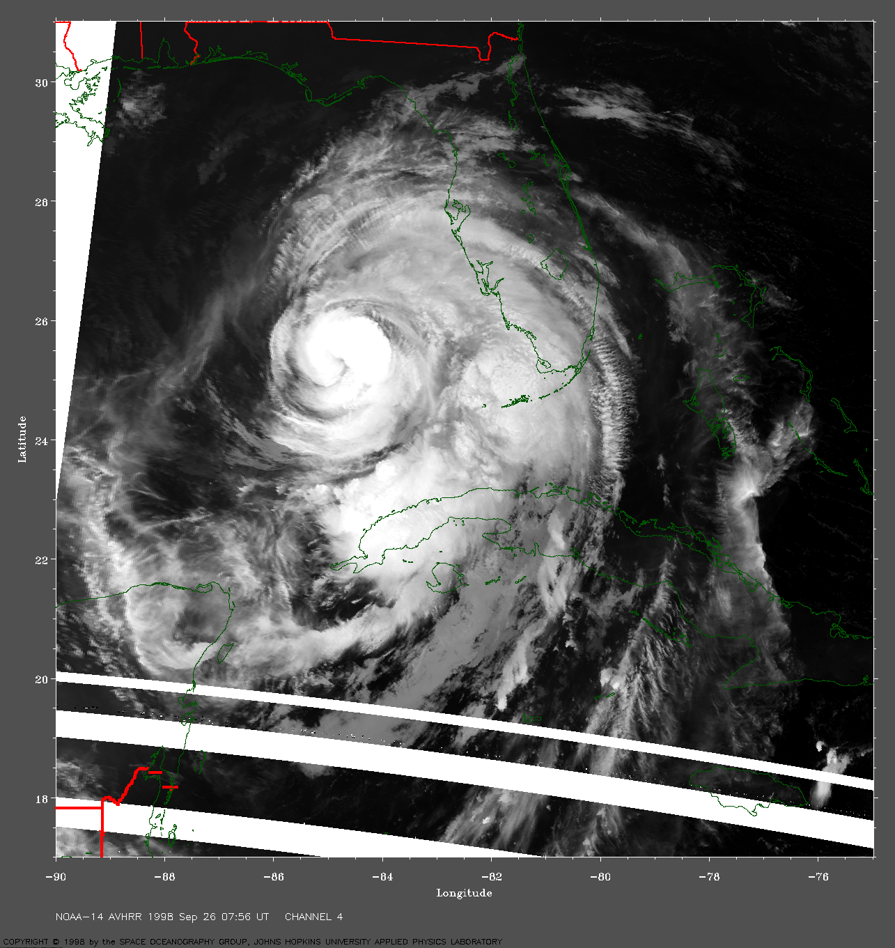
 1998 September 26 07:56 UT
NOAA-14 AVHRR channel 4 nighttime
image. A closer view (492 Kb) is seen by clicking on this small image.
Georges is moving toward the northwest. The white semicircles across
the bottom of this image are caused by data dropouts.
A very large image (981 Kb)
is also available.
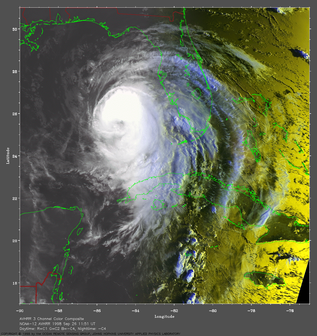
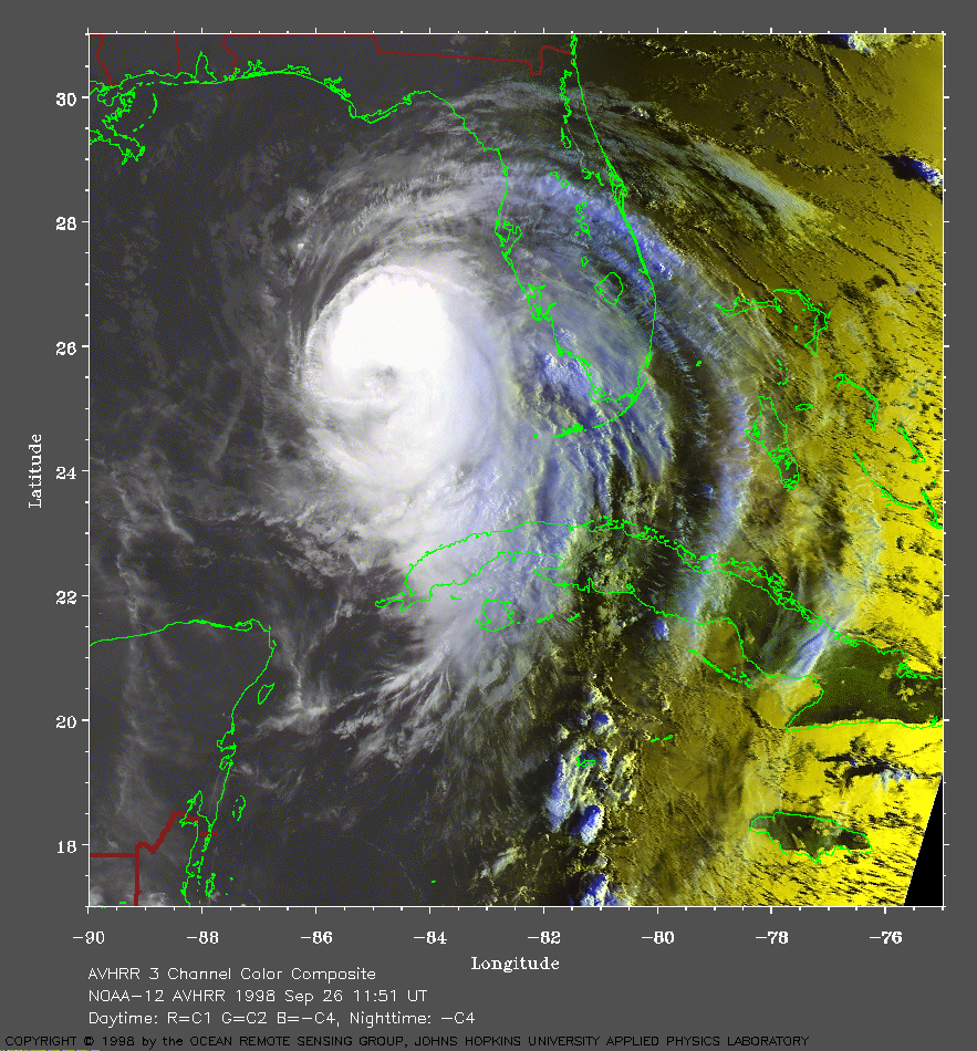 1998 September 26 11:51 UT
NOAA-12 AVHRR 3 channel color
composite early morning image. A closer view (453 Kb) is seen by clicking
on this small image. Georges is slowly becoming more organized after its
disruption by passage across the islands.
A very large image (965 Kb)
is also available.
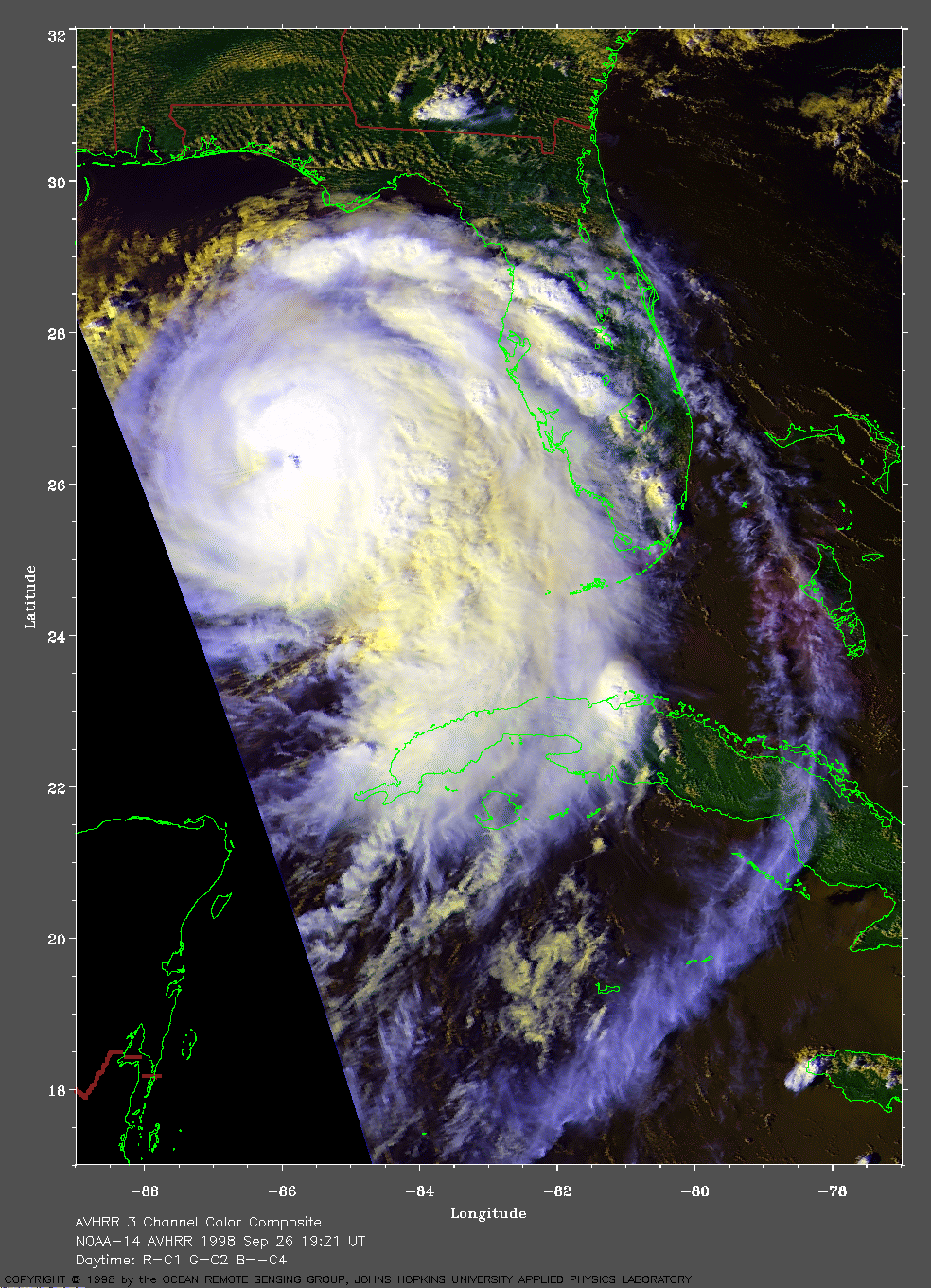
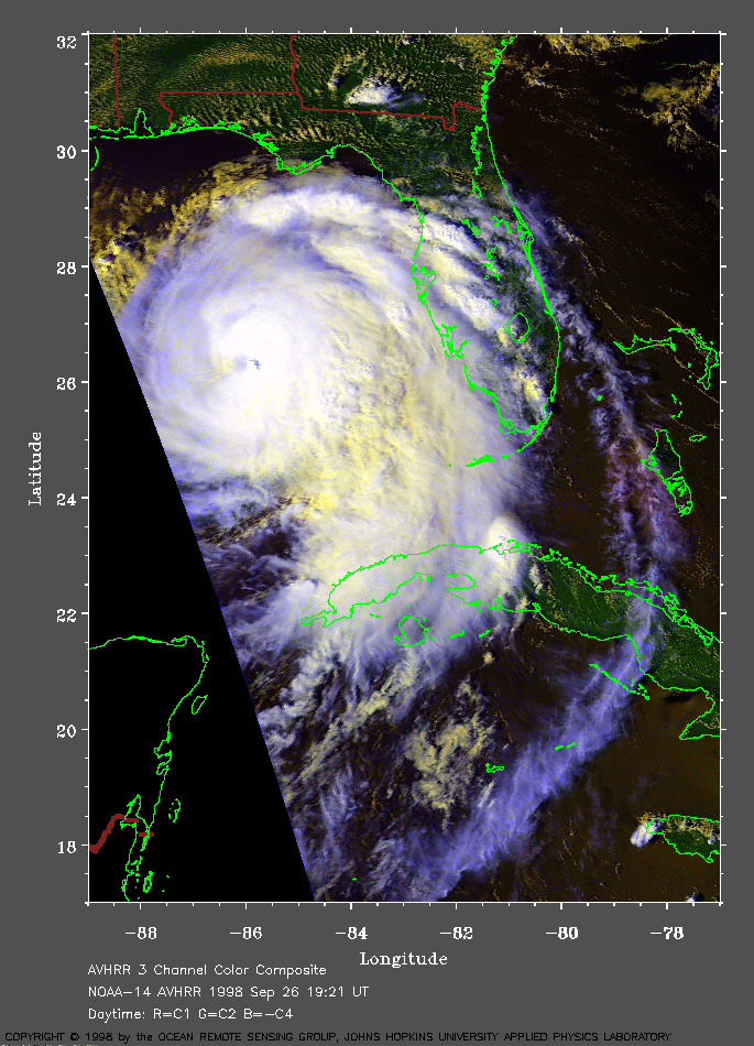 1998 September 26 19:21 UT
NOAA-14 AVHRR 3 channel color
composite daytime image. A closer view (289 Kb) is seen by clicking on
this small image. The inner core of Georges is becoming more organized.
A very large image (628 Kb)
is also available.
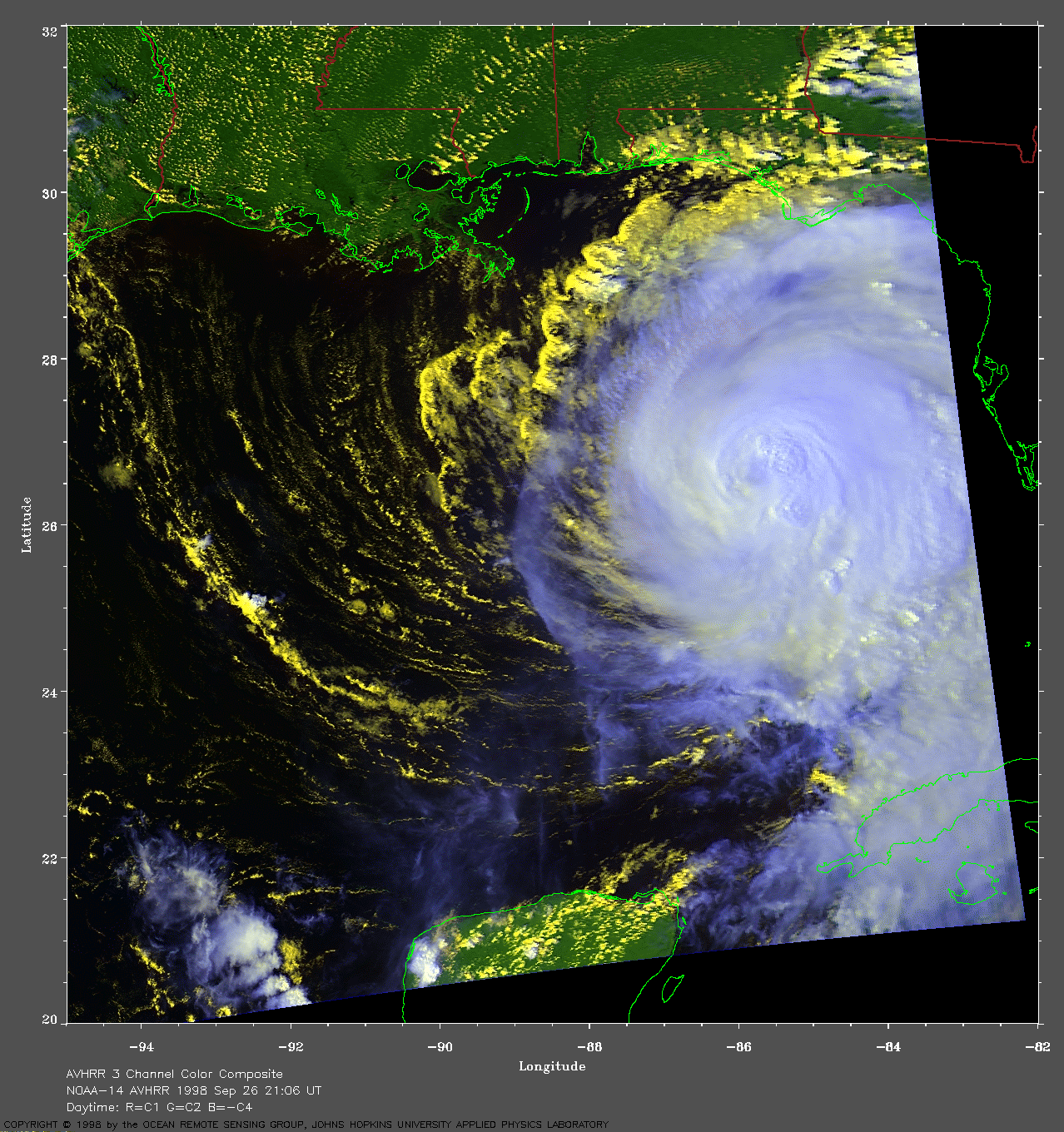
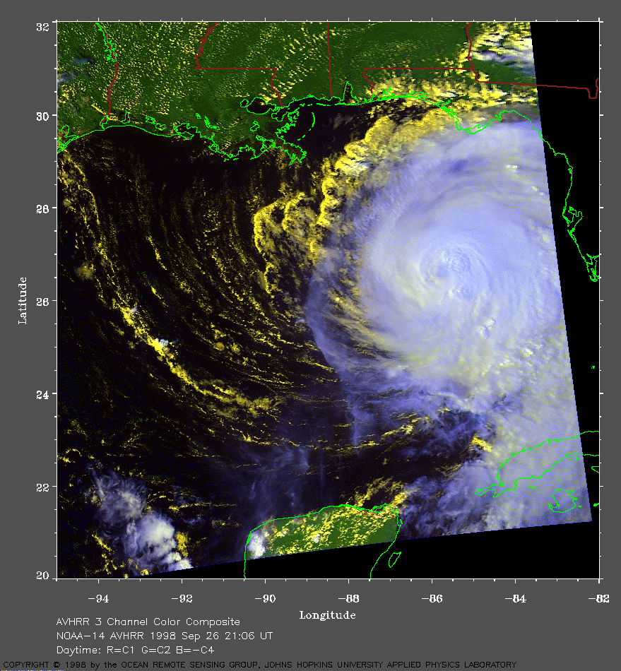 1998 September 26 21:06 UT
NOAA-14 AVHRR 3 channel color
composite daytime image. A closer view (348 Kb) is seen by clicking
on this small image. The maximum sustained winds have increased to 110
mph. In this image, the eye appears to be slowly reforming.
A very large image (764 Kb)
is also available.
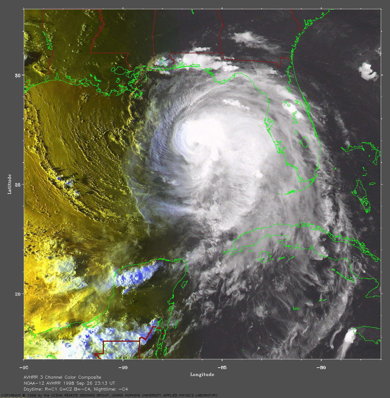
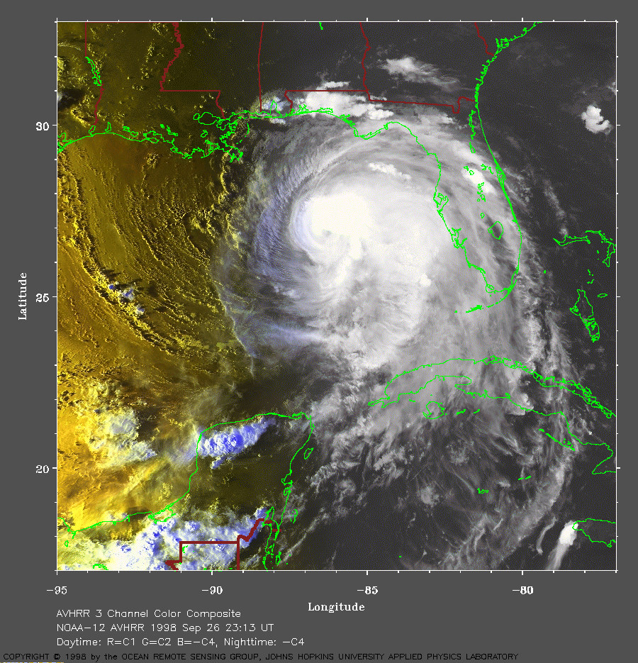 1998 September 26 23:13 UT
NOAA-12 AVHRR 3 channel color
composite evening image. A closer view (401 Kb) is seen by clicking on
this small image.
A very large image (947 Kb)
is also available.
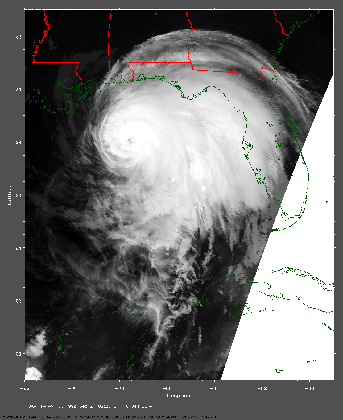
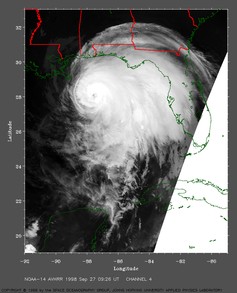 1998 September 27 09:26 UT
NOAA-14 AVHRR channel 4 early morning
image. A closer view (368 Kb) is seen by clicking
on this small image. The eye of Georges is plainly visible in this
image.
A very large image (738 Kb)
is also available.
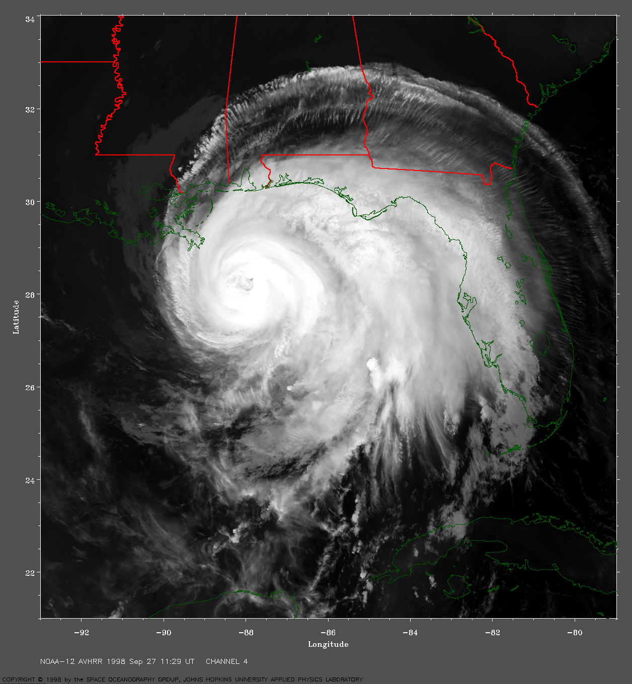
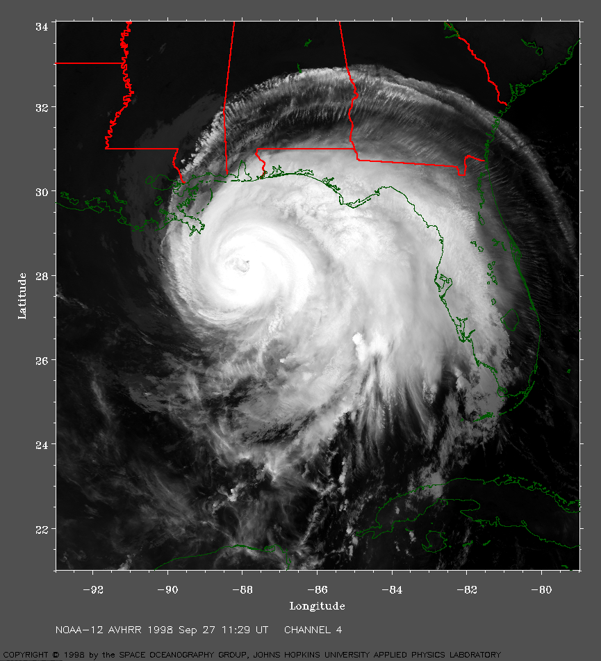 1998 September 27 11:29 UT
NOAA-12 AVHRR channel 4 early morning
image. A closer view (485 Kb) is seen by clicking on
this small image. Georges is moving toward the northwest.
A very large image (1039 Kb)
is also available.
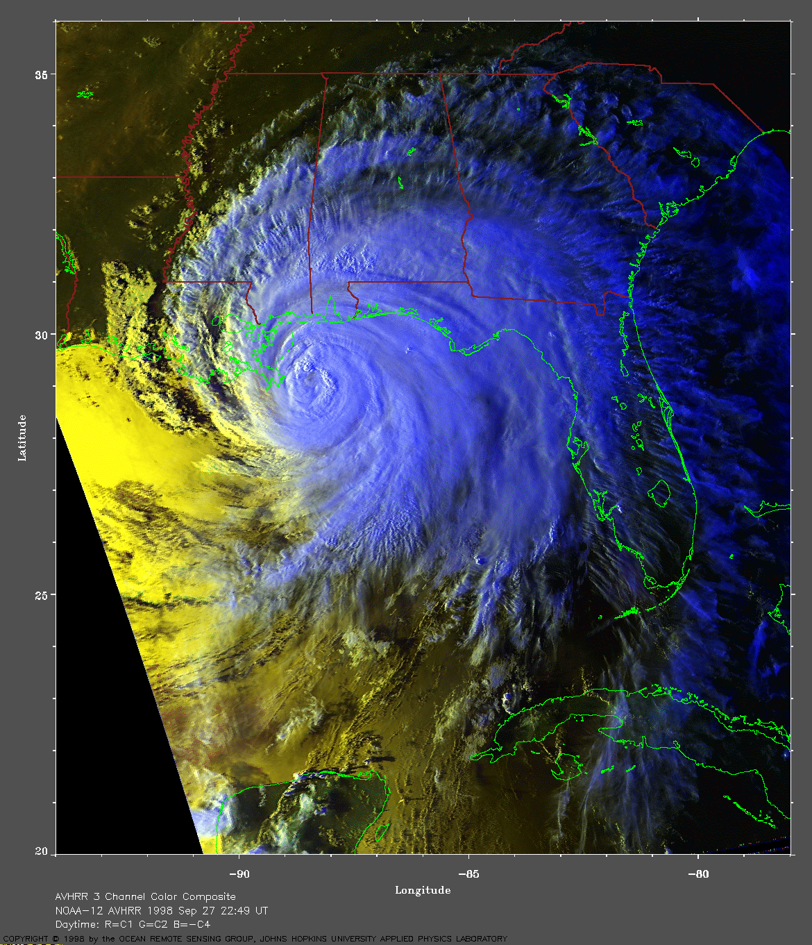
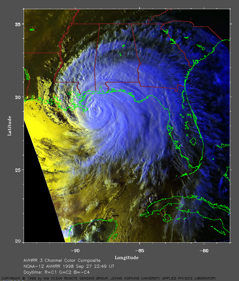 1998 September 27 22:49 UT
NOAA-12 AVHRR 3 channel color
composite evening image. A closer view (384 Kb) is seen by clicking
on this small image. The center of Georges is just off the mouth of the
Mississippi River. A NOAA automated weather buoy reported wind gusts up
to 74 mph and wave heights of 33 feet. The forward speed of Georges is
decreasing.
A very large image (807 Kb)
is also available.
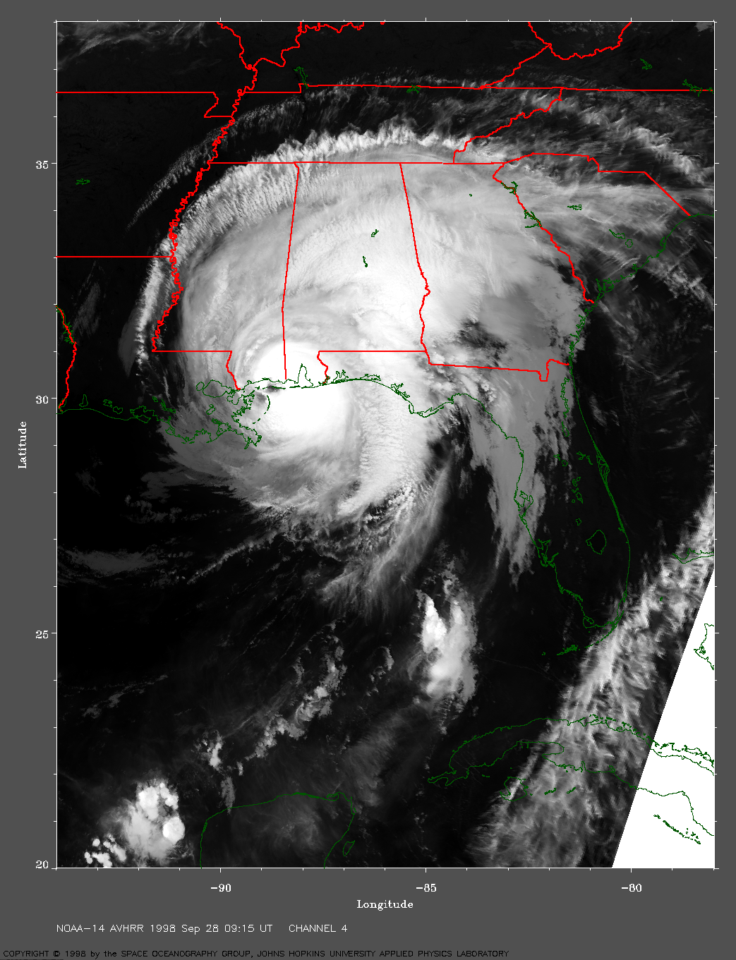
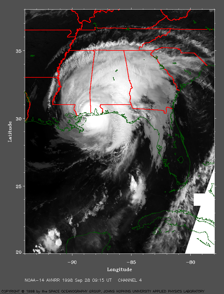 1998 September 28 09:15 UT
NOAA-14 AVHRR channel 4 early morning
image. A closer view (408 Kb) is seen by clicking on
this small image. The maximum sustained winds have dropped to about 105
mph. The eye of Georges is making landfall on the Gulf coast in this image.
Ground observations from within the eye noted that stars could be seen above.
A very large image (875 Kb)
is also available.
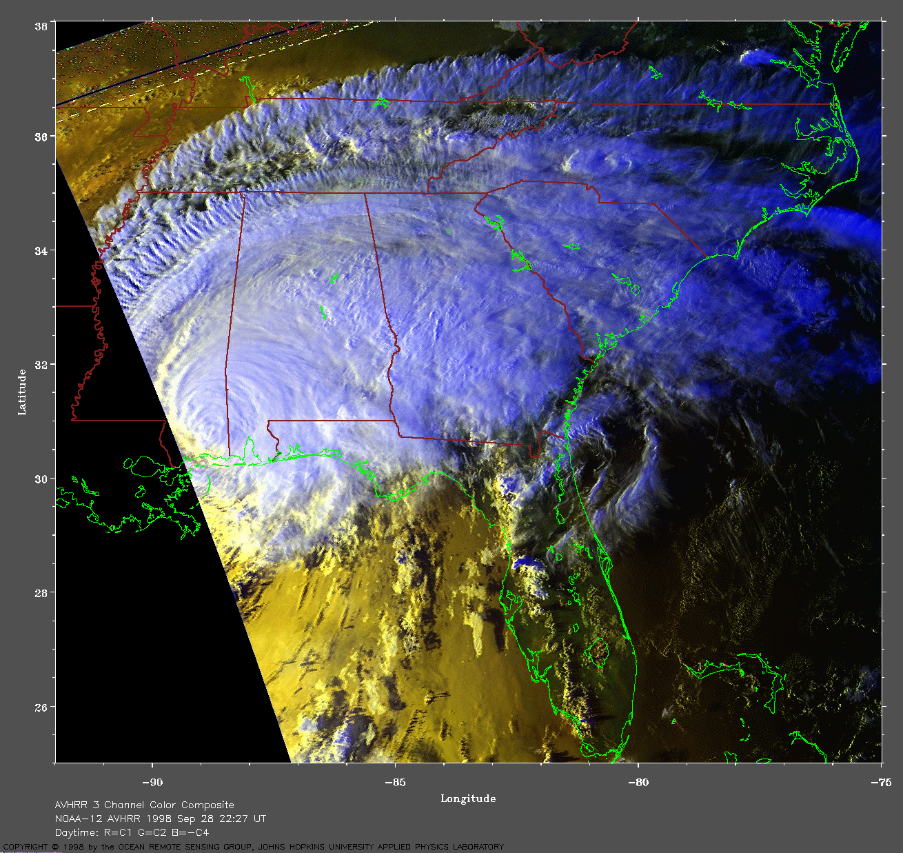
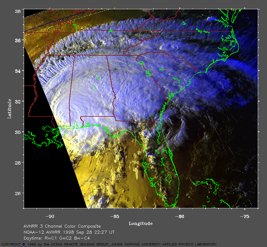 1998 September 28 22:27 UT
NOAA-12 AVHRR channel 3 color composite
evening image. A closer view (333 Kb) is seen by clicking
on this small image. The maximum sustained winds have dropped to about
70 mph.
A very large image (710 Kb)
is also available.
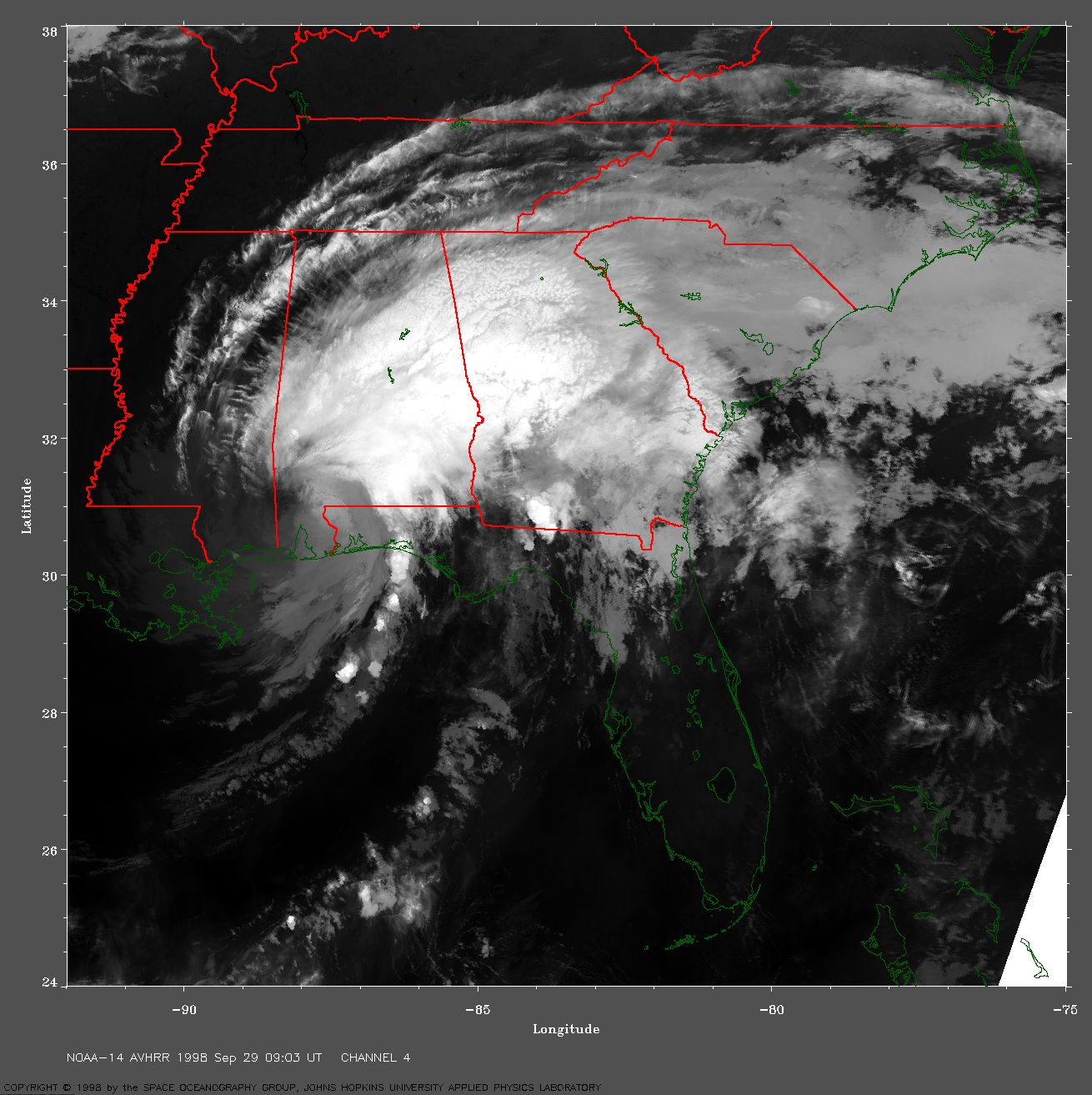
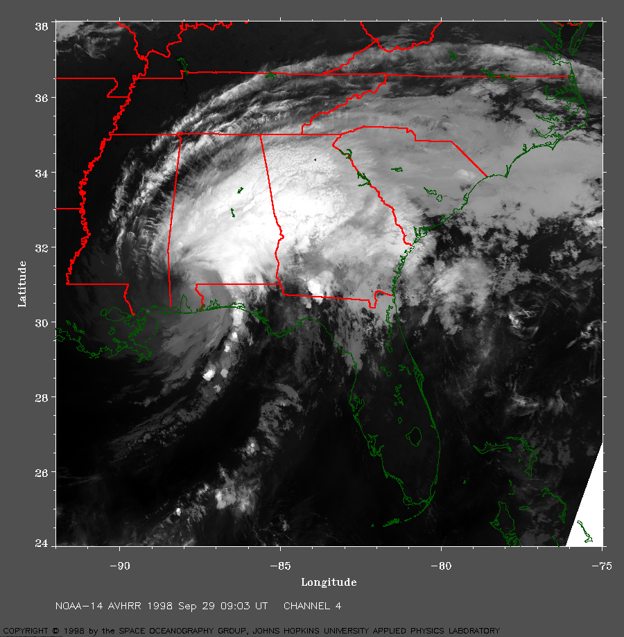 1998 September 29 09:03 UT
NOAA-14 AVHRR channel 4 early morning
image. A closer view (481 Kb) is seen by clicking on
this small image. The maximum sustained winds have dropped to near 40
mph.
A very large image (1023 Kb)
is also available.
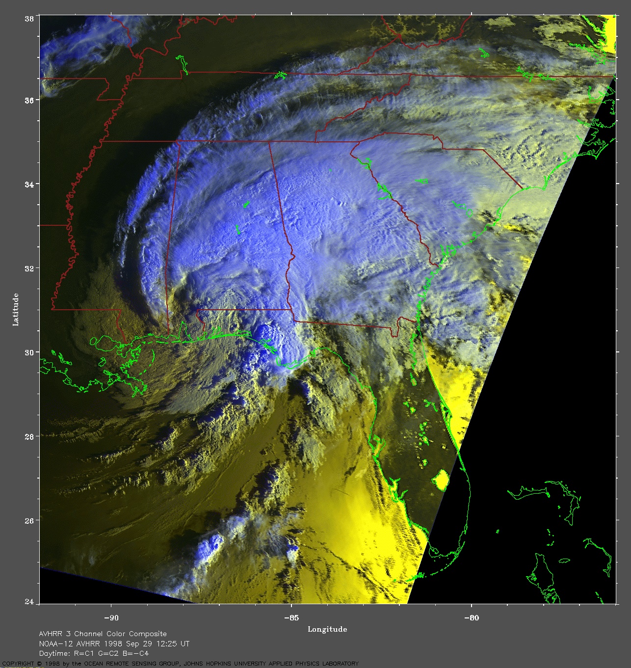
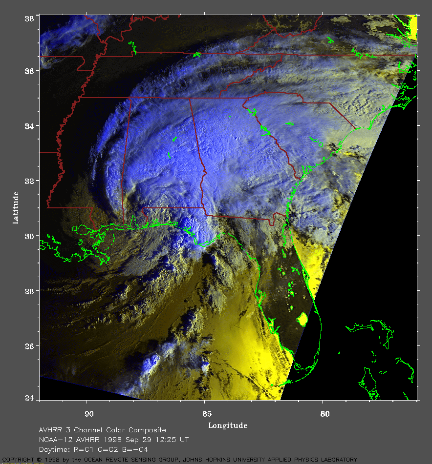 1998 September 29 12:25 UT
NOAA-12 AVHRR channel 3 color composite
morning image. A closer view (341 Kb) is seen by clicking
on this small image.
A very large image (779 Kb)
is also available.
NOAA AVHRR satellite images from JHU/APL DynaTrack