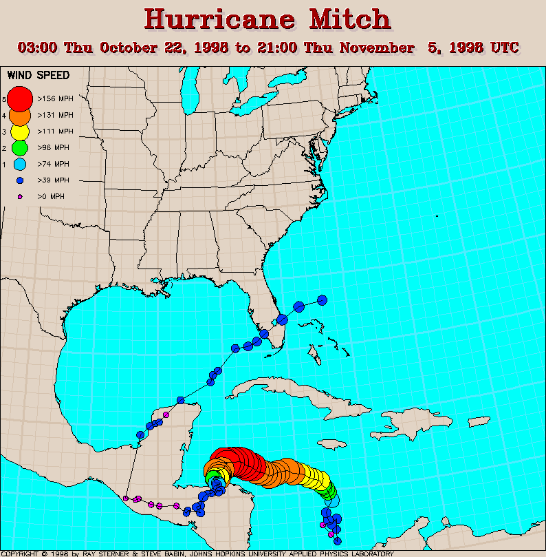
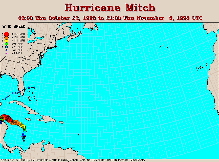
Track maps
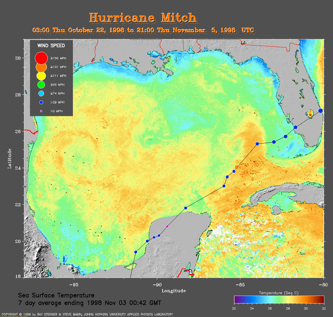 Mean SST Image from 3 November
(354 Kb)
This image is derived from averaging the sea surface temperature (SST)
data over 7 days ending 3 November 1998 to remove clouds. The track of
Mitch from 3 November to 5 November is overlaid on this image.
Mean SST Image from 3 November
(354 Kb)
This image is derived from averaging the sea surface temperature (SST)
data over 7 days ending 3 November 1998 to remove clouds. The track of
Mitch from 3 November to 5 November is overlaid on this image.
Track file
Track data (lat/lon, winds, etc.) in a text file.
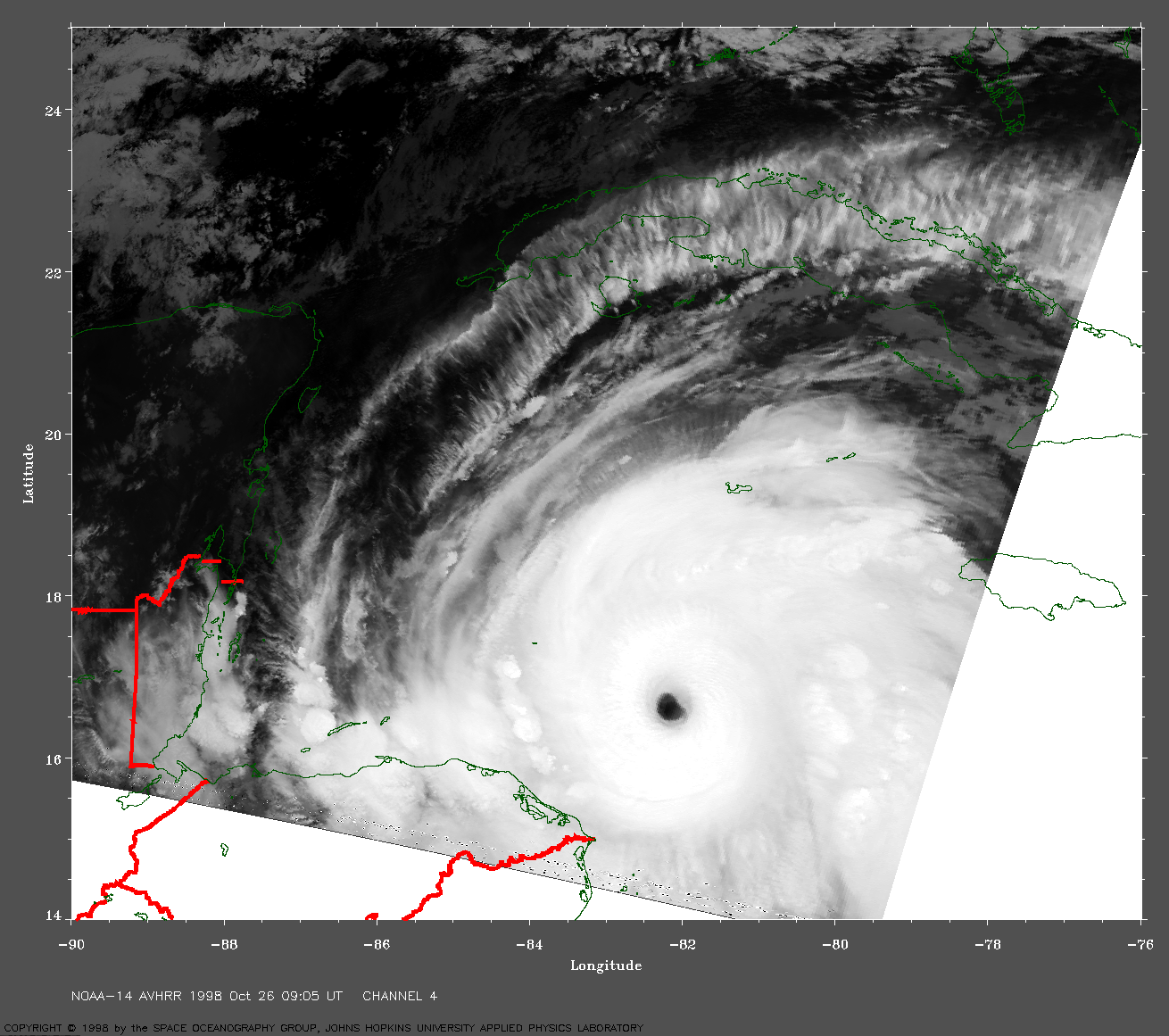
 1998 October 26 09:05 UT
NOAA-14 AVHRR
channel 4 early morning image. A closer view (405 Kb) is seen
by clicking on this small image. Note the well-defined eye that
measures roughly 15-20 nautical miles in diameter and the
cirrus outflow. Mitch is a dangerous category 4
(Saffir-Simpson scale) hurricane with 150 mph winds at this time.
The sea surface temperatures under Mitch are warmer than 29 C and this
will provide the energy to intensify Mitch.
A very large image (808 Kb)
is also available.
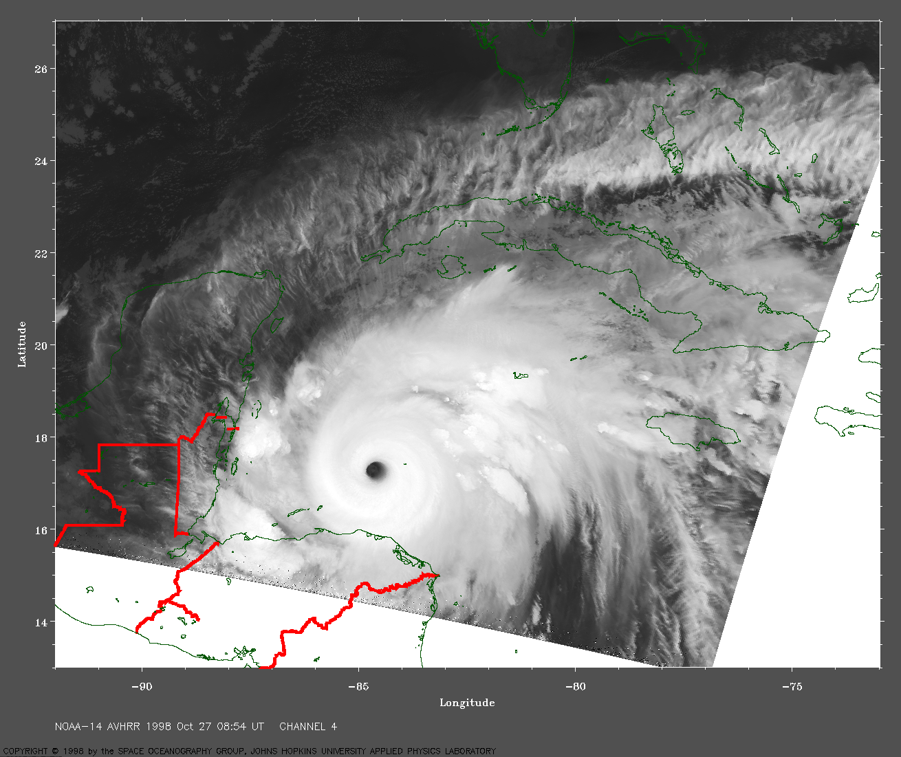
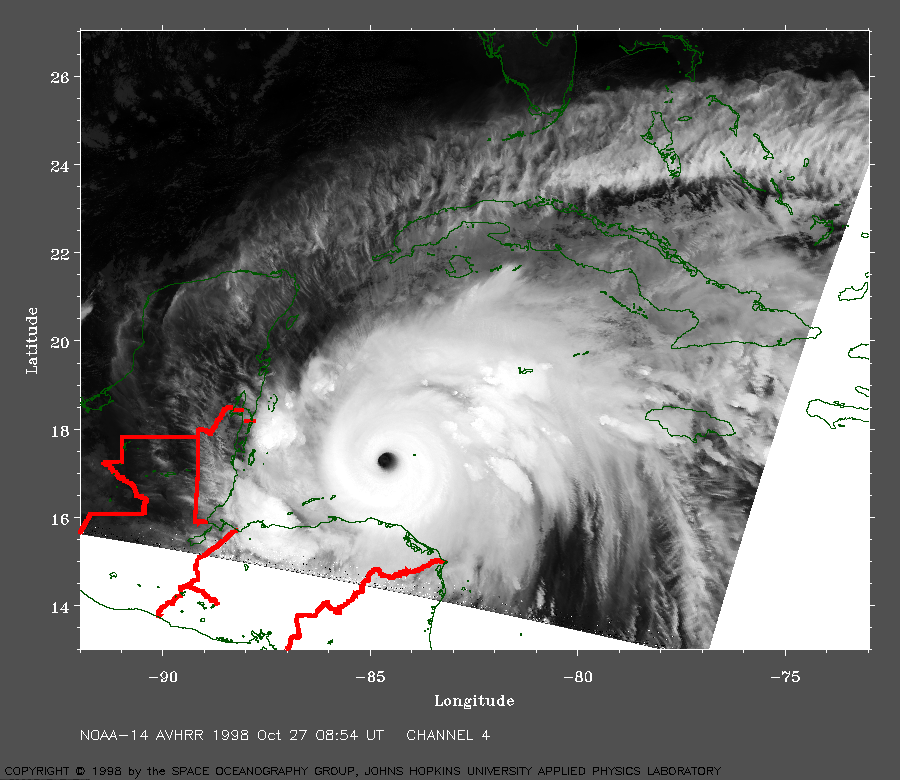 1998 October 27 08:54 UT
NOAA-14 AVHRR
channel 4 early morning image. A closer view (401 Kb) is seen
by clicking on this small image. Note the well-defined eye and the
cirrus outflow. Mitch is now a dangerous category 5
(Saffir-Simpson scale) hurricane with maximum sustained winds of 180 mph.
A very large image (810 Kb)
is also available.
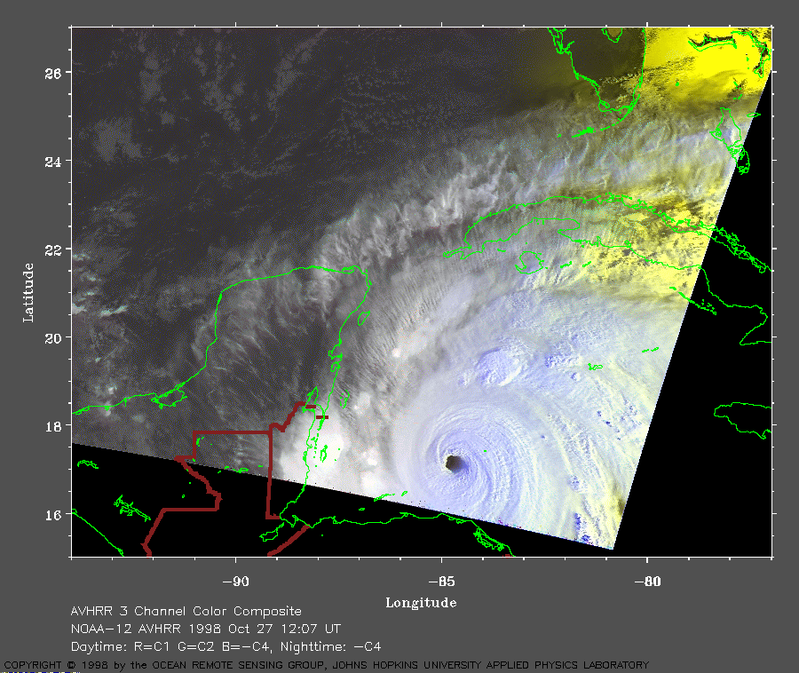 1998 October 27 12:07 UT
NOAA-12 AVHRR
3 channel color composite morning image. A closer view (227 Kb) is seen
by clicking on this small image. At this time, the maximum sustained
winds are still 180 mph. Mitch is moving slowly to the west.
A very large image (523 Kb)
is also available.
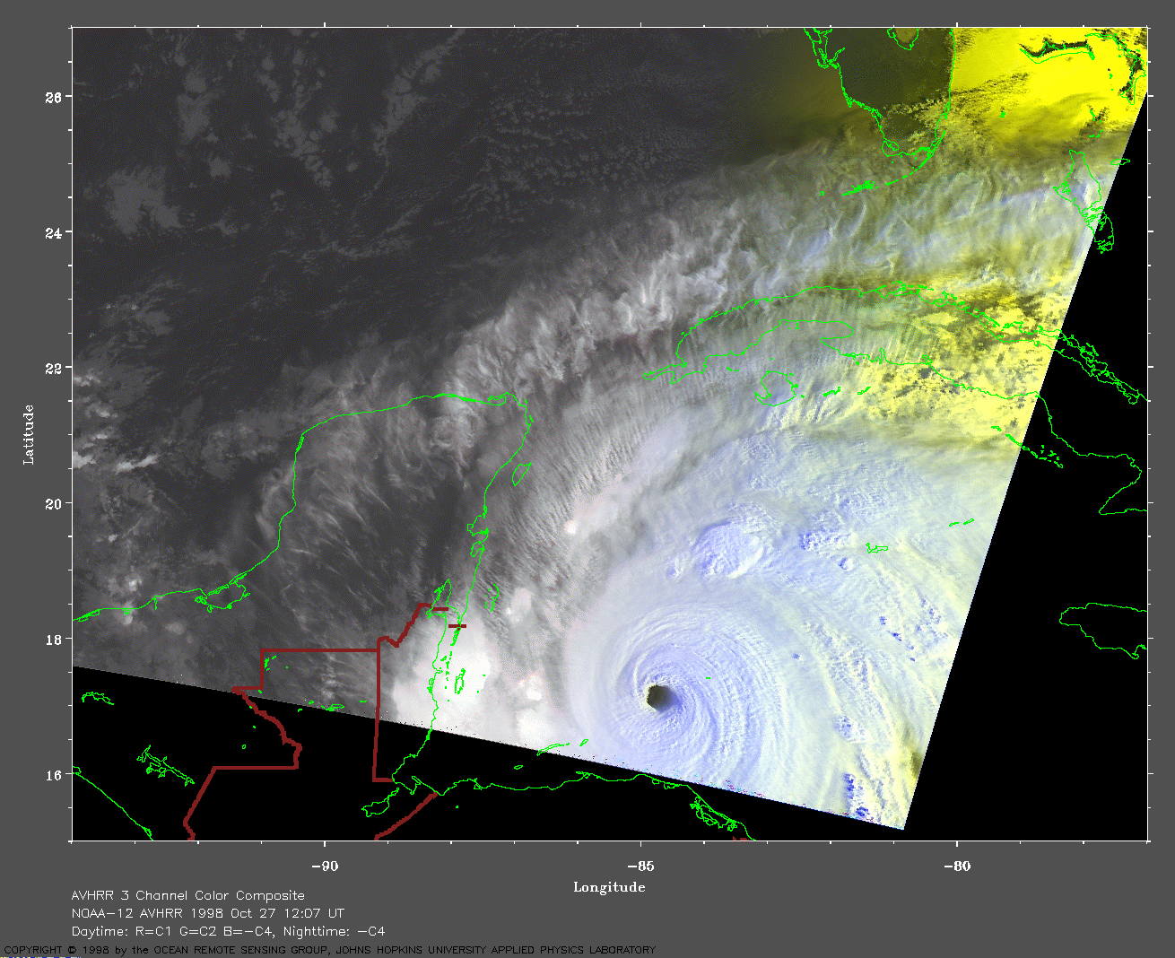
NOAA satellite AVHRR images from JHU/APL DynaTrack