Floyd developed from Tropical Depression 8 about 900 miles east of the Lesser Antilles.
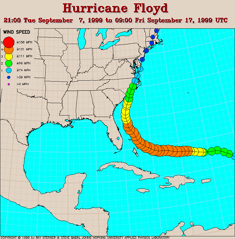
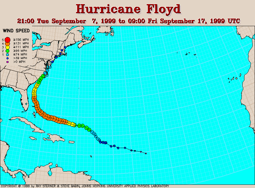
Track maps
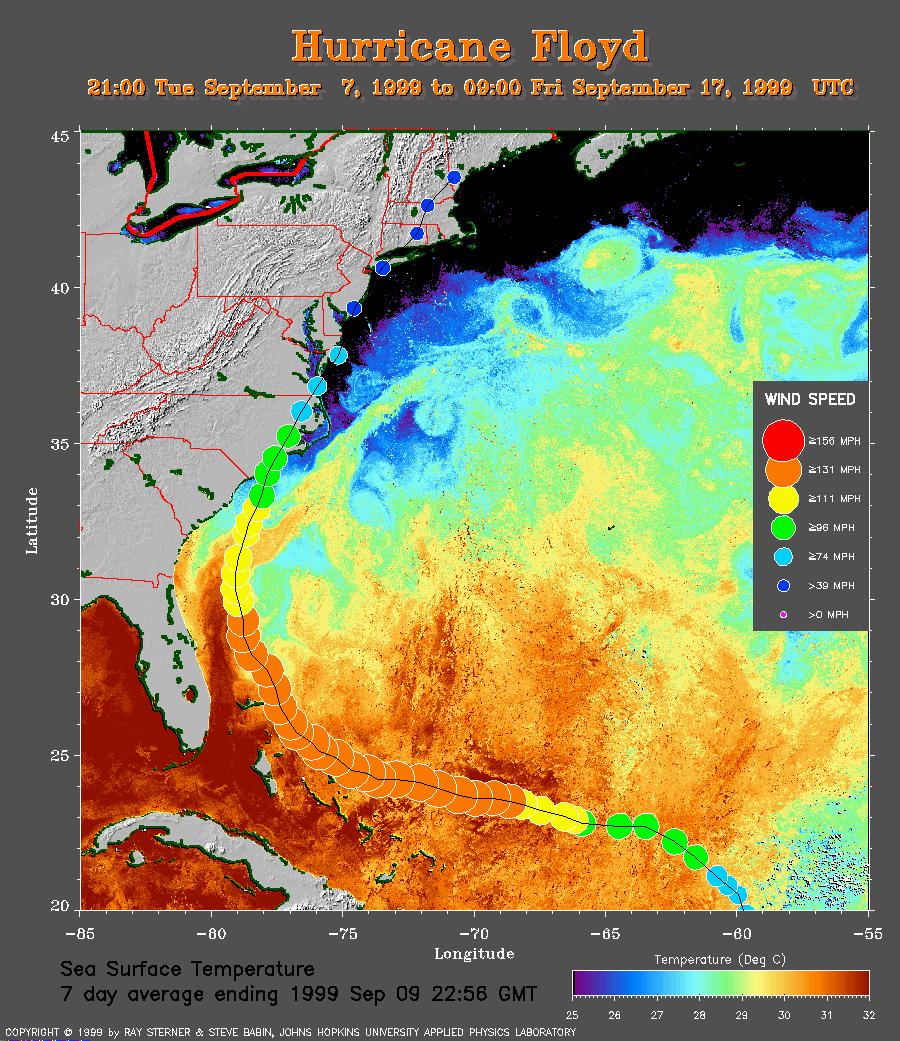 7 day composite average SST image from 9 September (246 Kb) This
image is derived from the average composite sea surface temperature (SST)
data over 7 days ending 9 September 1999. The averaging is done to remove
clouds (although some residual cloud contamination is noted in the lower
right corner of this image).
The temperature scale for the SST in this image is 25 to 32 C.
The track of Floyd is overlaid on this image. Notice how Floyd weakened
after crossing the remnants of Dennis' cool wake.
(Aside: the cool pool of water on the far
right of the image is probably a remnant of Cindy's cool wake.)
7 day composite average SST image from 9 September (246 Kb) This
image is derived from the average composite sea surface temperature (SST)
data over 7 days ending 9 September 1999. The averaging is done to remove
clouds (although some residual cloud contamination is noted in the lower
right corner of this image).
The temperature scale for the SST in this image is 25 to 32 C.
The track of Floyd is overlaid on this image. Notice how Floyd weakened
after crossing the remnants of Dennis' cool wake.
(Aside: the cool pool of water on the far
right of the image is probably a remnant of Cindy's cool wake.)
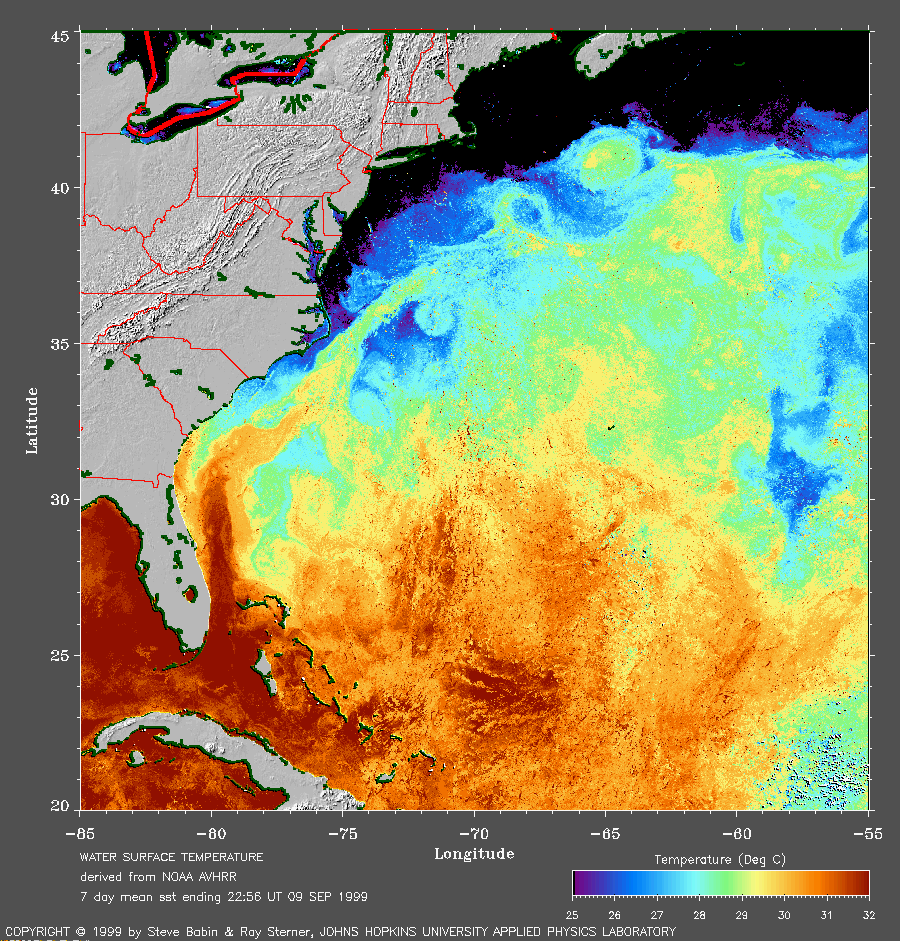
The
SST image without Floyd's track
(251 Kb) is also available.
Track file
Track data (lat/lon, winds, etc.) in a text file.
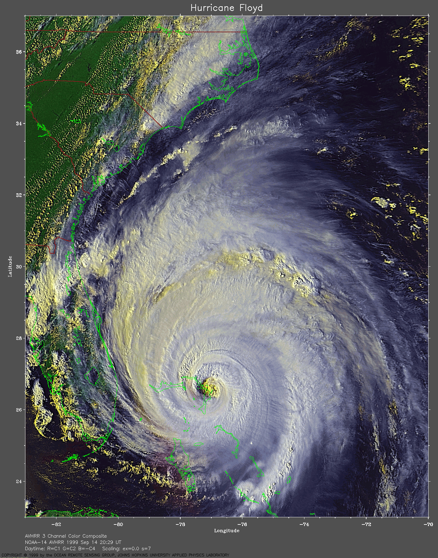
 1999 September 14 20:29 UT
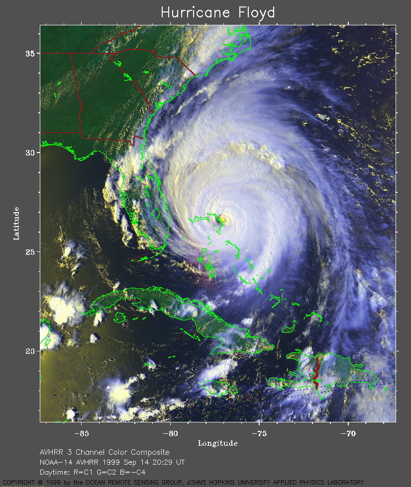
NOAA-14
satellite AVHRR 3 channel color composite daytime image. A closer view
(422 Kb) is seen by clicking on this small image.
Floyd is now 3 times the size of 1992 Hurricane Andrew.
Hurricane force winds extend up to 125 miles and tropical storm force
winds extend up to 290 miles from the center of this powerful storm.
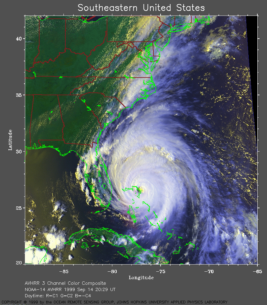
A regional view of the US Atlantic
coast is shown here (452 Kb).
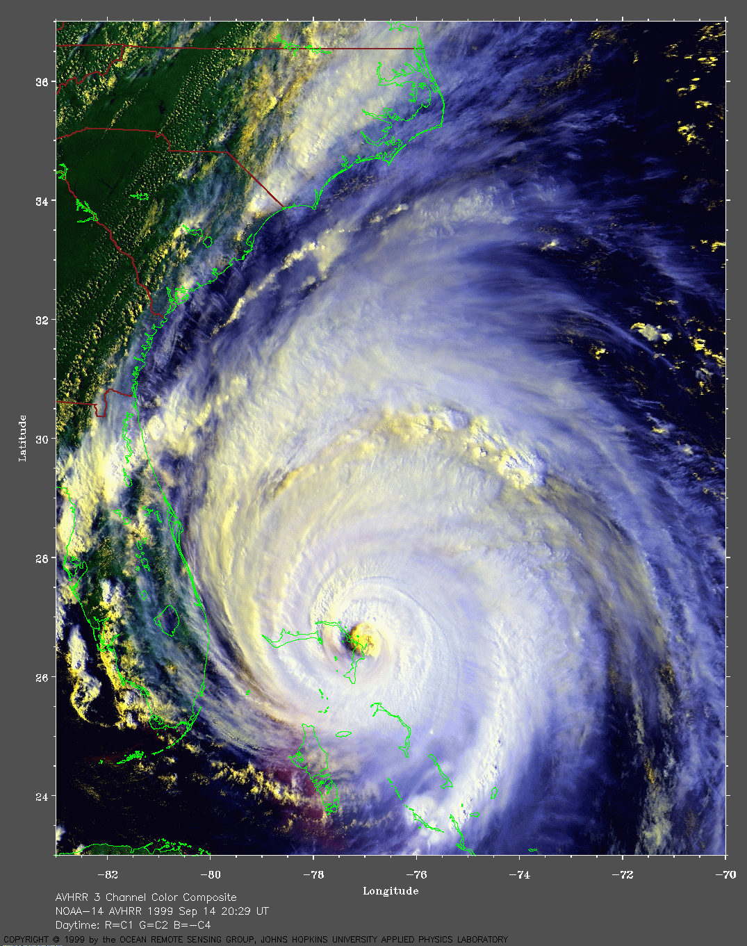
A very large image (749 Kb)
of Floyd is also available.
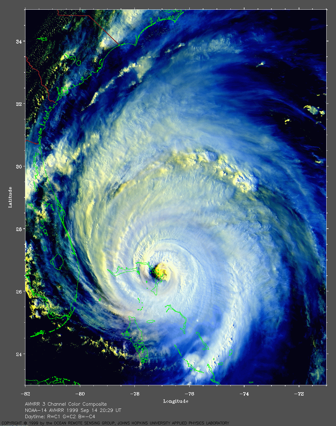
Another very large image (629 Kb)
of Floyd was made with higher contrast to bring out more cloudy
details.
An extremely large (1349
Kb) but extraordinarily detailed and beautiful
image of Floyd was made by Ray Sterner.
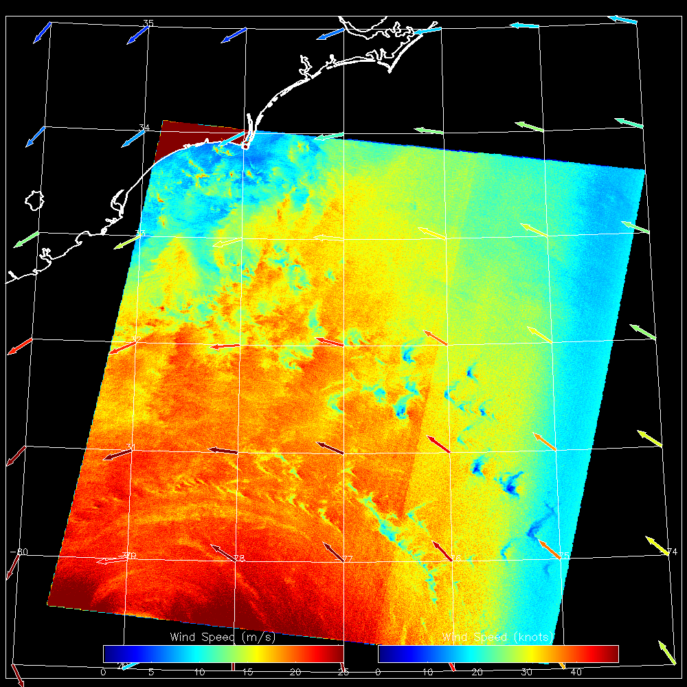 1999 September 15 11:09 UT
RADARSAT SAR-derived wind speeds northern image (550 Kb).
1999 September 15 11:09 UT
RADARSAT SAR-derived wind speeds northern image (550 Kb).
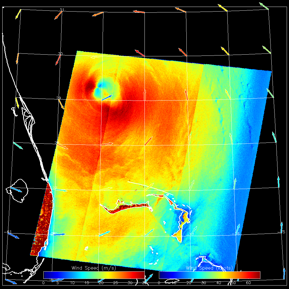 1999 September 15 11:10 UT
RADARSAT SAR-derived wind speeds southern image (540 Kb).
1999 September 15 11:10 UT
RADARSAT SAR-derived wind speeds southern image (540 Kb).
These images were produced as part of the StormWatch project. At about 12:00 UT (08:00 EDT) on 15 September, Floyd had maximum sustained winds of 135 mph (about 60 m/s) and the center was located at 29.3 N, 78.8W.
Aftermath of Floyd:
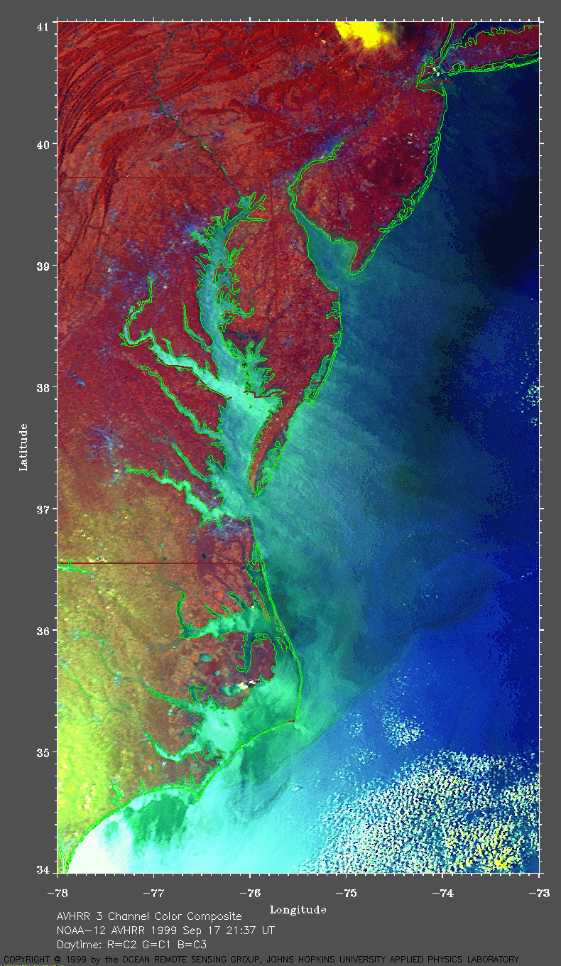
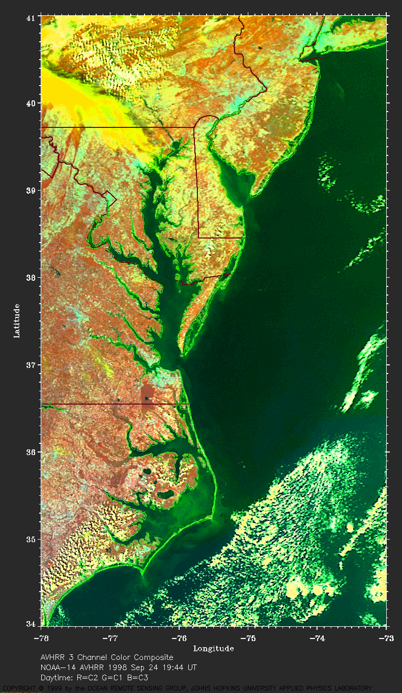 Pre-flood image (528 Kb) of the mid-Atlantic region of the US from
19:44 UT on 24 September 1998.
These images were made using red for AVHRR Channel 2, green for Channel 1
and blue for Channel 3. There is an area of convective clouds over
the Gulf Stream.
Pre-flood image (528 Kb) of the mid-Atlantic region of the US from
19:44 UT on 24 September 1998.
These images were made using red for AVHRR Channel 2, green for Channel 1
and blue for Channel 3. There is an area of convective clouds over
the Gulf Stream.
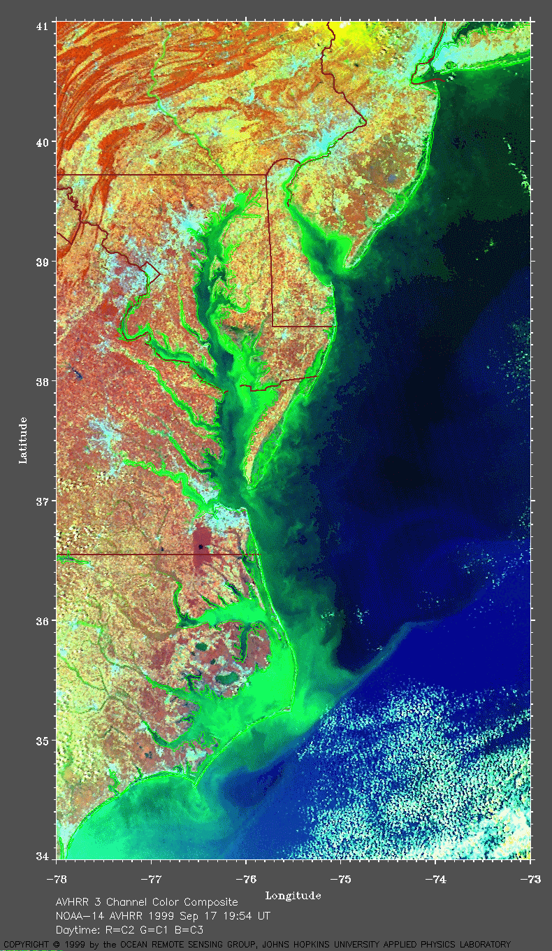 Flood image (543 Kb) of the mid-Atlantic region of the US
from 19:54 UT on 17 September 1999 after the passage of Floyd.
The flooding caused an increase in sediment in many of the rivers (e.g.,
Susquehanna, Potomac).
Note the green sediment plumes from the Albermarle and Pamlico Sounds
and the interaction of these plumes with the north wall of the Gulf
Stream (blue in this image).
Flood image (543 Kb) of the mid-Atlantic region of the US
from 19:54 UT on 17 September 1999 after the passage of Floyd.
The flooding caused an increase in sediment in many of the rivers (e.g.,
Susquehanna, Potomac).
Note the green sediment plumes from the Albermarle and Pamlico Sounds
and the interaction of these plumes with the north wall of the Gulf
Stream (blue in this image).
Wind streaks on the water are seen in this image obtained a few hours later and at a lower sun angle. The wind is blowing from the northwest. Note that the sediment plumes are continuing but are not as visible due to the sun angle and the way this image was processed.