Gert developed from Tropical Depression 9 near the Cape Verde Islands.
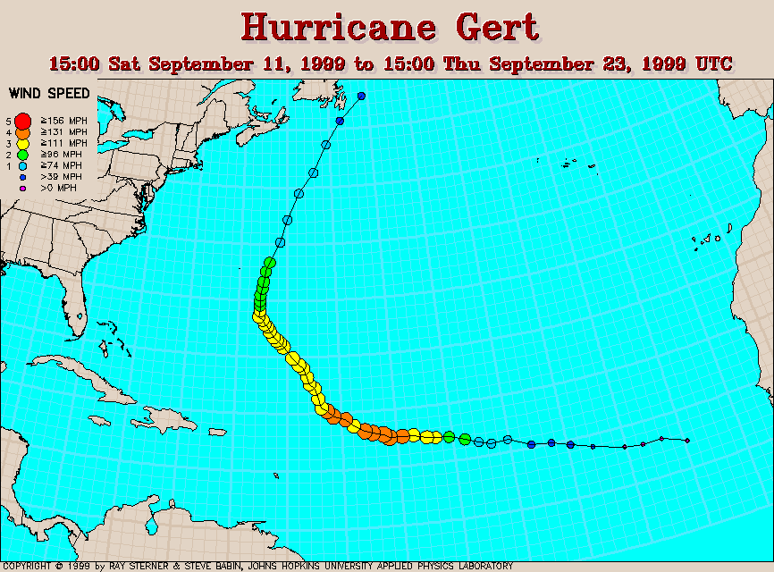
Track maps
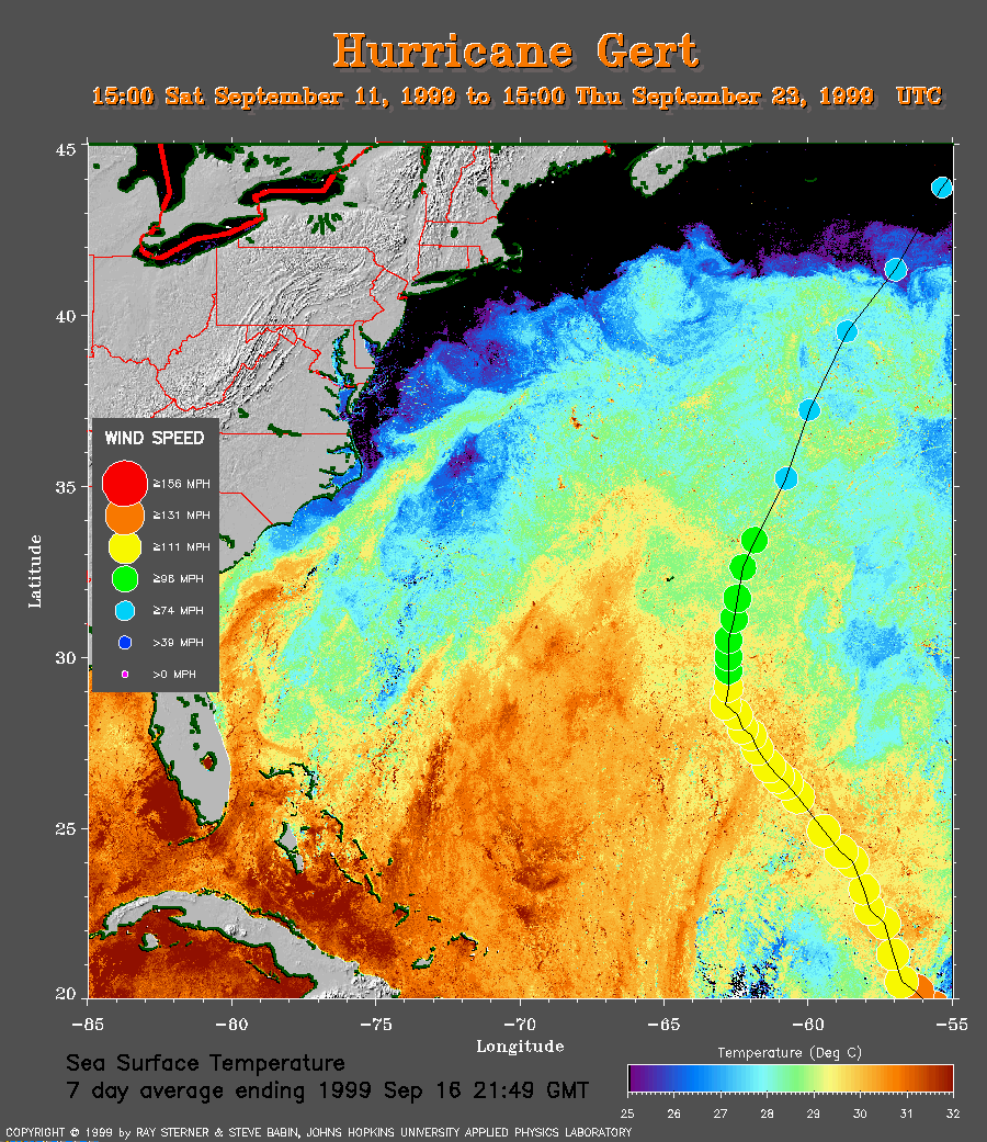 7 day composite average SST image from 16 September (254 Kb) This
image is derived from the average composite sea surface temperature
(SST) data over 7 days ending 16 September 1999. The averaging is done to
remove clouds. The track of Gert (coming from the lower right corner) is
overlaid on this image.
7 day composite average SST image from 16 September (254 Kb) This
image is derived from the average composite sea surface temperature
(SST) data over 7 days ending 16 September 1999. The averaging is done to
remove clouds. The track of Gert (coming from the lower right corner) is
overlaid on this image.
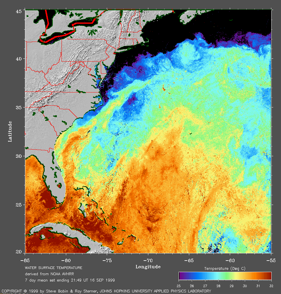
The
SST image without Gert's track
(259 Kb) is also available.
Track file
Track data (lat/lon, winds, etc.) in a text file.