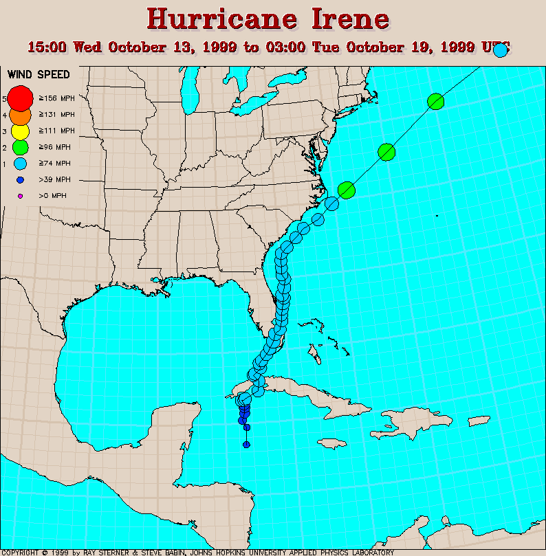
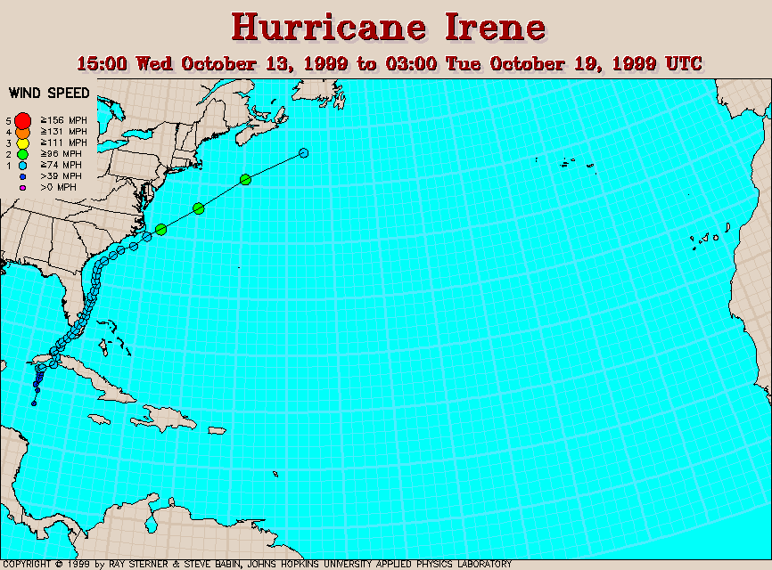
Track maps
Irene developed in the northwestern Caribbean Sea.
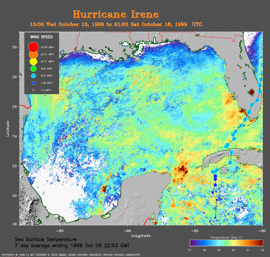 7 day composite average SST image from 6 October (352 Kb)
showing the track of Irene over the Caribbean Sea and Gulf of Mexico.
This image is derived from the average composite sea surface temperature
(SST) data over 7 days ending 6 October 1999. The averaging
is done to remove clouds.
7 day composite average SST image from 6 October (352 Kb)
showing the track of Irene over the Caribbean Sea and Gulf of Mexico.
This image is derived from the average composite sea surface temperature
(SST) data over 7 days ending 6 October 1999. The averaging
is done to remove clouds.
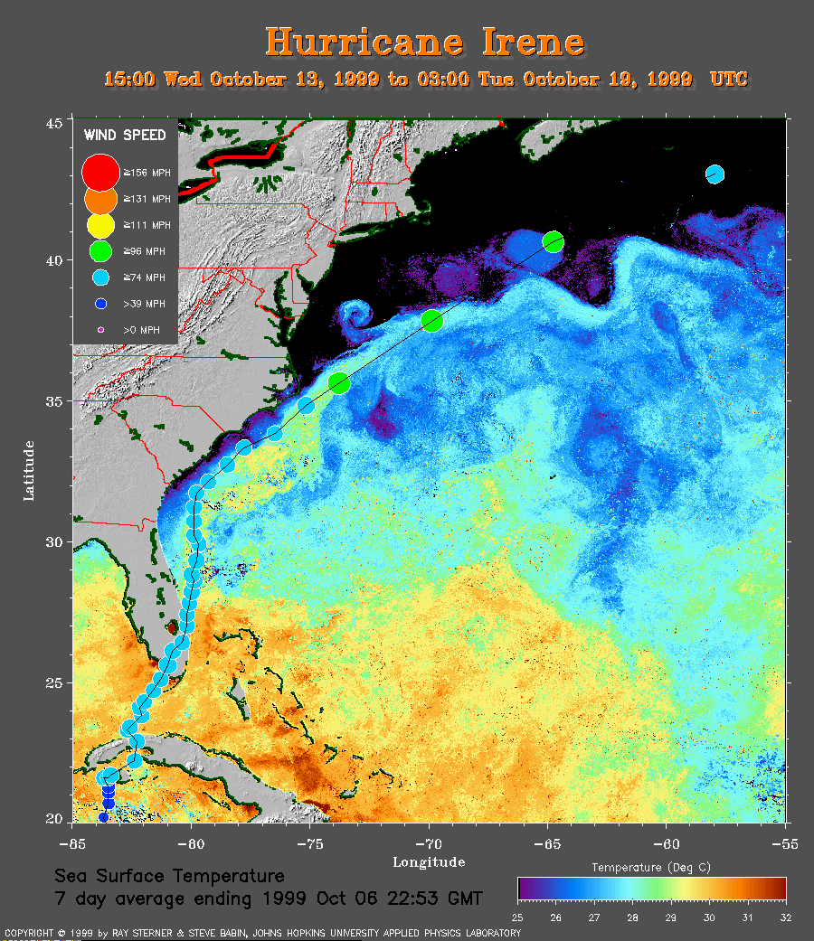 7 day composite SST image of the western North Atlantic Ocean
(240 Kb) showing the track of Irene.
7 day composite SST image of the western North Atlantic Ocean
(240 Kb) showing the track of Irene.
Track file
Track data (lat/lon, winds, etc.) in a text file.