Dennis developed from Tropical Depression 5 east of the Turks and Caicos Islands.
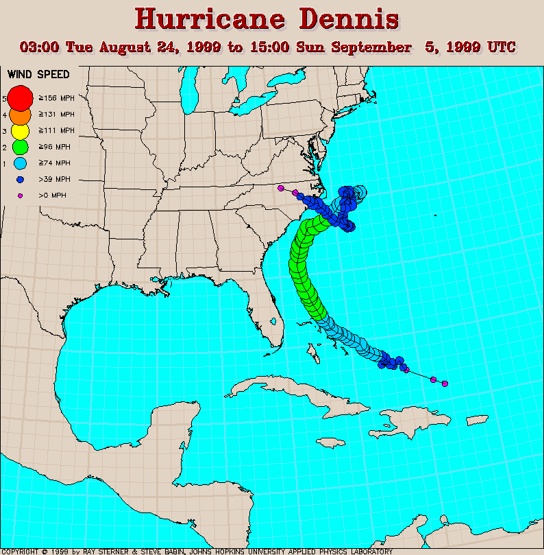
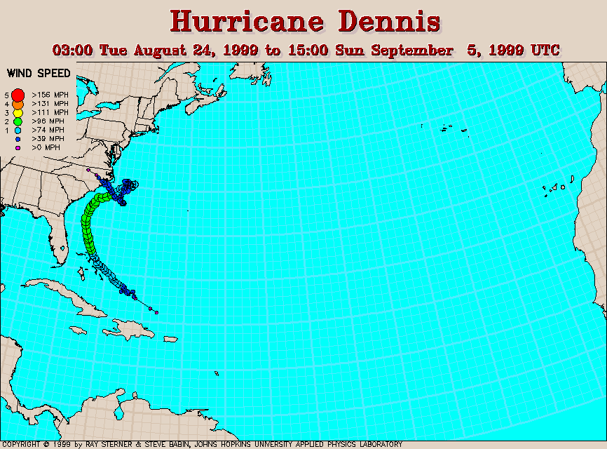
Track maps
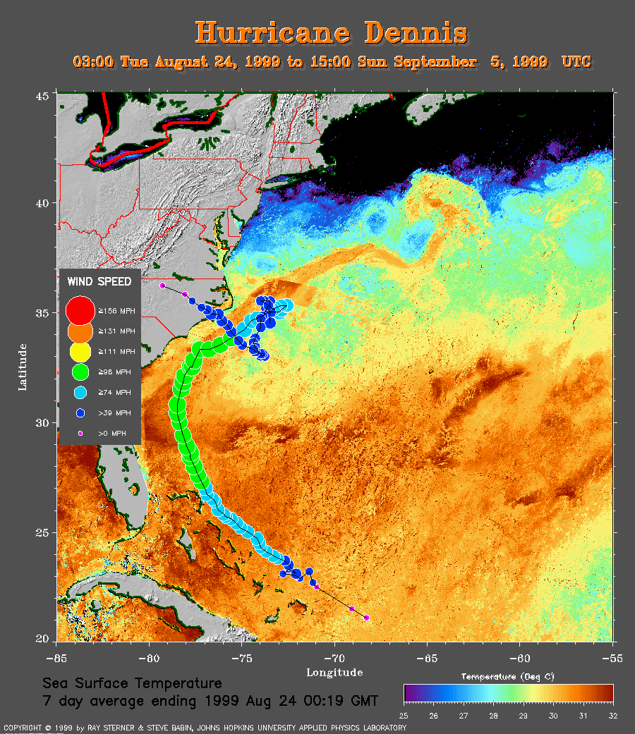 7 day average SST image from 24
August (260 Kb) This image is derived from the average composite sea
surface temperature (SST) data over 7 days ending 24 August 1999. The
averaging is done to remove clouds. The temperature scale for the SST in
this image is 25 to 32 C.
The track of Dennis is overlaid on this image. Notice how Dennis
intensifies as it moves over warmer water.
7 day average SST image from 24
August (260 Kb) This image is derived from the average composite sea
surface temperature (SST) data over 7 days ending 24 August 1999. The
averaging is done to remove clouds. The temperature scale for the SST in
this image is 25 to 32 C.
The track of Dennis is overlaid on this image. Notice how Dennis
intensifies as it moves over warmer water.
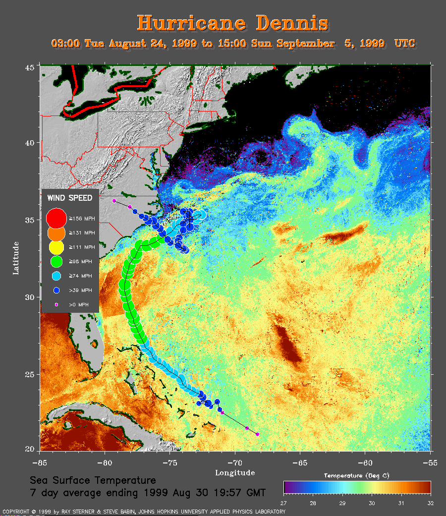 7 day average SST image from 30
August (229 Kb) with the temperature scale set to 27 to 32 C
to show the cool wake of Dennis.
The track of Dennis is overlaid on this image.
7 day average SST image from 30
August (229 Kb) with the temperature scale set to 27 to 32 C
to show the cool wake of Dennis.
The track of Dennis is overlaid on this image.
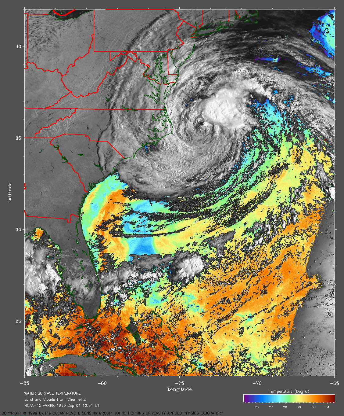
A single pass merged SST image (719 Kb) from 12:31 UT on
1 September 1999 shows the
cool wake left by Dennis.
This image was created by Ray Sterner.
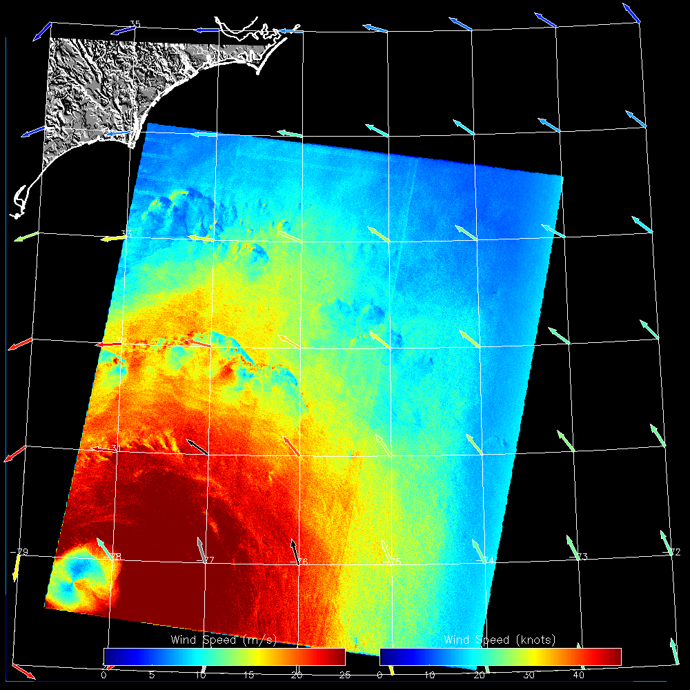
RADARSAT SAR-derived wind
speeds northern image (440 Kb) from 1999 August 29 11:05 UT
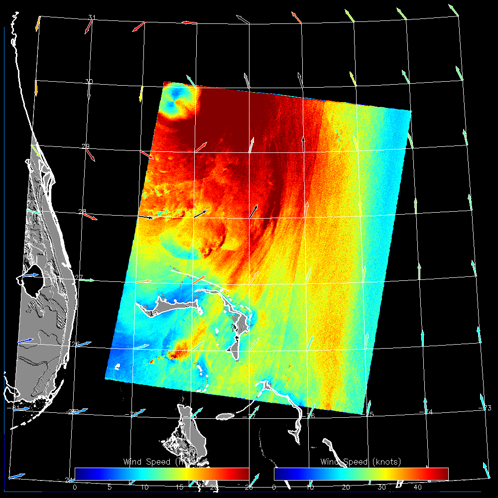
RADARSAT SAR-derived wind speeds southern image (440 Kb) from 1999 August 29 11:06 UT
Track file
Track data (lat/lon, winds, etc.) in a text file.