1-5 September Images
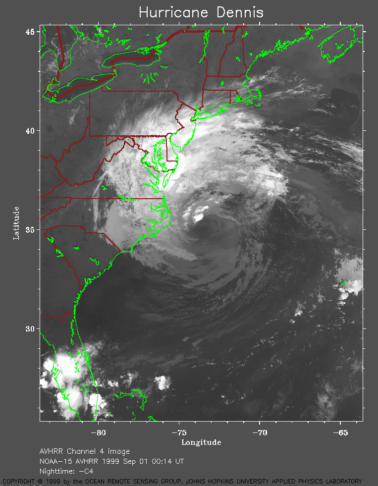 1999 September 1 00:14 UT
NOAA-15
AVHRR channel 4 nighttime image. A closer view (258 Kb)
is seen by clicking on this small image.
A very large image (1042 Kb)
is also available.
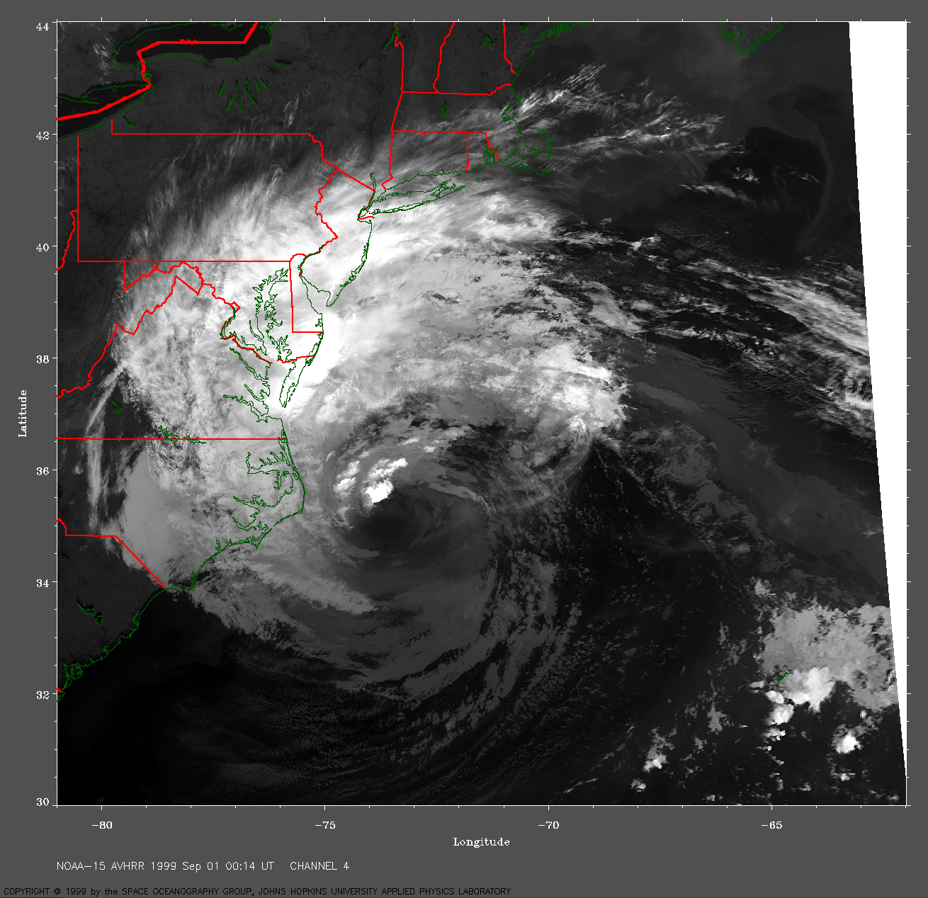
 1999 September 1 08:09 UT
NOAA-14
AVHRR channel 4 early morning image. A closer view (231 Kb)
is seen by clicking on this small image.
A very large image (997 Kb)
is also available.
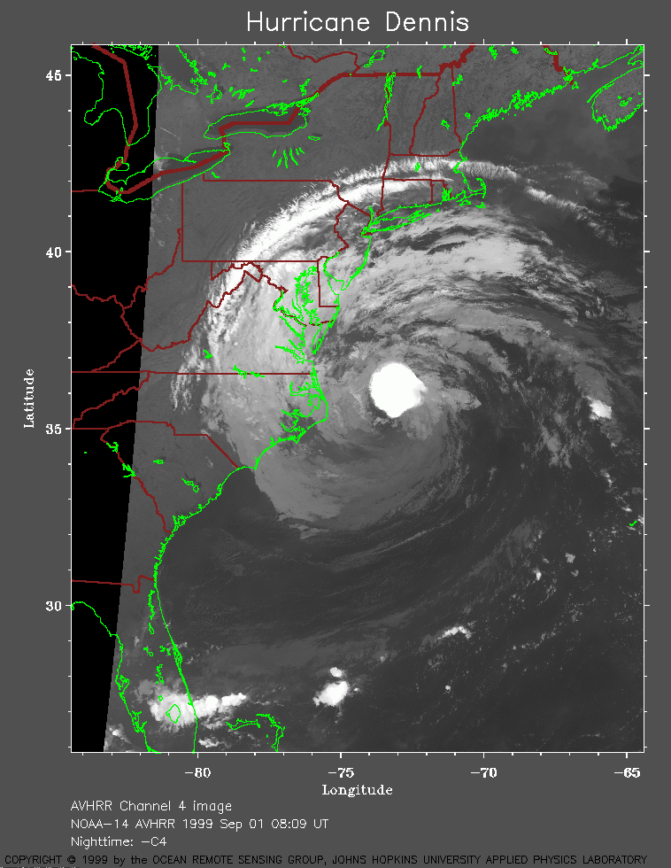
 1999 September 1 09:50 UT
NOAA-14
AVHRR channel 4 early morning image. A closer view (146 Kb)
is seen by clicking on this small image. The eastern part of the storm
is not shown on this pass.
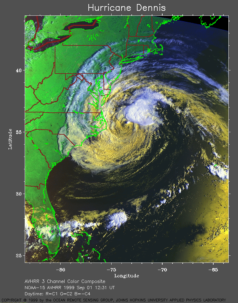 1999 September 1 12:31 UT
NOAA-15
AVHRR 3 channel color composite daytime image. A closer view (353 Kb)
is seen by clicking on this small image.
A very large image (714 Kb)
is also available.
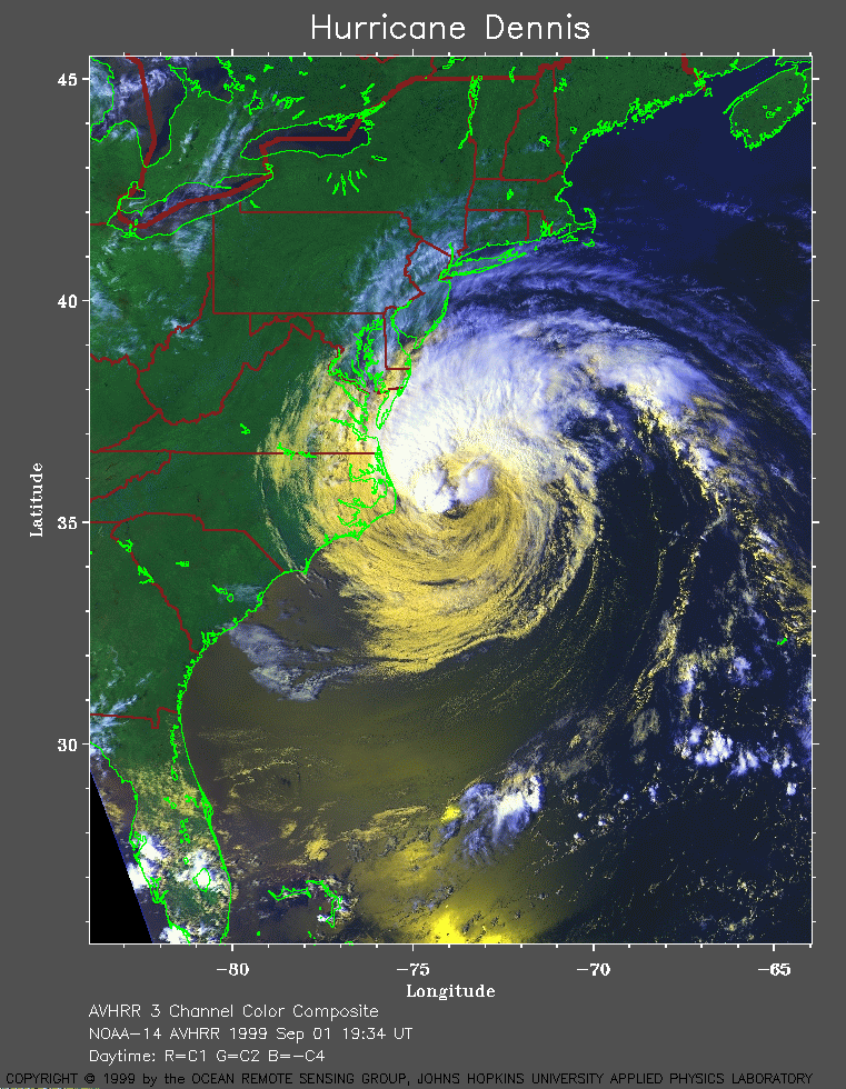 1999 September 1 19:34 UT
NOAA-14
AVHRR 3 channel color composite daytime image. A closer view (317 Kb)
is seen by clicking on this small image.
A very large image (650 Kb)
is also available.
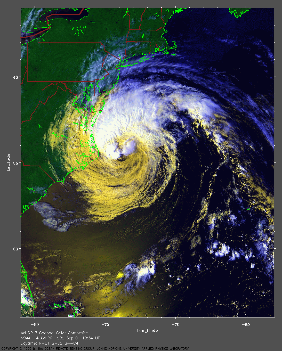
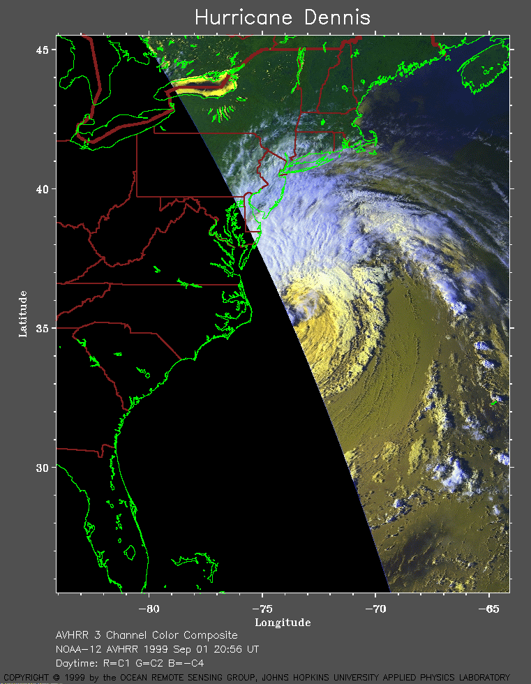 1999 September 1 20:56 UT
NOAA-12
AVHRR 3 channel color composite daytime image. A closer view (206 Kb)
is seen by clicking on this small image.
A very large image (628 Kb)
is also available.
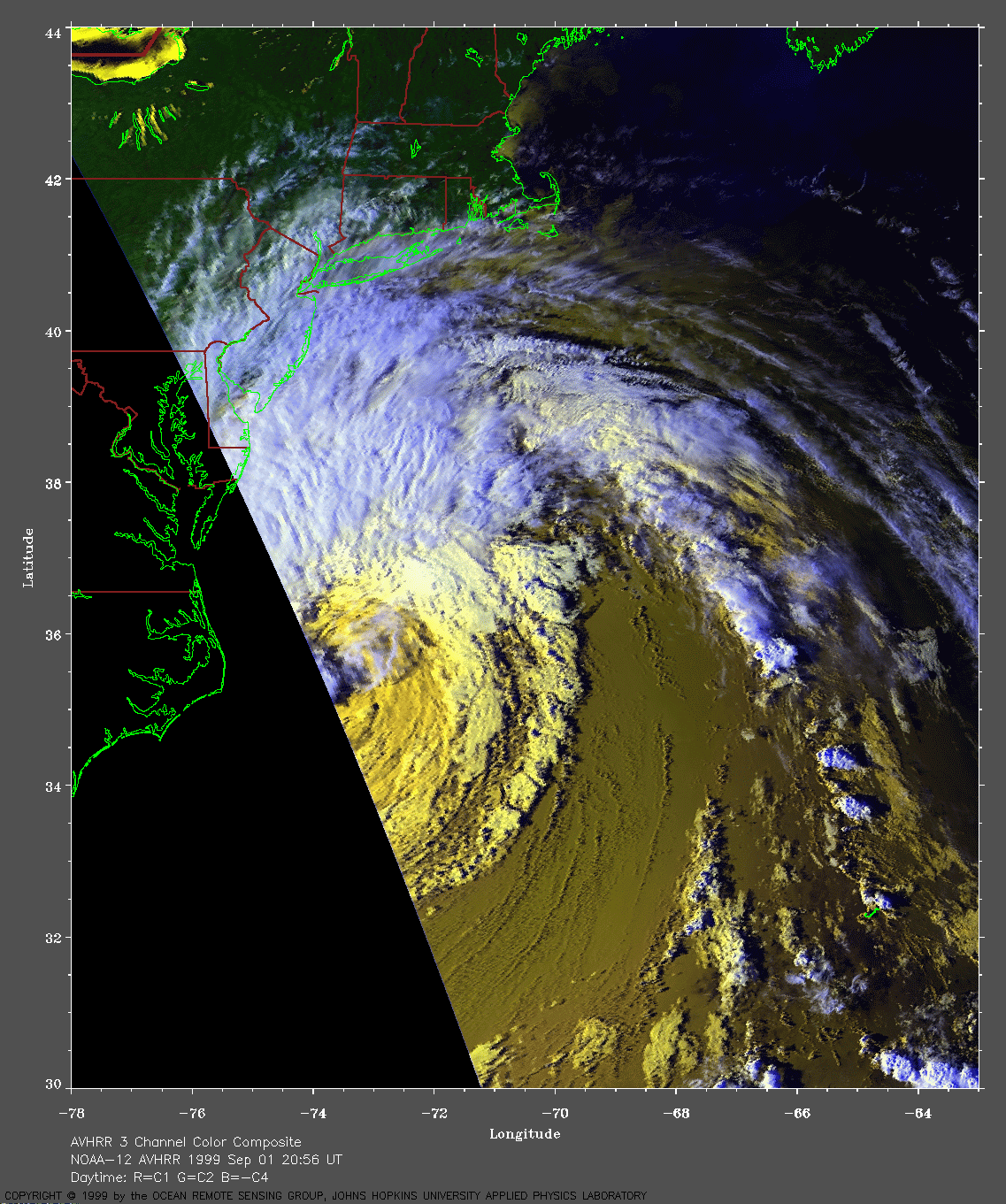
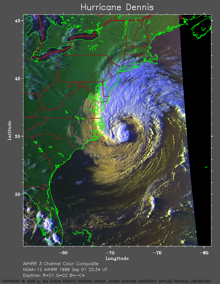 1999 September 1 22:34 UT
NOAA-12
AVHRR 3 channel color composite daytime image. A closer view (326 Kb)
is seen by clicking on this small image.
A very large image (512 Kb)
is also available.
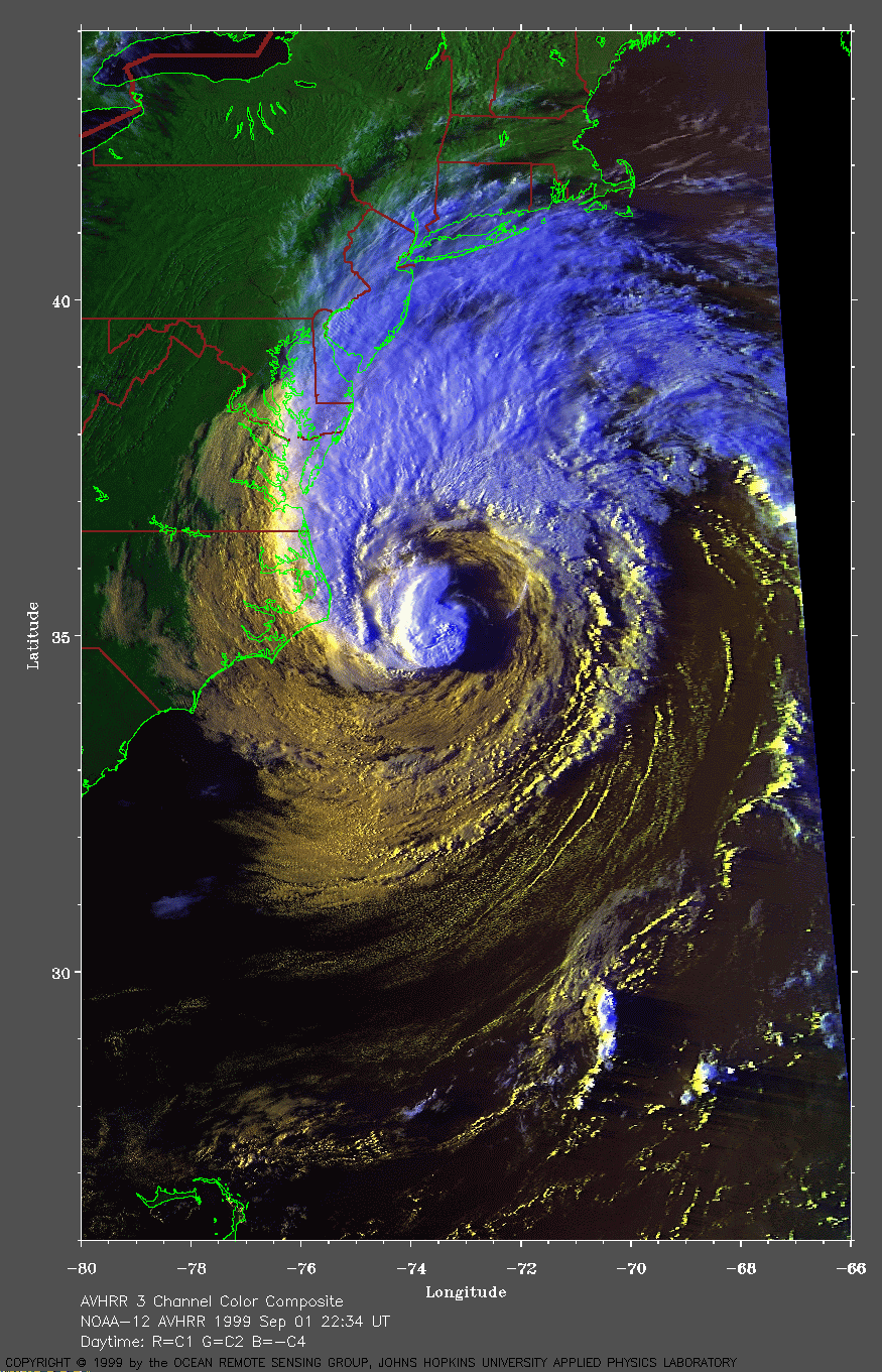
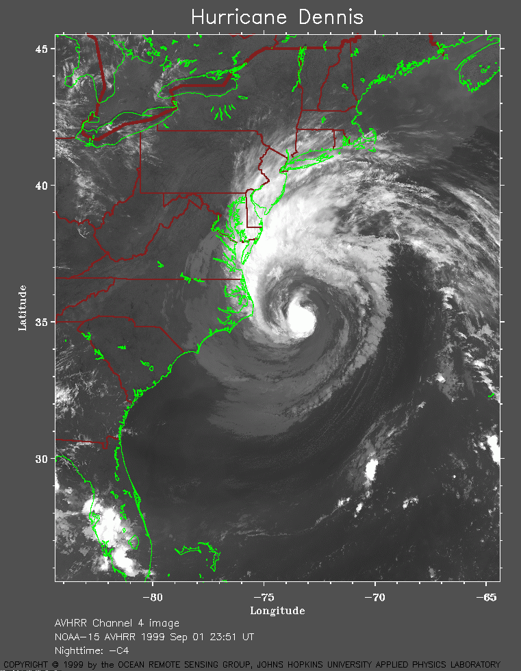 1999 September 1 23:51 UT
NOAA-15
AVHRR channel 4 evening image. A closer view (269 Kb)
is seen by clicking on this small image.
A very large image (1025 Kb)
is also available.
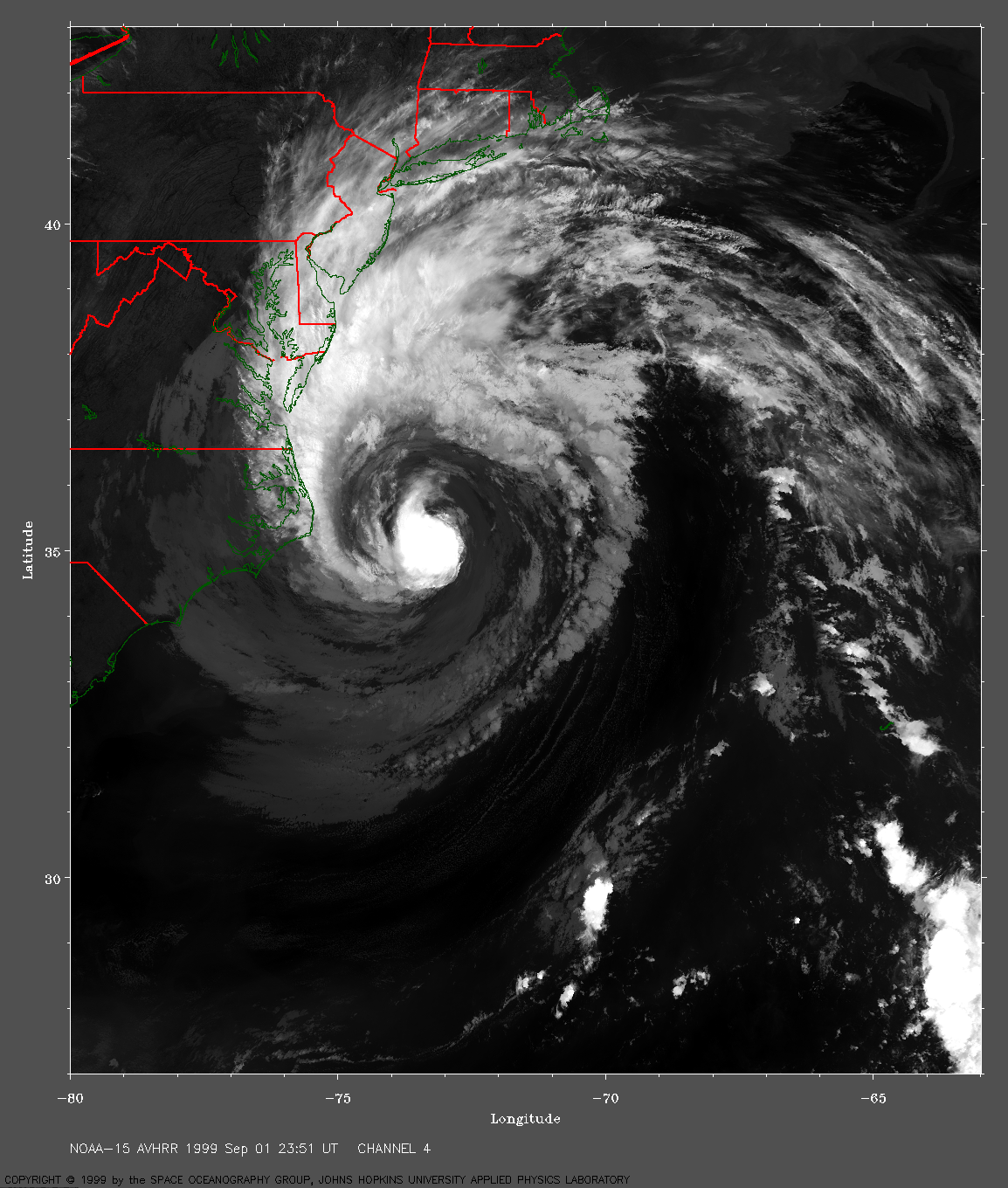
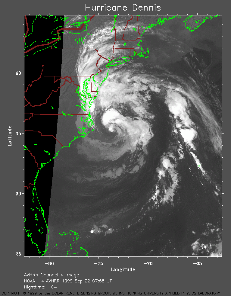 1999 September 2 07:58 UT
NOAA-14
AVHRR channel 4 early morning image. A closer view (238 Kb)
is seen by clicking on this small image.
A very large image (760 Kb)
is also available.
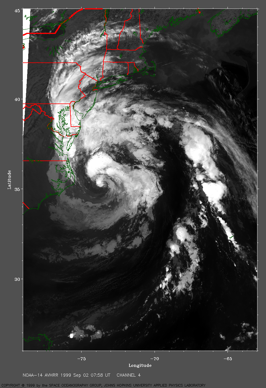
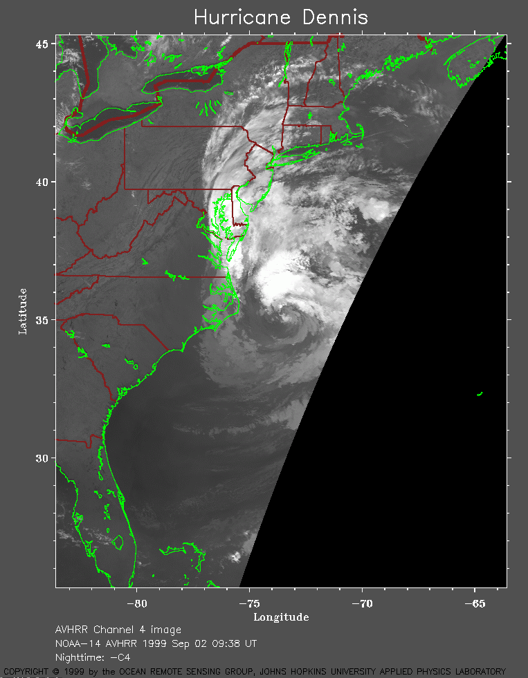 1999 September 2 09:38 UT
NOAA-14
AVHRR channel 4 early morning image. A closer view (179 Kb)
is seen by clicking on this small image.
A very large image (597 Kb)
is also available.
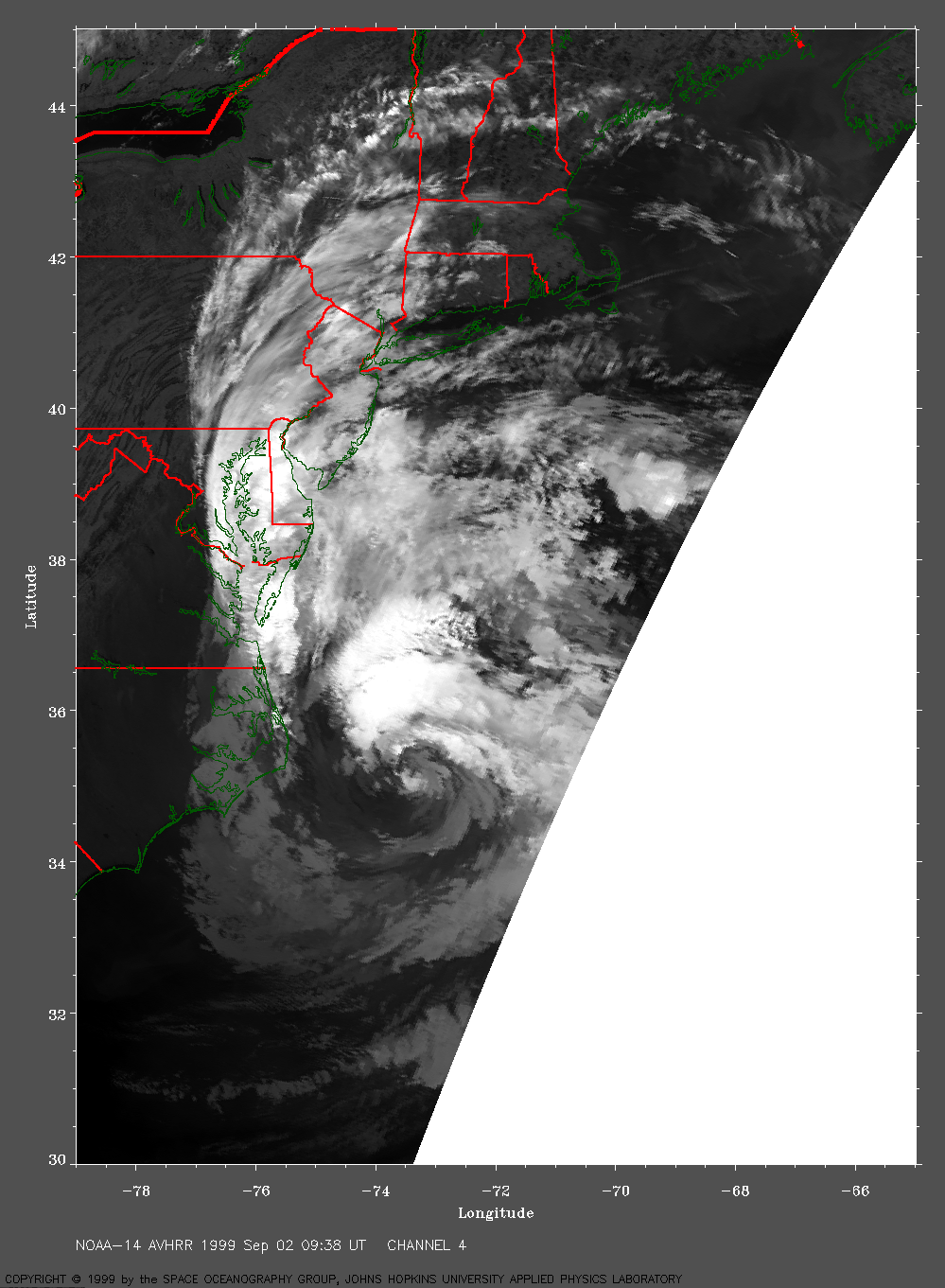
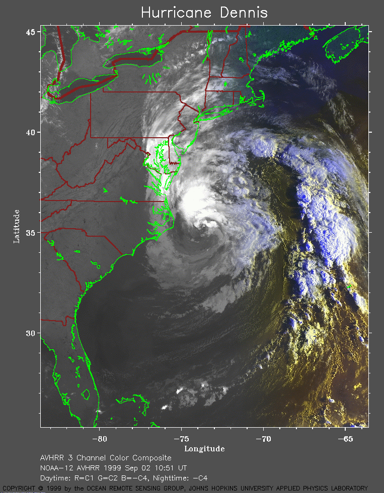 1999 September 2 10:51 UT
NOAA-12
AVHRR 3 channel color composite morning image. A closer view (333 Kb)
is seen by clicking on this small image.
A very large image (556 Kb)
is also available.
 1999 September 2 12:09 UT
NOAA-15
AVHRR 3 channel color composite morning image. A closer view (313 Kb)
is seen by clicking on this small image.
A very large image (542 Kb)
is also available.
 1999 September 2 13:49 UT
NOAA-15
AVHRR 3 channel color composite daytime image. A closer view (179 Kb)
is seen by clicking on this small image. Only the western edge of
Dennis is visible in this image.
A very large image (370 Kb)
is also available. Sun glitter on the ocean and on numerous lakes
(including Lake Ontario) is visible in this image. Note the outer band
of high clouds as far north as Canada.
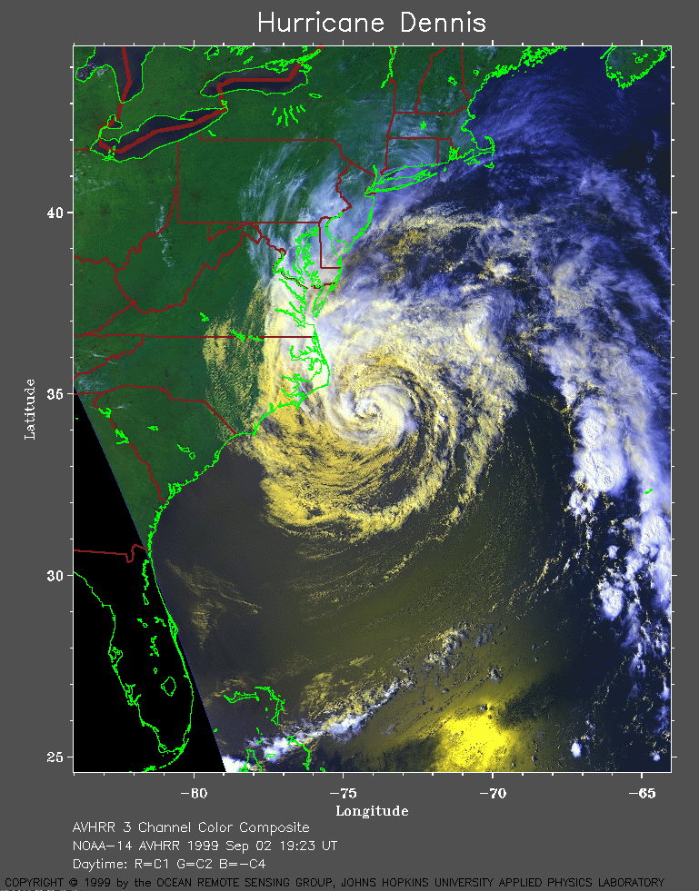 1999 September 2 19:23 UT
NOAA-14
AVHRR 3 channel color composite daytime image. A closer view (335 Kb)
is seen by clicking on this small image.
A very large image (748 Kb)
is also available.
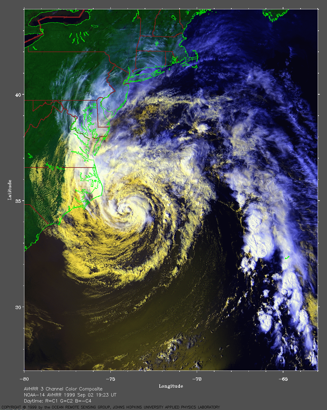
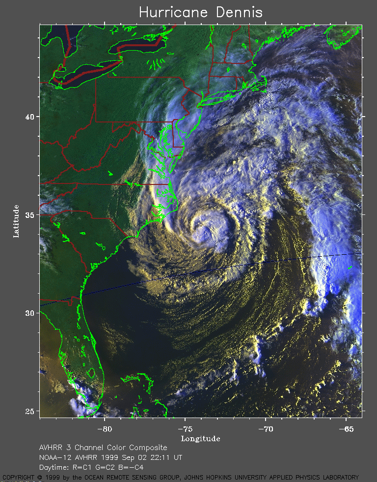 1999 September 2 22:11 UT
NOAA-12
AVHRR 3 channel color composite daytime image. A closer view (386 Kb)
is seen by clicking on this small image.
A very large image (719 Kb)
is also available.
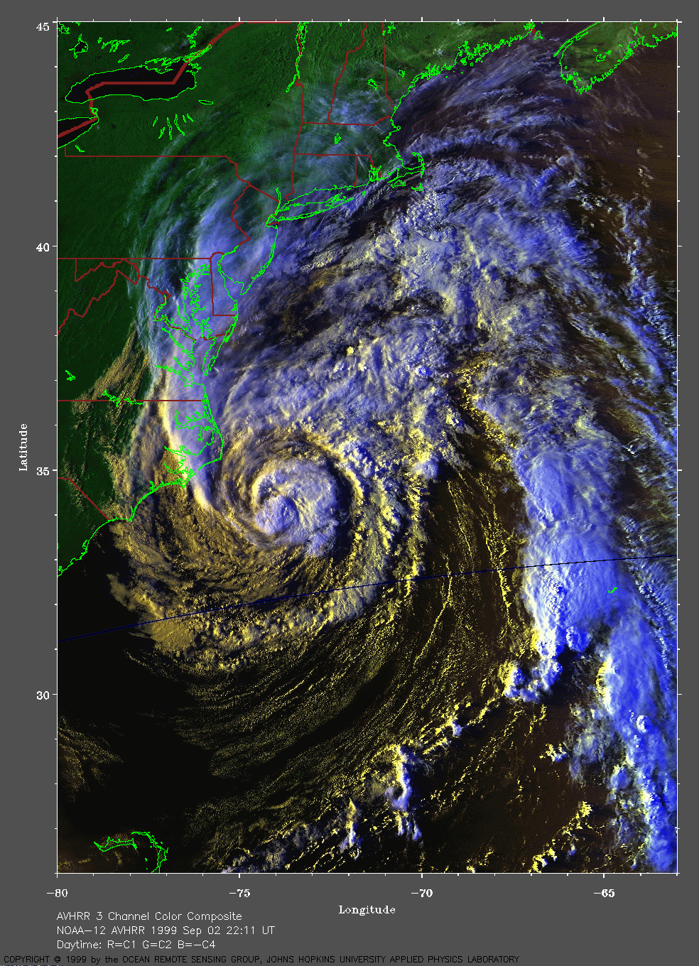
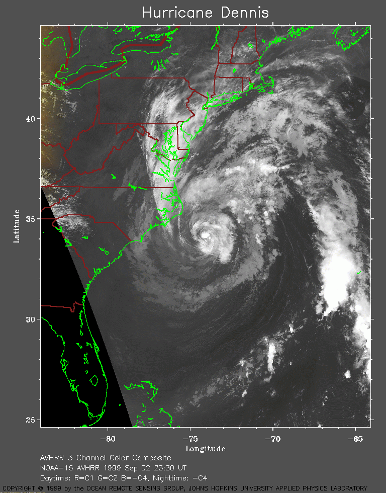 1999 September 2 23:30 UT
NOAA-15
AVHRR channel 4 evening image. A closer view (285 Kb)
is seen by clicking on this small image.
A very large image (1017 Kb)
is also available.
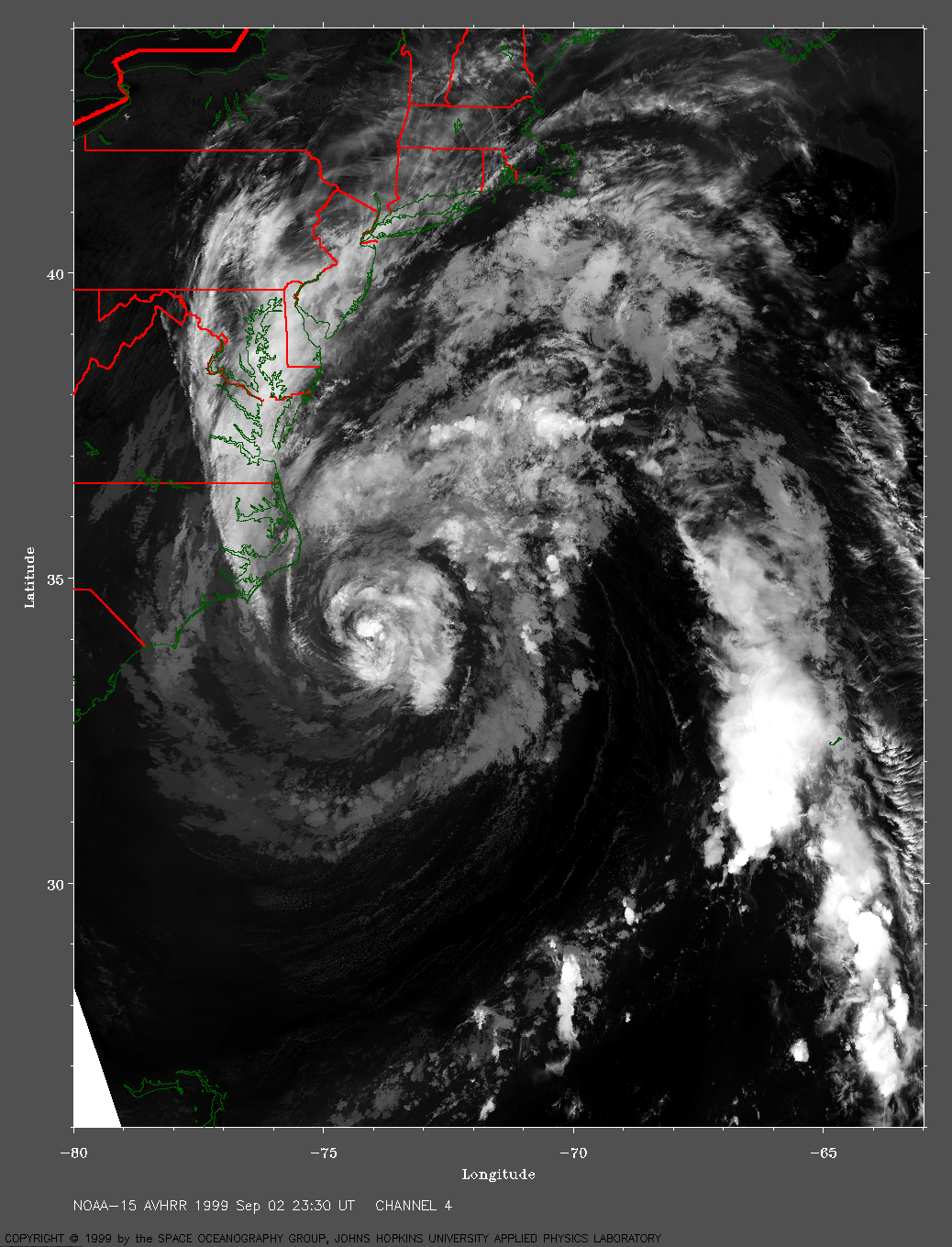
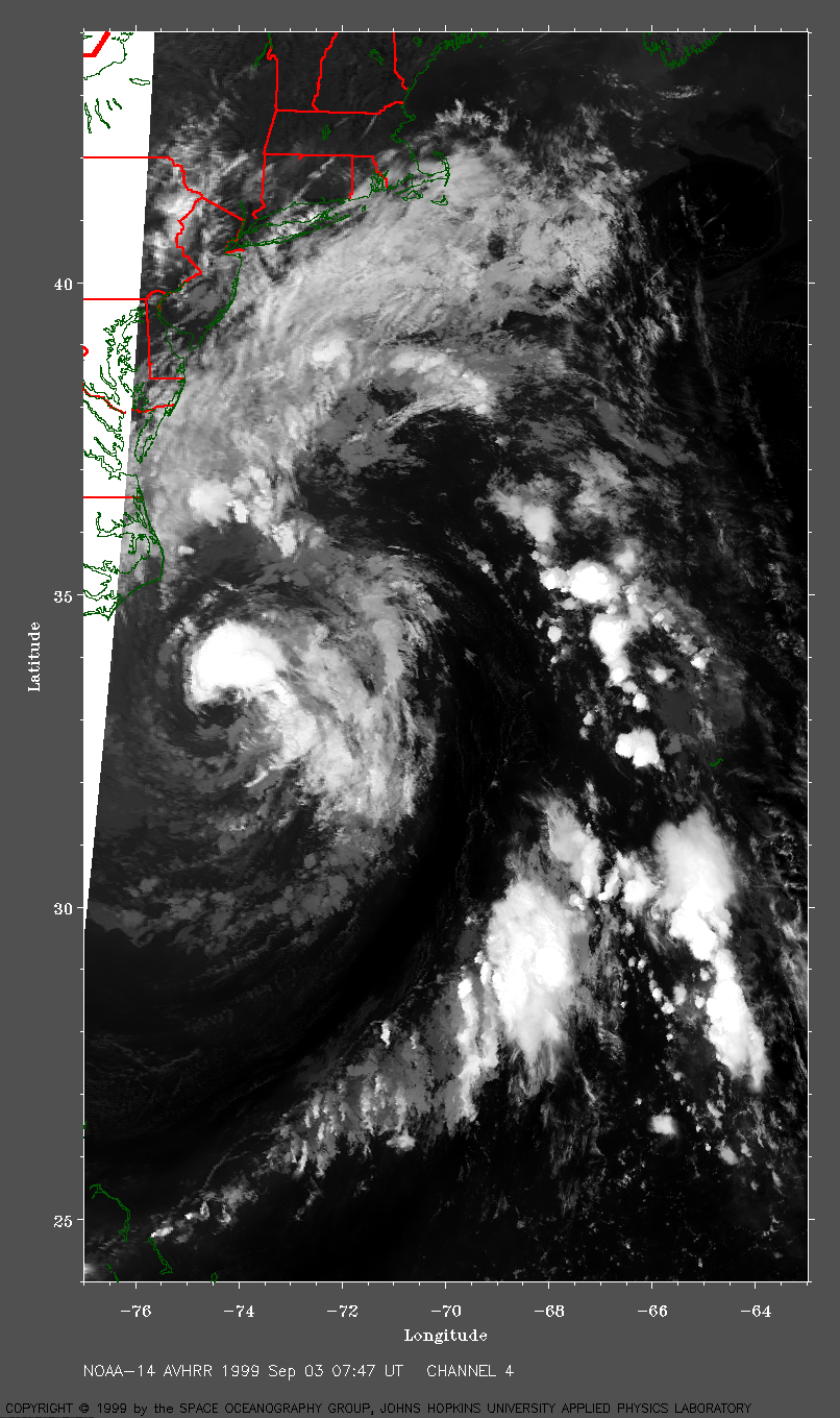
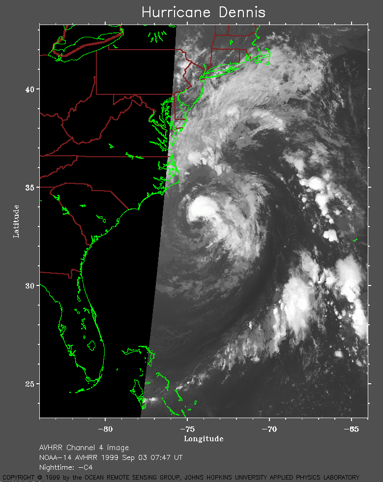 1999 September 3 07:47 UT
NOAA-14
AVHRR channel 4 early morning image. A closer view (210 Kb)
is seen by clicking on this small image.
A very large image (684 Kb)
is also available.
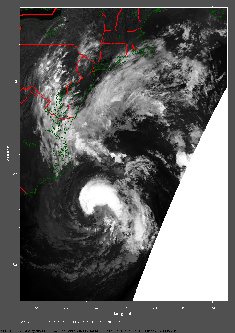
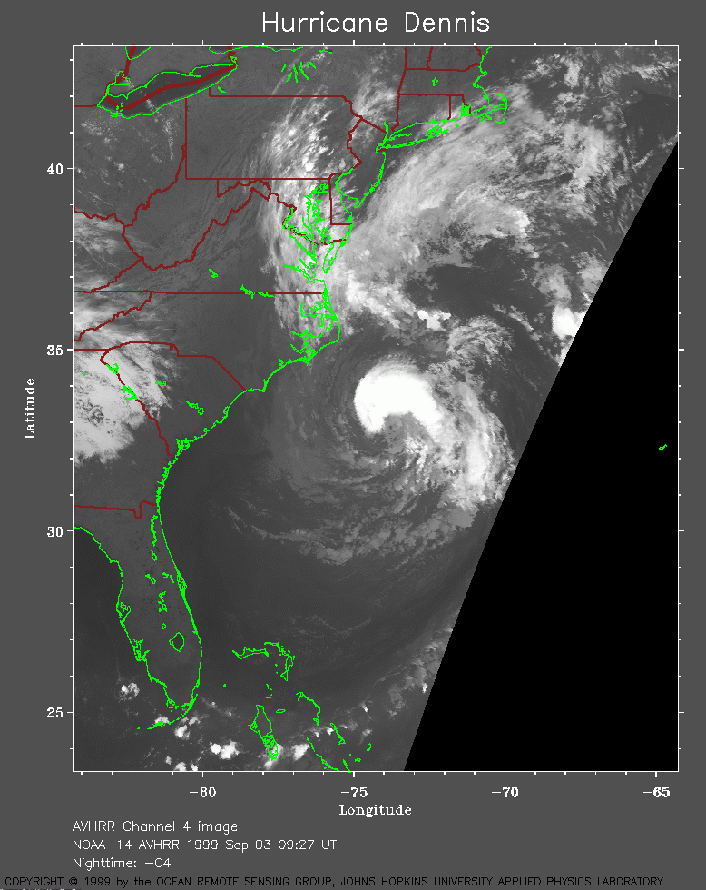 1999 September 3 09:27 UT
NOAA-14
AVHRR channel 4 early morning image. A closer view (226 Kb)
is seen by clicking on this small image.
A very large image (721 Kb)
is also available.
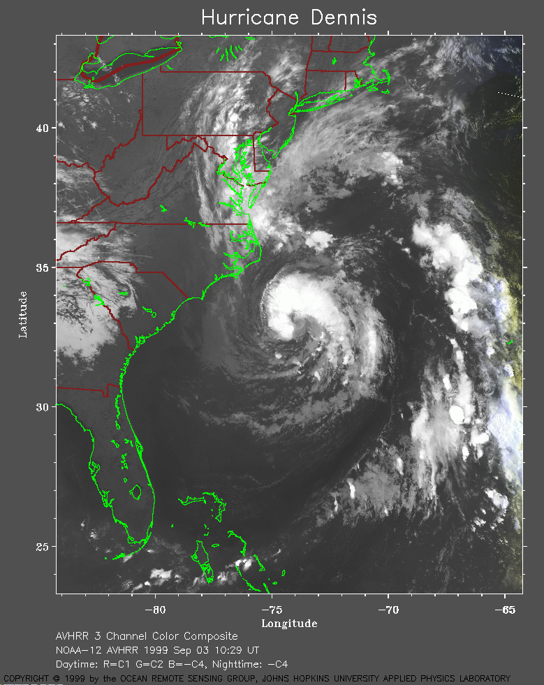 1999 September 3 10:29 UT
NOAA-12
AVHRR channel 4 early morning image. A closer view (324 Kb)
is seen by clicking on this small image.
A very large image (901 Kb)
is also available.
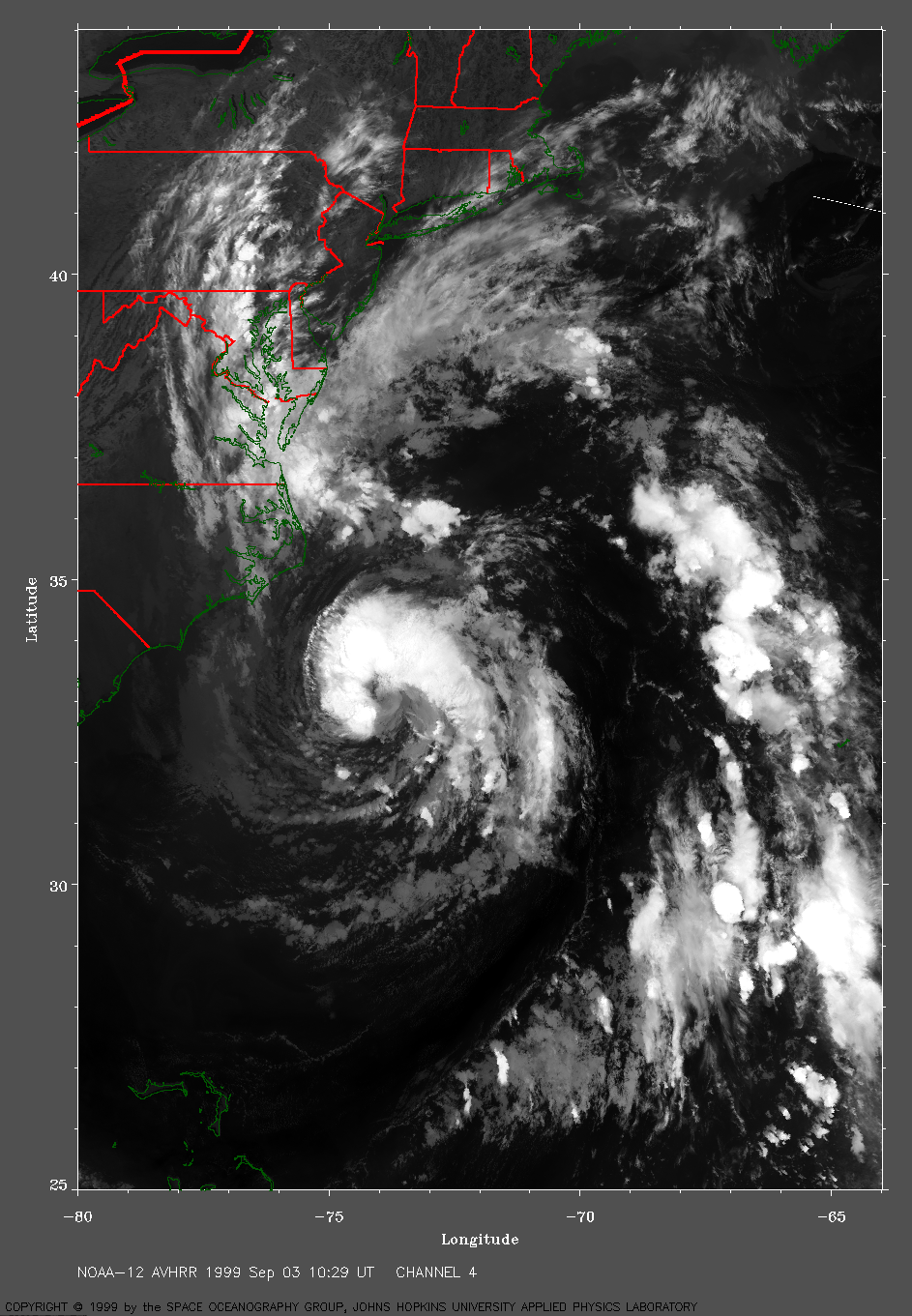
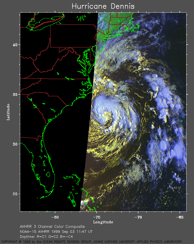 1999 September 3 11:47 UT
NOAA-15
AVHRR 3 channel color composite daytime image. A closer view (262 Kb)
is seen by clicking on this small image.
A very large image (484 Kb)
is also available.
 1999 September 3 13:28 UT
NOAA-15
AVHRR 3 channel color composite daytime image. A closer view (307 Kb)
is seen by clicking on this small image.
A very large image (609 Kb)
is also available.
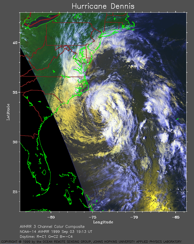 1999 September 3 19:13 UT
NOAA-14
AVHRR 3 channel color composite daytime image. A closer view (349 Kb)
is seen by clicking on this small image.
A very large image (764 Kb)
is also available.
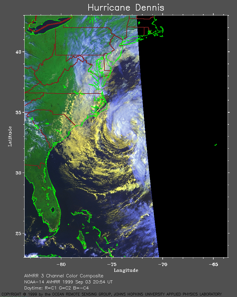 1999 September 3 20:54 UT
NOAA-14
AVHRR 3 channel color composite daytime image. A closer view (245 Kb)
is seen by clicking on this small image.
A very large image (427 Kb)
is also available.
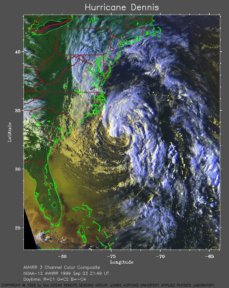 1999 September 3 21:49 UT
NOAA-12
AVHRR 3 channel color composite daytime image. A closer view (443 Kb)
is seen by clicking on this small image.
A very large image (898 Kb)
is also available.
 1999 September 4 09:16 UT
NOAA-14
AVHRR channel 4 early morning image. A closer view (267 Kb)
is seen by clicking on this small image.
A very large image (1026 Kb)
is also available.
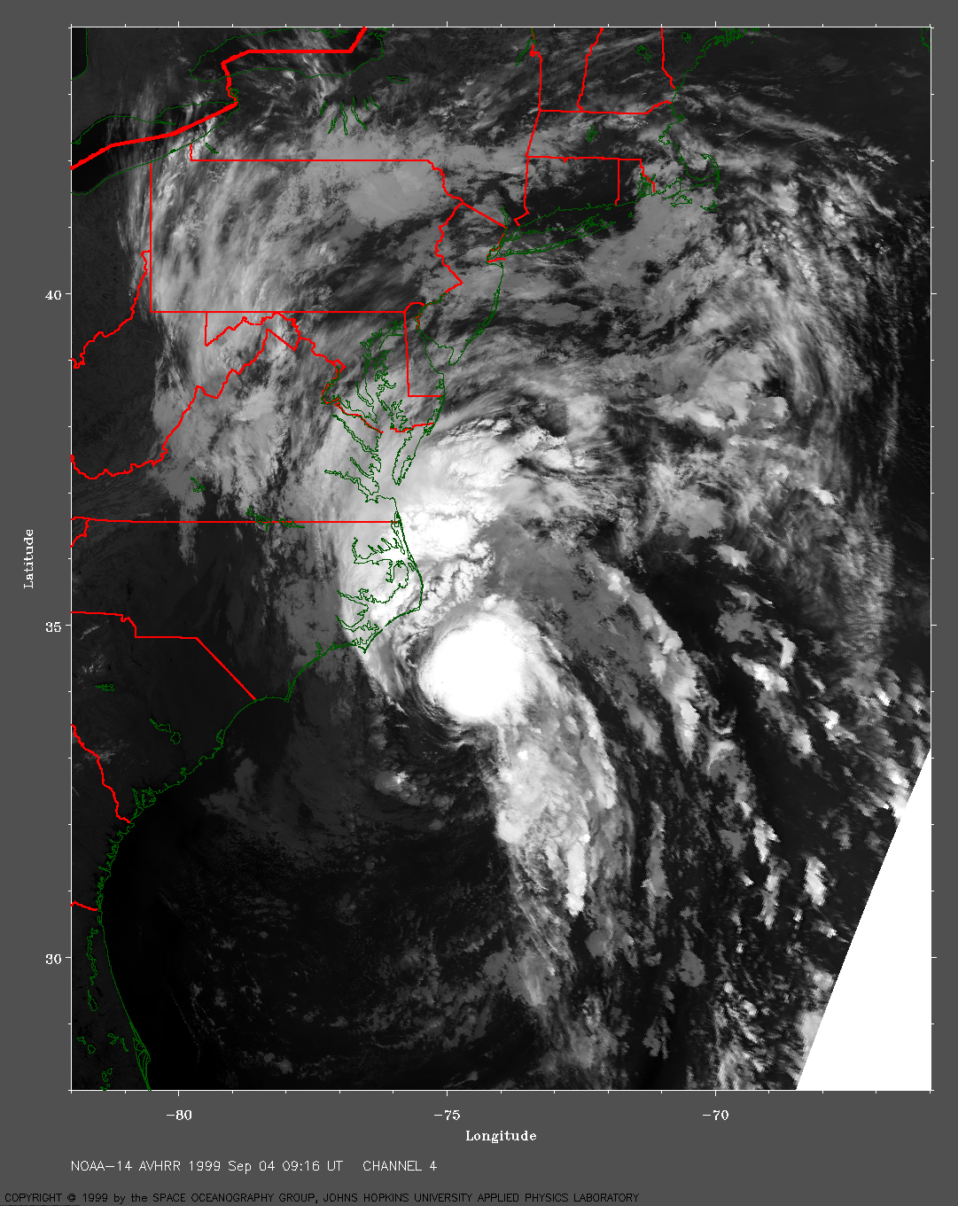
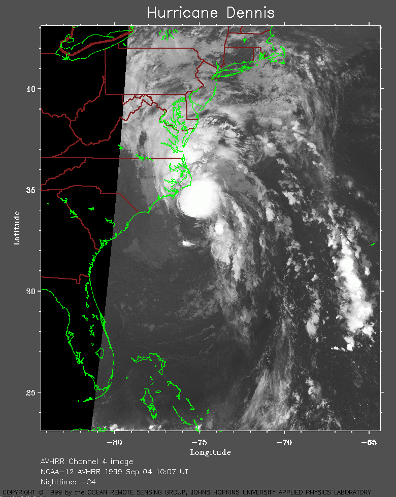 1999 September 4 10:07 UT
NOAA-12
AVHRR channel 4 early morning image. A closer view (248 Kb)
is seen by clicking on this small image.
A very large image (925 Kb)
is also available.
 1999 September 4 11:47 UT
NOAA-12
AVHRR 3 channel color composite daytime image. A closer view (253 Kb)
is seen by clicking on this small image.
A very large image (744 Kb)
is also available.
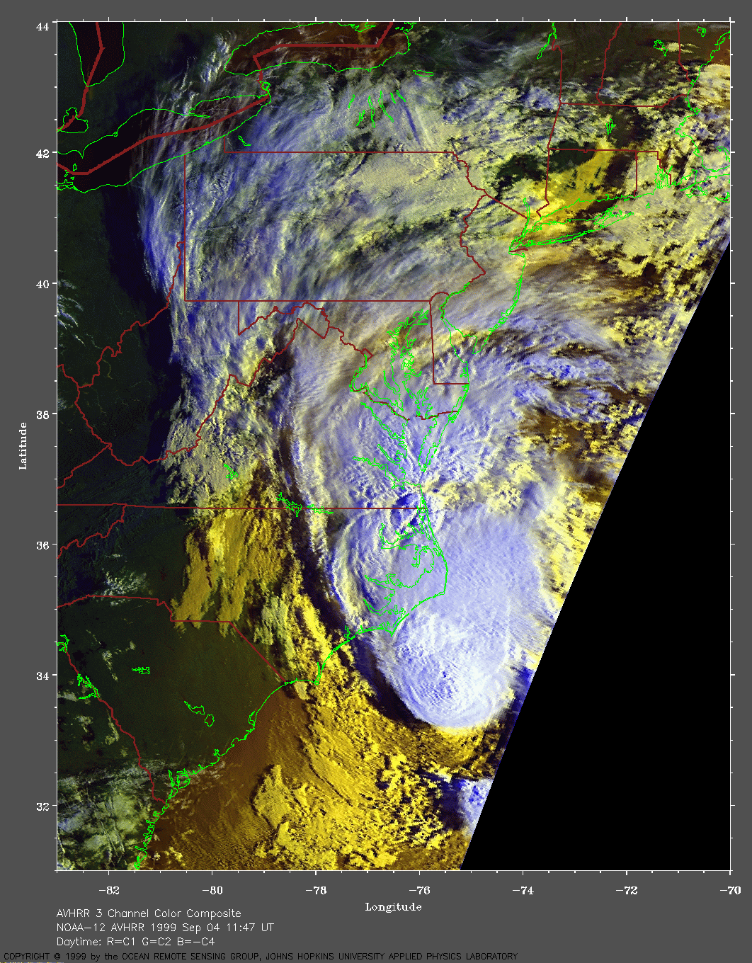
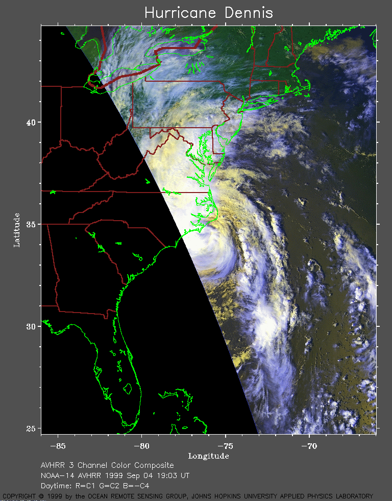 1999 September 4 19:03 UT
NOAA-14
AVHRR 3 channel color composite daytime image. A closer view (263 Kb)
is seen by clicking on this small image.
A very large image (506 Kb)
is also available.
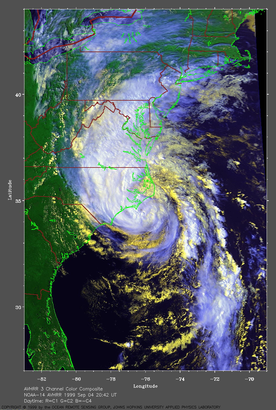
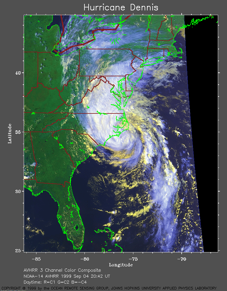 1999 September 4 20:42 UT
NOAA-14
AVHRR 3 channel color composite daytime image. A closer view (327 Kb)
is seen by clicking on this small image. At this time, Dennis is
about to cross the Carolina coast. With maximum sustained winds of 70
mph, Dennis is just below hurricane strength.
A very large image (648 Kb)
is also available.
A close-up image (990 Kb)
of the center of Dennis is also available. Note the hint of a possible
eye just off Cape Lookout.
 1999 September 5 00:25 UT
NOAA-15
AVHRR channel 4 nighttime image. A closer view (286 Kb)
is seen by clicking on this small image. Dennis is crossing the coast
and the maximum sustained winds are falling from 70 to 60 mph.
A very large image (829 Kb)
is also available.
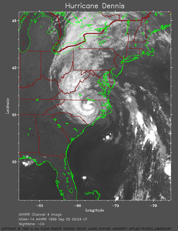 1999 September 5 09:04 UT
NOAA-14
AVHRR channel 4 early morning image. A closer view (270 Kb)
is seen by clicking on this small image. At this time, Dennis is inland
and the maximum sustained winds have fallen to 35 mph.
A very large image (833 Kb)
is also available.
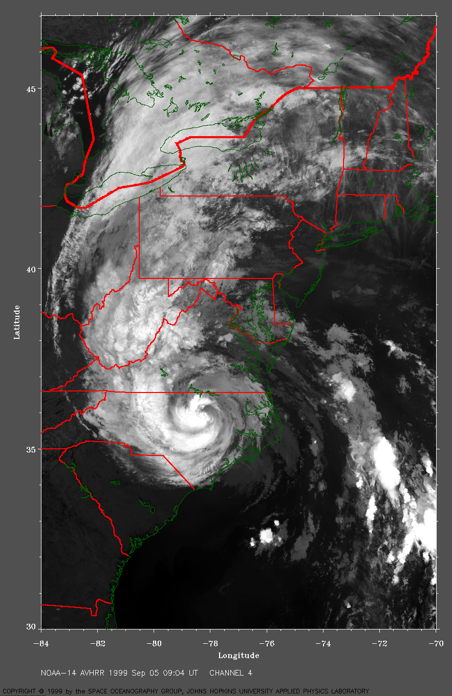
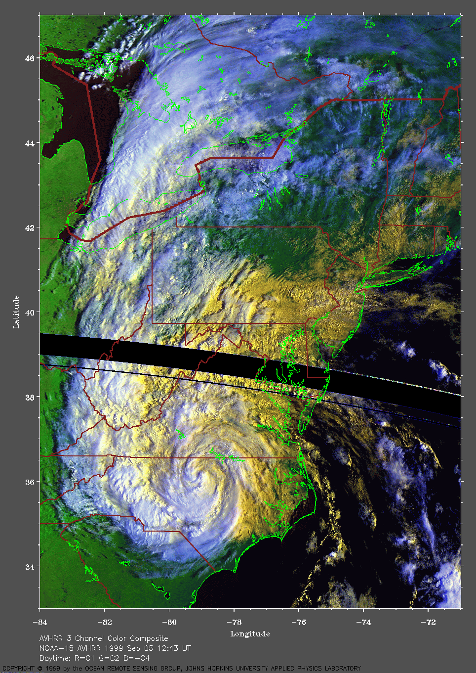
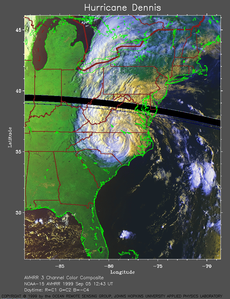 1999 September 5 12:43 UT
NOAA-15
AVHRR 3 channel color composite daytime image. A closer view (337 Kb)
is seen by clicking on this small image.
A very large image (697 Kb)
is also available.